Auckland Thunderstorms To Disrupt Flights November 30
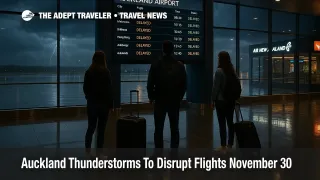
Auckland thunderstorms flights are at higher risk of disruption on November 30, 2025, as fast moving storm bands cross Auckland, New Zealand, during the evening peak and trigger severe thunderstorm warnings, surface flooding and short term power issues. MetService has issued and updated warnings for parts of the Auckland region and nearby districts as torrential downpours, frequent lightning and strong wind gusts move across the upper North Island. That combination turns airport transfers, self drive trips and late flights through Auckland Airport (AKL) into a time sensitive decision where travelers need to allow extra buffer and be ready to change plans.
The Auckland thunderstorms flights alert reflects a clear change from general spring showers to a pinpoint storm episode that affects the country's busiest gateway and several popular driving routes. Severe thunderstorm warnings now in force for parts of Kaipara, Auckland City, Waikato, Waitakere, Franklin, Rodney and the Albany area highlight very heavy rain and lightning, with MetService noting that thunderstorms are expected to be accompanied by intense downpours.
Local media and social posts show surface flooding in suburbs such as Onehunga and on sections of the motorway network, with brief reports of power interruptions as lightning cells moved over the city. Radio New Zealand describes a torrential downpour that disrupted events and commutes as the first band of storms crossed central Auckland, prompting a raft of alerts including a formal severe thunderstorm warning for the wider region. By about 5:25 p.m., Waka Kotahi NZ Transport Agency reported that road conditions were starting to return to normal as rain eased, while urging drivers to continue taking care on wet roads where ponding remains.
MetService and New Zealand Herald coverage both stress that the risk is not finished. Forecasts call for a second band of fast moving thunderstorms to sweep across Auckland later in the evening once the first wave clears, with more heavy rain and lightning likely to flare up over parts of the city and surrounding regions. That pattern means travelers cannot assume that an improving radar picture at rush hour will last, especially if they hold late evening departures or are planning to drive back into the city after dinner.
Thunderstorm risk this evening also extends into Northland, Waikato and the Bay of Plenty, where heavy rain and strong wind watches are in place for some districts and the same unstable air mass is expected to generate local storms. Self drivers coming in from Hamilton, Tauranga, Whangārei or smaller towns may face both poor visibility and pockets of surface flooding on state highways, especially near streams, gullies and low lying rural stretches. Coach services can also slow down on affected corridors, which cascades into longer transfer times even if downtown roads look relatively clear.
For flight operations, the main risk tonight is not a mass cancellation event but repeated short term disruptions. Airlines and ground handlers at Auckland Airport routinely pause ramp work and boarding when lightning is overhead, then restart once the immediate cell has passed. Thunderstorm downpours can also force aircraft to hold, divert or accept longer arrival spacing while air traffic control manages reduced visibility and wet runway conditions. That means travelers should plan for the possibility that an on time departure on paper may still leave late, especially during the hours when the second storm band is expected to cross the area.
Background, how MetService warnings work
MetService issues severe thunderstorm watches and warnings when radar and observations show storms capable of producing very heavy rain, large hail, strong wind gusts or frequent lightning. Civil Defence guidance for events of this type repeatedly notes that very heavy or torrential rain can cause surface or flash flooding about streams, gullies and urban areas, and that driving conditions can become extremely hazardous in a short time. A warning signals that severe thunderstorms are either occurring or imminent in the listed areas, while an outlook highlights where storms are more broadly possible.
For Auckland, the key practical implication is that low lying suburbs, motorway underpasses and known flood spots can see water ponding quickly, even if the rain only lasts a few tens of minutes. Past flood events in the city have repeatedly closed key hubs such as Britomart and created long waits for buses when lines or roads were inundated, with emergency managers reminding residents that floods are one of Tāmaki Makaurau's most common hazards. That history is why authorities encourage residents and visitors to treat thunderstorm warnings seriously rather than assuming summer storms will simply blow through.
Airport transfers and same day connections
For anyone flying in or out of Auckland Airport tonight, the main adjustment is time and flexibility. In dry, uncongested conditions, many local travelers cut transfer times close, especially on domestic flights or familiar routes from the city center or inner suburbs. With severe thunderstorms around, heavy rain and crashes can slow State Highway 20, key arterials in South and West Auckland and even short shuttle runs between hotels and the terminal. Adding 30 to 60 minutes of buffer for road transfers this evening is a reasonable baseline, especially for international flights or any itinerary that would be hard to rebook.
Travelers holding tight same day connections through Auckland, for example domestic to international or regional to domestic hops, should try to keep both legs on a single ticket so that the connecting airline is obliged to help in the event of misconnects. Those using separate tickets or mixing low cost carriers with full service airlines have less protection and may want to move to earlier feeder flights or shift onward legs to tomorrow, when forecasts suggest more stable conditions.
Public transport in Auckland can continue operating during heavy rain, but Auckland Transport warns that severe weather can slow buses and trains, force diversions around flooded sections and, in some cases, temporarily suspend services where tracks or corridors are inundated. Passengers using buses or trains to reach the airport should plan for these knock on delays, follow live service alerts and avoid relying on the last possible service of the evening.
Driving conditions and safety
On the roads, the guidance from Auckland Transport, Civil Defence and motoring organizations is consistent. When heavy rain, wind and thunderstorms are in play, drivers should slow down, increase following distance, turn on headlights in low visibility and stay alert for debris, fallen branches and localized flooding. Authorities are clear that motorists should not drive through floodwaters, because water depth and hidden hazards are hard to judge and vehicles can be swept off roads or damaged in shallow but fast moving flows.
Auckland Emergency Management also stresses that people on foot, bikes or scooters should stay away from streams, culverts and stormwater systems during and immediately after cloudbursts, since steep catchments and urban drainage can turn routine gullies into dangerous flows in minutes. For tonight's storms, the practical takeaway is that postponing non essential driving until after the heaviest cells have passed is the safest choice, particularly for visitors unfamiliar with local flood spots.
Regional itineraries and the days ahead
For travelers using Auckland as a springboard into wider New Zealand, the short term impact of tonight's thunderstorms should be seen in context. The same humid, unstable pattern that has produced record warm November days and thousands of lightning strikes over the country has also brought spells of sunshine between fronts, and current outlooks suggest conditions should improve over the North Island on December 1 before the next system arrives later in the week.
Drivers heading to popular regions such as Northland, Waikato and Bay of Plenty in the next day or two should still keep an eye on MetService watches and any local heavy rain warnings, since saturated ground and repeated storms can keep some rural roads vulnerable. However, this is not a multi day state of emergency for Auckland at this point, rather a concentrated evening where short term flooding, lightning and brief travel disruption are likely and where smart timing can make a big difference.
For longer horizon planning, visitors with December trips should note that weather is only one part of New Zealand's current travel risk picture. A separate industrial dispute could see Air New Zealand cabin crew strike on December 8, a move that union statements suggest might force large scale cancellations if talks fail, adding another layer of uncertainty for itineraries through Auckland. Combining that risk with the kind of fast moving storms seen today makes it even more important to build slack into schedules and avoid tightly packed, non changeable bookings.
In practical terms, tonight's Auckland thunderstorms flights event is a reminder to treat weather warnings as operational signals rather than background noise. Travelers who monitor official channels, plan airport transfers with extra time, avoid risky driving in flood prone spots and keep their tickets flexible will have many more options if delays or brief closures ripple through the system over the next several hours.
Sources
- Severe thunderstorm warning issued for Auckland, surrounding regions, November 30, 2025, RNZ
- Severe thunderstorm warning issued for parts of Kaipara, Auckland City, Waikato and nearby areas, NZCity
- Weather, thunderstorms, heavy rain and wind watches for parts of country, NZ Herald
- Travelling during severe weather watches and warnings, Auckland Transport
- Update 5:25 p.m. road conditions returning to normal as rain eases, NZTA Auckland
- Floods hazard advice for Auckland, Auckland Emergency Management
- Floods, Get Ready, National Emergency Management Agency
- Driving in heavy rain or floodwater, AA New Zealand
- Very warm November brings record breaking temperatures and thunderstorms, 1News
- Auckland Airport profile and traffic role, Auckland Airport and New Zealand tourism sources