Atlantic Canada Winter Storm Airline Waivers Dec 3 2025
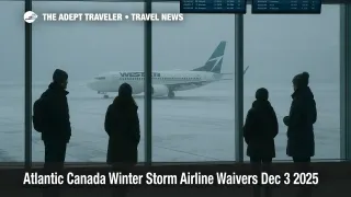
Passengers traveling into or through Atlantic Canada now have more flexibility but also more reason to slow down, because a powerful nor'easter bringing heavy wet snow, rain and strong winds across Nova Scotia, New Brunswick, Prince Edward Island and Newfoundland has triggered a patchwork of Environment Canada snowfall and wind warnings, school closures and very poor driving conditions. WestJet has responded with formal winter storm waivers for Halifax Stanfield International Airport (YHZ) and St. John's International Airport (YYT) covering key dates between December 2 and 4 2025, giving eligible passengers a one time fee free change or cancellation. Anyone connecting through these hubs in the next two days should treat tight itineraries as fragile, add generous buffer time and be ready to reroute through more stable Canadian gateways if the storm undercuts their original plan.
In practical terms, Atlantic Canada winter storm waivers now allow many WestJet customers routed via Halifax and St. John's to move flights away from the worst of the storm without paying change fees, while other airlines use their standing travel alert policies to manage similar risks.
Where The Storm Is Hitting Hardest
The core weather pattern is a classic early season nor'easter that slid north from the United States and is now centered over Atlantic Canada. Environment and Climate Change Canada has snowfall and wind warnings in place across large parts of Nova Scotia and Newfoundland, with Canadian Press reporting that yellow level alerts call for 20 to 30 centimetres of snow in some regions and orange level alerts in central Newfoundland and northern Cape Breton call for 30 to 50 centimetres by Wednesday evening.[Global News winter storm moves into Atlantic Canada][1] The Weather Network adds that central and eastern Newfoundland, including corridors that feed St. John's, can see 20 to 40 centimetres of snow with snowfall rates reaching three to five centimetres per hour and coastal gusts between 80 and 100 kilometres per hour, enough to produce whiteout conditions, slick roads and scattered power outages.[The Weather Network Atlantic Canada nor'easter outlook][2]
New Brunswick's eastern coast is under a special weather statement for 10 to 15 centimetres of snow, and forecasters warn of dangerous driving on key routes such as Highways 101, 102 and 104 and possible delays or closures on the Confederation Bridge. St. John's Metro schools have preemptively closed for Wednesday, and local authorities across Newfoundland are flagging plowed but slippery roads, near zero visibility in squalls and a high chance of localized flooding where heavy snow mixes with rain and coastal surge.[Newfoundland and Labrador English School District status report][3]
For air travelers, the most immediate pressure points are Halifax Stanfield and St. John's, which serve as critical gateways for domestic connections, Western Canada links and some transatlantic flights. Although the storm does not automatically close runways, heavy wet snow and strong crosswinds force slower arrival and departure rates, lengthen deicing queues and make it harder for crews and aircraft to stay on schedule.
WestJet Winter Storm Waivers For Halifax And St. John's
WestJet's current travel advisories page lists specific winter storm advisories for both Halifax and St. John's, each with its own dates and conditions.[WestJet travel advisories][4] For Halifax, the winter storm advisory covers travel on or between December 2 and 3 2025. For St. John's, the advisory covers travel on or between December 3 and 4 2025. In both cases, WestJet states that for flights booked directly through the airline, including UltraBasic fares, customers are entitled to a zero dollar one time fee waiver for changes or cancellations as long as requests are made more than two hours before departure.
The key details for WestJet operated flights into or out of Halifax Stanfield and St. John's under these advisories include the following. One time changes can be made without paying a change fee, although any difference in fare applies if you move to a more expensive routing, date or cabin, and residual value is refunded when you move to a cheaper option. Travel on the changed itinerary must be completed within 60 days of the original departure date, which gives some leeway to push a trip into a calmer window without abandoning it altogether. For cancellations, the change fee is also waived, and the funds are refunded or credited based on the original fare rules, with Basic and UltraBasic tickets generally converted into a WestJet Travel Bank credit that is valid for a defined period.
WestJet also extends similar one time fee waivers to WestJet Vacations packages tied to flights in the advisory windows, but here the fine print matters. Package changes are subject to any difference in package price and a hotel penalty, currently two hundred dollars per person for many properties, and cancellations typically move the remaining value into a Future Travel Credit valid for two years.[WestJet travel advisories][4] Travelers who booked through an online travel agency or brick and mortar agent must work through that original booking source, since WestJet will not change those tickets directly.
For practical planning, anyone headed into or out of Halifax or St. John's on WestJet through December 4 should pull up their reservation, cross check the dates against the advisory, and decide whether to move travel earlier or later in the 60 day window. Pushing a trip by one or two days, or rerouting through Calgary, Toronto or Montreal instead of Halifax on eastbound legs, may sharply reduce the risk of an overnight delay in Atlantic Canada while still keeping the trip intact.
How Air Canada Manages Storm Disruption
Air Canada has not published a stand alone Atlantic Canada storm waiver page, but it uses its Daily Travel Outlook and Travel Alert system to handle events like this. Under that policy, flights marked with a Travel Alert icon in the Daily Travel Outlook trigger a rebooking window that typically allows customers to move their flights by up to three days on either side of the original date, sometimes longer during peak periods, without paying a change fee or additional fare when staying within the same cabin and routing.[Air Canada Daily Travel Outlook and Travel Alert policy][5]
The fine print for Air Canada is more restrictive than WestJet's broad 60 day window. Origin and destination must usually stay the same, or at least within a defined radius of sister airports, and the rebooking must be on Air Canada operated and marketed flights. However, within those constraints, minimum and maximum stay rules, change fees and advance purchase rules are largely waived inside the rebooking window, which takes a lot of friction out of moving to a safer date. Travelers booked on Air Canada to or through Halifax or St. John's should check the Daily Travel Outlook on the day of travel, look for the Travel Alert icon and then call or use online tools to move to a less exposed departure if their flight is covered.
Surface Travel, School Closures And Onward Connections
The Atlantic Canada nor'easter does not respect mode boundaries, and for many travelers the biggest risk is the combination of flight disruption with ground transport problems. The Canadian Press and Global News note that winds near exposed coasts in Nova Scotia and Newfoundland can reach between 80 and 100 kilometres per hour, piling up large waves, pounding surf and elevated sea levels while heavy wet snow falls inland.[Global News winter storm moves into Atlantic Canada][1] The Weather Network adds that snowfall rates of three to five centimetres per hour in some Newfoundland corridors will lead to very rapid accumulation, drifted roads and near whiteout conditions.[The Weather Network Atlantic Canada nor'easter outlook][2]
In practice, this can close or severely slow segments of the Trans Canada Highway and regional routes into Halifax and St. John's, back up ferry traffic and interrupt bus services that feed airport corridors. With St. John's Metro schools closed on December 3 and local municipalities cancelling nonessential services, travelers should assume that same day drives to or from the airport will take longer than usual, and that ride share or taxi availability may be constrained as drivers choose safer windows or stay off the roads altogether.[Newfoundland and Labrador English School District status report][3]
If your itinerary relies on landing in Halifax or St. John's and then driving several hours along coastal or interior routes the same day, this is the time to add a hotel night near the airport or move the trip by a day or two using available waivers. Trying to thread a late afternoon arrival into a long winter highway drive while a storm is still peaking is a classic way to multiply risk.
How This Connects To The United States Nor'easter
This Atlantic Canada storm is essentially the northern extension of the same wider system that has been driving heavy snow, icing and flight disruption across the northeastern United States, which we covered in our recent briefing on Boston, New York and Philadelphia delays.[Flight Delays And Airport Impacts: December 2 2025][6] The shared pattern is that periods of heavy precipitation, low cloud and gusty winds first slow the busiest American hubs, then push into the Canadian Maritimes, amplifying any residual backlog in airline schedules.
For transatlantic travelers, that means that a missed connection in Boston or New York can cascade into missed onward flights into Halifax or St. John's, even if the local weather in Atlantic Canada temporarily improves. The safest approach is to treat the entire northeast and Atlantic Canada corridor as a single storm affected ecosystem and spread connections accordingly.
Practical Steps For Travelers
For the next two days, the safest assumption for anyone using Halifax Stanfield or St. John's is that flight schedules are vulnerable, and surface travel to and from the airports can be slow or intermittently dangerous. That translates into a few concrete moves. First, if you are on WestJet and your travel dates fall within the current Halifax or St. John's waiver windows, use the zero fee change to move to a clearer day or earlier flight before storm bands peak, rather than waiting at the gate and hoping. International or transcontinental travelers should aim for at least three hours of connection time through these hubs, preferably more, and avoid separate tickets entirely.
Second, for Air Canada itineraries, consult the Daily Travel Outlook and Travel Alert policy and ask whether your specific flight is covered by a Travel Alert rebooking window.[Air Canada Daily Travel Outlook and Travel Alert policy][5] When it is, moving up or back by a day within that window often costs nothing and can shift you out of the riskiest conditions. Third, assume that ground transfers will take longer than mapping apps suggest today. Build extra time into drives, budget for airport parking if taxi or ride share supply looks thin, and consider overnighting near the airport if your trip depends on early morning departures after a heavy snow.
Finally, anyone with flexibility over their overall travel dates can avoid a lot of stress simply by pushing nonessential trips into a calmer period later in the week or the following week. The current storm is significant but time limited, and Atlantic Canada's aviation and road networks are experienced at digging out once the heaviest snow and wind pass. Using the available waivers and alerts to sidestep the peak rather than trying to bull through it is the most reliable way to keep your plans intact.
Sources
- [Weather Alerts for Halifax Metro and Halifax County West, Environment and Climate Change Canada][7]
- [Winter storm moves into Atlantic Canada, bringing heavy wet snow and high winds, Canadian Press via Global News][1]
- [Multitude of disruptions in Atlantic Canada possible with incoming nor'easter, The Weather Network][2]
- [Daily Travel Outlook and Travel Alert Rebooking Policy, Air Canada][5]
- [Travel advisories, WestJet official site][4]
- [Winter Storm, Snowfall, and Wind Warnings Issued Ahead of Wednesday's Nor'easter, Sheerr Weather][8]
- [School Status Report, Newfoundland and Labrador English School District][3]
- [Flight Delays And Airport Impacts: December 2, 2025, The Adept Traveler][6]