Flight Delays And Airport Impacts: December 6, 2025
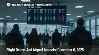
US flight delays December 6 2025 are being shaped by snow and low clouds in New England, stubborn low ceilings at several big coastal and southern hubs, and scattered thunderstorms near the Gulf Coast. Travelers connecting through Boston, Philadelphia, Washington National, Charlotte, Tampa, Memphis, Dallas Fort Worth, Dallas Love Field, Seattle, and San Francisco face the highest odds of schedule creep as the day goes on. Anyone with tight connections at these airports should add buffer, prefer earlier flights, and be ready to rebook if a delay threatens onward travel.
In plain terms, today's US flight delays are being driven by a combination of winter weather around Boston Logan International Airport (BOS), widespread low clouds and fog at several major hubs, and thunderstorms along key East Coast and Gulf corridors that the Federal Aviation Administration and its Air Traffic Control System Command Center highlight in the current operations plan.
Winter Weather Returns To New England And Parts Of The Midwest
The FAA Daily Air Traffic Report page still shows Friday, December 5, as the latest published summary, pointing to snowy conditions around Philadelphia International Airport (PHL), the Washington area airports, Minneapolis Saint Paul International Airport (MSP), and Salt Lake City International Airport (SLC), along with low clouds in Atlanta, Charlotte, Memphis, Nashville, and Seattle, and gusty winds in Chicago. That snapshot helps explain the pattern heading into the weekend, but today's operational detail comes from the FAA's December 6 operations plan.
The latest Air Traffic Control System Command Center advisory for December 6 lists Boston Logan as under snow and low ceilings, a combination that usually requires deicing, longer departure queues, and more conservative arrival spacing. National Weather Service offices across the north central United States also describe a fast moving clipper system bringing several inches of snow to parts of the north central Plains, the Midwest, the eastern Great Lakes, and the Northeast this weekend, which aligns with Boston's snow signal and lingering impacts in the upper Midwest.
Near Minneapolis and the upper Midwest, forecasters expect a banded snow event with several inches possible in southern Minnesota, tapering to lighter totals around the Twin Cities, which still supports slower taxi operations and the risk of deicing queues at MSP, especially in the afternoon and evening. Even where skies are relatively clear, bitter cold from an Arctic outbreak across much of the central and northeastern United States is keeping temperatures well below normal, which increases deicing time and can leave untreated pavement slick with black ice.
For travelers, this means that morning and afternoon banks in Boston and parts of the Midwest will run more slowly than on a dry day, even without dramatic radar returns. Aircraft need deicing, runway and taxiway friction has to be monitored, and spacing between arrivals may be widened, all of which translate into modest but compounding delays.
Low Ceilings Hit Southern And West Coast Hubs
The current FAA operations plan for December 6 lists a cluster of major hubs under low ceiling constraints, including Ronald Reagan Washington National Airport (DCA), Charlotte Douglas International Airport (CLT), Tampa International Airport (TPA), Memphis International Airport (MEM), Dallas Fort Worth International Airport (DFW), Dallas Love Field (DAL), Seattle Tacoma International Airport (SEA), and San Francisco International Airport (SFO). Low ceilings affect arrival rates because controllers must maintain larger separation for approaches, and departures can be held on the ground if inbound flows begin to back up.
In the Pacific Northwest and Northern California, aviation forecast discussions describe continued fog and low stratus intruding into Bay Area terminals, with Tule fog and a stagnant pattern keeping ceilings low for much of the morning. That supports slower morning pushes at SFO, and to a lesser degree at SEA, especially when combined with routine construction work on taxiways and ramps that the FAA operations plan calls out at both airports.
In the Southeast and southern plains, low clouds around Charlotte, Tampa, Memphis, and the Dallas airports make the system more sensitive to any minor disruption. The same advisory notes runway and taxiway closures at Nashville and Chicago Midway that extend through later in December, so even when weather is marginal rather than severe, localized bottlenecks can develop during busy periods.
Travelers connecting through these hubs should assume that early morning waves may depart slightly behind schedule while low clouds and fog are at their worst, with some improvement during midday when ceilings often lift. Still, any thunderstorm flare up or new patch of fog can quickly reverse those gains.
Thunderstorms And Snowbird Traffic Shape East And Gulf Corridors
En route, the FAA operations plan highlights thunderstorms affecting New York, Jacksonville, and Houston airspace centers, which cover a wide swath of East Coast and Gulf routes. A National Weather Service overview for the mid Atlantic and Gulf states describes a storm and trailing cold front moving slowly through the Gulf Coast and Southeast with widespread rain showers and isolated thunderstorms, while a fast moving clipper delivers snow farther north.
The same FAA plan notes moderate snowbird volume across the National Airspace System and active and potential Airspace Flow Programs affecting Florida bound traffic, which typically means that popular routes into south and central Florida run near capacity and become more vulnerable to reroutes and holding when storms pass near major arrival corridors. Even small convective cells near the coast can force traffic off preferred routes and add a few minutes of airborne delay that ripple into later banks.
If you are flying to or from Florida, the Gulf Coast, or Caribbean gateways today, it is worth assuming longer flight times and leaving extra buffer for cruise departures, resort shuttles, or separate onward tickets. Aligning cruise embarkation with a day before arrival remains the safest option in this kind of pattern.
How Busy Is The System Today
Live statistics from FlightAware show a moderately busy but not extreme disruption day. As of this writing, FlightAware reports about 11,951 delays worldwide and roughly 1,715 delays within, into, or out of the United States, along with about 373 global cancellations and 101 cancellations tied to US airports. Those numbers are elevated compared with a calm shoulder season day but far below the worst holiday travel days or shutdown related cuts seen earlier this fall.
The FAA's latest operations plan explicitly states that Denver International Airport should remain on a favorable configuration all day and that no ground delay programs are currently active at major hubs, although staffing triggers at Philadelphia and the Dallas terminal area, plus an active Airspace Flow Program over the mid Atlantic, could still create localized slowdowns. In other words, the system is working under weather and capacity constraints, but with planning in place to avoid cascading nationwide gridlock.
Practical Planning For Today's Flights
For today, the risk picture is clear enough to support some simple planning rules. First, connections through Boston, Philadelphia, Washington National, Charlotte, Dallas Fort Worth, Seattle, and San Francisco deserve at least two hours on one ticket and longer if you have to clear security again or retrieve bags between carriers. Second, if you have flexibility, favor earlier departures, particularly for flights that rely on aircraft arriving from snowy or low ceiling affected hubs, since delays tend to compound across the day.
Travelers headed to Florida, the Gulf Coast, or Caribbean gateways should monitor thunderstorms along their routes and consider moving critical trips off the most heavily booked midday banks if seats are available on morning or evening flights. The combination of thunderstorm reroutes and high snowbird volume makes these waves less forgiving of any disruption. Finally, keep your airline app notifications enabled, and be ready to accept or request rebooking options if a delay pushes your connection below about 90 minutes at an affected hub.
For a view of how today's pattern has evolved, it may help to review our prior daily delay coverage from December 1 and December 5, which trace the post Thanksgiving winter storm sequence and the first Arctic blast that set up this weekend's cold and snow regime. Together, these days show how an early season storm, runway construction, and staffing constraints can combine into recurring but manageable friction across the network rather than single day chaos.
Sources
- FAA Daily Air Traffic Report, December 5, 2025
- FAA ATCSCC Advisory 035 DCC 12 06 2025 Operations Plan
- FlightAware live flight delay and cancellation statistics
- NOAA National Weather Service Philadelphia Mount Holly, weekend storm overview
- NOAA National Weather Service Twin Cities, winter storm warnings and discussion
- Reuters, Arctic blast grips central, northeastern US in sub freezing cold