Storm Bram To Bring Flood Risk To Ireland, UK Travel
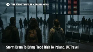
Storm Bram is now a confirmed Atlantic storm that will hit Ireland, Scotland, Wales, and parts of western England with very strong winds and heavy rain from the night of December 8 through December 9, creating a two day window of higher travel disruption risk across flights, ferries, and major road and rail corridors. Met Éireann has issued Status Yellow wind warnings nationwide and stepped up to Status Orange wind alerts for multiple coastal counties, while the UK Met Office has put amber wind warnings over northwest Scotland and yellow alerts across much of western Britain. Travelers moving between Ireland and the UK, or using coastal routes within either country, should expect slower journeys, possible cancellations, and the need for larger buffers in case floods, debris, or power cuts shut down parts of the network.
In plain terms, Storm Bram Ireland UK travel disruption means a deep Atlantic low is crossing the islands at the start of the working week, pulling very strong southerly winds and bands of heavy rain over already saturated ground that will make road, rail, air, and ferry operations less reliable on December 8 and 9.
Met Éireann's meteorologist commentary describes a deepening low pressure system, named Storm Bram, moving in from the Atlantic to bring strong to gale force southerly winds and periods of heavy rainfall across Ireland from late on December 8 into December 9. After a week of persistent rain, soils are already saturated and many rivers are near bank full, so additional rain is expected to trigger surface and river flooding through Tuesday and possibly into Wednesday in low lying areas and along rivers, especially in Cork, south Kerry, south Tipperary, and Waterford. Ireland faces a Status Yellow wind warning for the whole country, plus Status Orange wind warnings for coastal counties including Cork, Kerry, Waterford, Wexford, Clare, Limerick, Donegal, Galway, Leitrim, Mayo, and Sligo during the day on December 9, with impacts explicitly including difficult travel conditions, wave overtopping, debris, and power outages.
On the UK side, the Met Office says Storm Bram will bring strong winds and very heavy rain to northern and western parts of the country, with amber warnings in force for high winds over northwest Scotland from the afternoon of December 9 into the early hours of December 10 and wider yellow wind warnings for Wales, southwest England, Northern Ireland, and other western areas. Within the amber area, gusts could reach around 90 miles per hour in exposed locations, while many western regions can expect widespread 50 to 60 mile per hour gusts and up to 70 miles per hour in coastal and upland spots, conditions that can close bridges to high sided vehicles and force rail and ferry operators to suspend some services. Heavy rain totals of 40 to 60 millimeters are forecast in many western districts, with 80 to 100 millimeters possible in parts of Wales and southwest England, which is roughly half a month's average rainfall in a short period and enough to trigger additional flood warnings.
For air travelers, the main risks are crosswinds and low visibility at western facing airports and the knock on effects when inbound and outbound waves are delayed or reduced. Dublin Airport (DUB) and airports in Cork, Shannon, Kerry, Knock, and Donegal face a period of strong southerly winds and squally showers during their busy morning and midday departure banks on December 9, which can slow runway operations, increase spacing between aircraft, and produce go arounds or diversions when gusts exceed operating limits. In the UK, Glasgow Airport (GLA), Edinburgh Airport (EDI), Inverness Airport (INV), and regional fields in western Scotland are under the amber wind zone, while Belfast City Airport (BHD), Belfast International Airport (BFS), Liverpool John Lennon Airport (LPL), Manchester Airport (MAN), Cardiff Airport (CWL), Bristol Airport (BRS), and airports across southwest England sit inside wider yellow warnings. Even when airports remain open, the combination of strong crosswinds, heavy showers, and air traffic control spacing can produce substantial departure delays and a cascade of missed connections for travelers relying on short haul feeders into transatlantic and European flights.
Ferry routes between Ireland and the UK are particularly exposed when storms send long fetch southerly or southwesterly winds up the Irish Sea and over the Celtic Sea. Services on Dublin Holyhead, Rosslare Pembroke, Rosslare Fishguard, Belfast Cairnryan, and crossings from Cork and Waterford can all see schedule changes or outright cancellations when gale force winds and high waves make safe berthing difficult, especially around high tide when wave overtopping and coastal flooding are most likely. Local authorities and marine warnings already highlight the potential for wave overtopping and coastal flooding along southern and western Irish coasts during the height of Bram, which in turn can close access roads to ports and force operators to hold vessels in port or re time departures.
Overland travel will also feel the storm. Irish and UK forecasters warn that saturated ground and fresh downpours raise the risk that rivers and streams will overtop and that surface water will accumulate quickly on key trunk roads, particularly in south and west Ireland, western Scotland, Wales, and southwest England. Strong gusts can bring down branches and trees, send debris onto carriageways, and force temporary closures of exposed bridges, with Scottish transport authorities already warning that high winds during the amber warning window are likely to cause travel disruption in large parts of the country. Rail lines that hug river valleys or coastlines may see temporary speed restrictions or suspensions when flooding is present or when engineers have to inspect tracks for washouts and fallen trees, which can produce delays long after the most intense band of wind and rain has passed.
Background: How Named Storms Affect Travel Planning
Ireland's Met Éireann and the UK Met Office jointly participate in a Western Europe storm naming program, where a storm is named when it is expected to bring medium or high impacts in at least one partner country. Bram sits on the 2025 to 2026 storm list and was named because of its expected impacts on both Ireland and the UK, not because it is necessarily the strongest system of the season. For travelers, the appearance of a named storm accompanied by orange or amber warnings is a signal to treat forecast disruption seriously, review cancellation and change policies, and consider whether nonessential trips that fall inside the peak impact window can be moved. In practice, these storms often produce pockets of severe disruption amid broader areas of merely unpleasant weather, which is why route specific planning matters more than blanket cancellations.
Storm Bram also arrives as part of what meteorologists describe as a conveyor belt of Atlantic low pressure systems, driven by a strong jet stream, that will keep conditions unsettled across western Europe into mid December. Even once Bram itself clears, further frontal systems are likely to bring additional rain and wind to already wet catchments, so travelers who are planning multi country trips through Ireland, the UK, and nearby European coasts should expect a pattern of rolling weather related delays rather than a quick return to stable, dry conditions.
For anyone with fixed travel in the next 24 to 72 hours, the practical steps are straightforward but time sensitive. First, monitor airline, airport, and ferry operator alerts daily, and turn on app notifications for your specific bookings so that any re timing or cancellation notice arrives as early as possible. Second, build in extra hours for transfers through Dublin, Belfast, Glasgow, Edinburgh, Manchester, and other western hubs whenever a short haul leg connects into a long haul flight, and strongly avoid separate tickets that require new check in or baggage recheck on Bram's peak days. Third, if you have flexibility, shift discretionary travel off December 9 or route through less exposed hubs in central or eastern Britain and continental Europe until winds ease and flood waters recede. Finally, treat coastal walks, sea walls, and headlands as no go zones during peak gusts, and respect local advice about flooded roads and power lines even if the worst of the rain seems to have moved on.
Sources
- Storm Bram bringing very strong winds and heavy rain, Met Éireann meteorologist commentary
- Met Éireann Status Yellow and Orange Storm Bram wind warnings
- Storm Bram to bring destructive winds and risk of flooding, Waterford City and County Council
- Storm Bram has been named, Met Office
- Amber wind warning for Storm Bram, Transport Scotland
- Storm Bram will lead to strong winds and heavy rain, UK and Ireland coverage