Storm Bram Disrupts UK And Ireland Travel Networks
Travelers moving through Ireland and the United Kingdom are now facing broad, multi day disruption as Storm Bram brings severe winds, heavy rain, and coastal flooding across core air, rail, road, and ferry corridors on December 9 and 10, 2025. The storm, first felt most strongly along Ireland's Atlantic coast, is now affecting major hubs including Dublin, London, Manchester, Glasgow, Edinburgh, and Belfast, with confirmed cancellations and delays across all modes. Anyone with tight same day connections should expect rolling queues, probable misconnects, and the real possibility of needing to overnight near airports or ports instead of completing journeys as planned.
In plain terms, the Storm Bram UK Ireland travel disruption has shifted from a forecast risk to a live operational problem, with weather warnings now aligned to real world cancellations and closures that will shape itineraries for at least several days.
This piece updates Adept Traveler's earlier Ireland focused Storm Bram coverage to reflect the storm's wider footprint over Britain and Ireland, and to map how the same North Atlantic system is now hitting long distance flights, Irish Sea ferries, and key rail lines as it tracks east and gradually weakens.[1]
Ireland's airports: early epicenter of cancellations
Ireland has taken some of the earliest and sharpest hits as Bram's strongest winds crossed the country late on December 8 into December 9. Met Éireann issued Status Orange wind warnings for multiple coastal and inland counties, warning of very strong to gale force southerly winds, severe gusts, and coastal flooding, along with difficult travel conditions on exposed roads, rail lines, and ferry approaches.
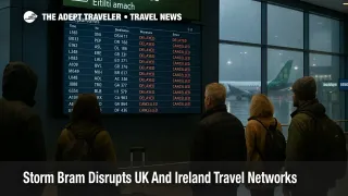
Dublin Airport (DUB) has been the main aviation pinch point. Ireland focused travel briefings report that at least 42 rotations, meaning 21 arrivals and 21 departures, were cancelled on December 9 as Bram's 160 kilometer per hour gusts made crosswind landings and departures unsafe and forced some trans Atlantic flights to divert, while Cork Airport (ORK), Shannon Airport (SNN), and Ireland West Airport (NOC) also reported additional cancellations and knock on delays. Local media and aviation trackers have since counted even higher totals of cancelled flights, and operators continue to warn that more disruption is likely as aircraft and crews work back into position.
For travelers, that means Dublin no longer functions as a fully reliable hub in the short term. Same day connections between regional Irish airports and long haul flights out of Dublin, as well as itineraries that chain Dublin with London or continental European hubs, now carry a higher risk of missed onward flights or forced overnight stays, especially for those traveling on separate tickets.
UK airports: broader delays ripple through the network
Across the Irish Sea, the Met Office named Bram on December 8 and issued amber wind warnings for northwest Scotland and widespread yellow wind and rain warnings for much of Wales, southwest England, Northern Ireland, and parts of England and Scotland, signaling a risk of 70 to 90 mile per hour gusts in the most exposed locations and 50 to 70 mile per hour winds more widely.
By December 10, UK focused aviation coverage was reporting around 600 flight delays and at least 32 cancellations attributed to Storm Bram across airports in London, Manchester, Belfast City, Glasgow, and Edinburgh, mainly affecting services operated by British Airways, easyJet, Ryanair, Aer Lingus, and Emerald Airlines. Most of these cancellations are short haul flights within the British Isles and to nearby European destinations, but they still create long queues at rebooking desks and strain hotel capacity near hubs when passengers cannot be reaccommodated until the next day.
The practical pattern for travelers is familiar from previous windstorms. Long haul flights are more likely to operate, although with longer taxi times and holding patterns, while short haul and regional services take the brunt of cancellations because they can be consolidated or scrubbed more easily. Crosswinds and wet runways also mean that minimum connection times at airports such as London Heathrow Airport (LHR), London Gatwick Airport (LGW), and Manchester Airport (MAN) may no longer be realistic, especially for passengers connecting between separate tickets or between different terminals.
Ferries and ports: Irish Sea and Western Isles routes hit
Bram is also a maritime storm, and its impact on ferries around Ireland, the Irish Sea, and western Scotland is now significant. Irish outlets and ferry operators report multiple cancellations on routes linking Ireland with both Britain and France, including selected Irish Ferries and Stena Line sailings between Dublin and Holyhead, as well as services between Dublin or Rosslare and Cherbourg that have been delayed or moved to later days.
In Scotland, Caledonian MacBrayne has announced that Western Isles routes including those linking Oban with Barra, Islay, and South Uist are either cancelled outright or operating under heavily modified schedules while high seas and strong winds persist. Live updates from maritime and emergency channels underscore that swell, spray, and the combination of high astronomical tides and Bram's southerly winds are increasing the risk of wave overtopping, particularly along exposed Atlantic and Irish Sea coasts.
A local police update in southwest Scotland has gone as far as advising that, due to temporary closures at Holyhead, all Dublin Holyhead sailings are suspended for an extended period, with travelers urged to check with their operators and to expect diversion to alternative routes where capacity allows. Even if that specific timeframe shortens as conditions improve, it is a clear signal that Irish Sea crossings should be treated as high risk for last minute cancellations for the next several days.
Rail and roads: speed restrictions, inspections, and closures
Rail and road networks are dealing with their own version of Bram's chaos. Network Rail has warned that lines across Scotland face temporary closures and speed restrictions as heavy rain, strong winds, and flooding increase the risk of fallen trees, power line damage, and landslips, with passengers urged to check journeys before travel rather than assuming normal timetables. On December 10, ScotRail confirmed that while most services are running, lines such as Fort William to Mallaig, Dingwall to Kyle of Lochalsh, and Cathcart to Neilston remain closed until daylight inspections clear debris and assess damage.
In England and Wales, heavy rain and strong winds have led to scattered flooding incidents and road closures, including earlier closures of the M48 Severn Bridge and sections of motorways in Scotland after high sided vehicles overturned in the wind. Across Ireland, similar problems are cropping up on rural roads and in low lying coastal areas, where standing water, fallen trees, and localized flooding force detours or complete closures for several hours at a time.
For travelers, the only safe assumption is that door to door journeys, especially those combining rural roads with long distance rail or ferries, will take significantly longer than printed schedules suggest. Hiring a car to "beat" the disruption is unlikely to help on days when both roads and railways are constrained at the same time.
Background: how Storm Bram fits into the season
Storm Bram is part of the 2025 to 2026 European windstorm season and has been identified as a Shapiro Keyser type extratropical cyclone, meaning it is a fast deepening low pressure system that can generate multiple zones of damaging wind and heavy rain as it passes. Met Éireann named Bram on December 8, 2025, and both it and the UK Met Office issued overlapping wind and rain warnings as the storm crossed Ireland and moved into the British Isles on December 9.
While individual storms are driven by short term atmospheric patterns, UK climate assessments increasingly point to heavier rainfall events and more frequent periods of saturated ground as a result of climate change, which in turn raises the risk that storms like Bram will trigger flooding, landslides, and longer lasting disruption even once winds abate.
How long will the disruption last
By December 10, some of Bram's strongest winds have started to ease, but Met Office and Met Éireann outlooks suggest that showers, gusty conditions, and pockets of heavy rain will persist into December 11, particularly in northern and western areas, and that rivers and coastal waters will remain high. That means travel disruption is likely to continue on a rolling basis even as operators work to restore normal schedules.
Rail infrastructure managers in Scotland indicate that lines closed by Bram will reopen only after daylight inspections, and that speed restrictions may remain in place for some time to guard against landslips on saturated embankments. Ferry operators are similarly clear that sailings will only resume as marine warnings are downgraded and seas moderate, and that some routes, especially longer Irish Sea and Atlantic crossings, may face extended disruption while ships and crews are repositioned.
In practical terms, travelers with flexibility should treat December 9 to 11 as a window in which nonessential trips can be postponed or rerouted, and in which it is safer to build itineraries around inland routes and larger, more resilient hubs rather than smaller ports and airfields.
What travelers should do now
Anyone booked to fly into or out of Dublin, London, Manchester, Glasgow, Edinburgh, Belfast, Cork, Shannon, or regional Scottish and Irish airports between December 9 and 11 should check flight status repeatedly, not just once, and should log in to airline apps to monitor rebooking options, waivers, and automatic re protection offers. Where possible, keep travel on a single ticket with one airline group so that missed connections are handled automatically, and consider moving nonessential trips to later in the week if change fees are waived.
Ferry passengers, particularly on Irish Sea routes and Western Isles crossings, should assume that same day port to airport connections are fragile and plan for the possibility of being stranded on one side of the water overnight if sailings are scrubbed. Booking flexible tickets, carrying overnight essentials in hand luggage, and identifying alternative routes, for example via different ports or by rail around the Irish Sea, will make it easier to adapt.
Rail travelers in Scotland, northern England, Wales, and storm exposed parts of Ireland should check operator alerts on the morning of travel, particularly if journeys involve rural branches that may still be closed for inspection. Adding at least one extra train's worth of buffer time before any onward flight or ferry, and carrying water, snacks, a power bank, and any required medication in a small day bag, will reduce stress if services are slowed or diverted.
Finally, travelers should remember that while weather related cancellations often fall under "extraordinary circumstances" for compensation rules, European carriers must still offer a choice of refund or rerouting and provide basic care, such as meals and hotel accommodation when passengers are stranded overnight, so it is worth keeping receipts and documenting conversations with airlines and ferry companies when seeking reimbursement later. For broader planning around winter storms in Europe, Adept Traveler's evergreen storm travel guide remains a useful companion to this live alert.[2]
Sources
- Storm Bram has been named
- Strong winds and heavy rain will affect Ireland
- Severe weather, Ireland and United Kingdom, ECHO Daily Flash
- Storm Bram brings travel chaos to trains, boats and planes
- Storm Bram grounds over 40 flights and shakes Ireland's holiday travel plans
- UK faces travel chaos due to Storm Bram
- UPDATE, rail lines closing and speeds reduced across Scotland for Storm Bram
- Storm Bram, what are the weather warnings in my county
- 2025-26 European windstorm season, Storm Bram