Cyclone Grant Cocos Flights Still Fragile After Eases
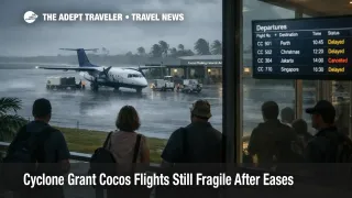
Tropical Cyclone Grant's direct threat to the Cocos (Keeling) Islands has eased, but travelers should not treat that as an all clear for transport. Emergency WA messaging for the islands moved into a "Threat is reduced" posture across December 25 and December 26, 2025, reflecting lower immediate risk on the ground. Visitors and residents transiting through Cocos (Keeling) Islands Airport (CCK) should still plan for fragile flight operations because residual winds, sea conditions, and recovery sequencing can cause late cancellations and delayed restarts in a thin market.
The practical change for travelers is that the problem shifts from sheltering decisions to logistics decisions. When the alert level steps down, transport providers often resume cautiously, and they may still pause if conditions remain marginal or if aircraft and crews are not in position. The result is a common failure mode for remote islands, flights show as operating, then flip to delayed or cancelled close to departure, and the next available seats may be days away depending on schedules and load factors.
Who Is Affected
Travelers already on the Cocos (Keeling) Islands are the most exposed, especially anyone with a hard deadline connection onward to Australia. The island's limited lift means a single disrupted rotation can strand passengers, separate groups, and force unplanned hotel nights. This is amplified during holiday periods when spare seats are limited and rebooking options are narrow.
Inbound travelers with near term arrivals are also affected, including people using the islands as a stopover in an eastern Indian Ocean itinerary, and anyone visiting friends, family, or government facilities with fixed reporting dates. Even if the flight operates, knock on effects can include baggage delays, missed check in windows, and short notice changes that create expensive last mile problems in a market with fewer taxis, fewer alternative accommodations, and fewer same day substitutes.
Marine services and small craft movements remain in the risk envelope after the "Threat is reduced" step. DFES guidance emphasizes that cyclones can bring dangerous seas and associated hazards that do not end the moment the warning level shifts. If travelers were relying on lagoon or near shore services for transfers, tours, or supplies, those operations can remain suspended until operators are confident conditions are stable.
What Travelers Should Do
For departures from Cocos (Keeling) Islands Airport (CCK) within the next 24 hours, assume the schedule can change late and build a buffer around every fixed time commitment. Confirm status directly with your airline, and plan to be contactable, because rebooking decisions often need quick responses when capacity is constrained. If you must travel onward the same day, avoid stacking separate tickets where a missed leg would strand you without protection.
Use decision thresholds instead of hoping for perfect timing. If your onward itinerary includes a cruise embarkation, a last flight of the night, or a medical or family deadline, treat a fresh delay or a deteriorating forecast as a reroute trigger rather than a wait and see moment. In thin markets, the cost of waiting can be losing the only workable seat on the next operating service, so moving early can be the safer strategy when the downside is high.
Over the next 24 to 72 hours, monitor both the hazard signals and the operational signals. Emergency WA alert level changes can move up or down as conditions evolve, and DFES notes the warning levels are designed to reflect changing risk before, during, and after a cyclone. Pair those updates with Bureau of Meteorology reporting for wind and sea conditions, then watch for airline communications that indicate whether operations are returning normally or being restarted in limited waves.
How It Works
Cyclone disruption on remote islands is not only about the storm's closest approach, it is about how quickly the transport system can safely restart. Even when the direct threat eases, residual winds and sea state can keep aircraft within operating limits on paper while still making turnarounds unreliable in practice. On small islands, the operational tolerance is narrower because there are fewer spare aircraft, fewer alternative airports, and fewer extra crews available to absorb variance.
First order effects appear at the source, the airfield and local marine approaches. If the island's runway environment is wet, crosswinds are high, or visibility is variable, flights may be delayed, cancelled, or limited to specific windows. DFES explicitly warns that airports may be closed when a cyclone threatens, and that travelers should contact their airline, which is the right model even as the warning level de escalates.
Second order ripples show up immediately in connections and accommodation. A cancelled or heavily delayed flight can push travelers into a smaller set of later departures, which concentrates demand into the next available inventory and makes re accommodation harder. That then spills into hotel nights, extension fees, and itinerary breaks for travelers who planned onward flights, tours, or ferries on a tight chain. In island markets, the ripple can last longer than the weather, because the recovery depends on aircraft positioning, crew duty limits, and how quickly airlines can reflow passengers through a limited schedule.
Sources
- Cyclone Overview, Department of Fire and Emergency Services
- Prepare for a Cyclone, Department of Fire and Emergency Services
- Tropical Climate Update, Bureau of Meteorology
- Tropical cyclone forecast, Bureau of Meteorology
- Cyclone Advice Prepare Now, Cocos (Keeling) Islands, ABC Emergency
- Emergency WA expands to protect Indian Ocean Territories, WA Government