Cyclone Koji North Queensland Flights Jan 10 to 12
Tropical Cyclone Koji is moving toward the North Queensland coast, and transport operators are already pausing air, sea, and local links from Townsville to the Whitsundays. Travelers transiting Townsville Airport (TSV), heading to Magnetic Island, or holding Whitsunday island ferries and reef day tours face the highest disruption risk between January 10, 2026, and January 12, 2026. Before you head out, confirm your flight and ferry status, build in extra time and accommodation flexibility, and set a clear cutoff for rebooking if warnings expand or closures extend.
Cyclone Koji North Queensland flights are already being disrupted because the airport, ferry, and tour network depends on safe operating windows that shrink fast once gale warnings, port closures, and local transport suspensions begin.
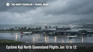
Townsville Airport says it will close from 4:00 pm on Saturday, January 10, 2026, and it directs passengers booked on flights on Saturday, January 10, 2026, or Sunday, January 11, 2026, to contact their airline. That single closure matters beyond Townsville because it forces aircraft and crews to reposition away from the coast, which can delay the restart even after conditions improve, especially when carriers consolidate schedules to protect their networks.
On the ground, Translink says all Townsville services will be suspended from 4:00 pm due to Tropical Cyclone Koji, and it notes Magnetic Island services are impacted. That turns last mile planning into a real constraint, because even travelers who manage to reroute flights can still lose the ability to reach accommodation, ferry terminals, or alternative pickup points safely.
On the water, SeaLink Magnetic Island has already cancelled specific late afternoon sailings on Saturday, January 10, 2026, and published an amended timetable, with a warning that further disruptions into Monday depend on cyclone development and movement. In the Whitsundays corridor, Cruise Whitsundays has posted cancellations for Sunday, January 11, 2026, and Monday, January 12, 2026, spanning both reef products and inter island transfers, which is the practical point where many resort itineraries break.
Who Is Affected
Travelers are most exposed if their itinerary stacks multiple links inside the warning zone, for example a flight into Townsville Airport (TSV), a same day transfer to the ferry, and a booked accommodation check in on Magnetic Island. The same is true for Whitsundays itineraries that rely on timed ferry connections, reef departures, or airport to marina transfers, because once marine operators pause, the system does not have much spare capacity to catch everyone up quickly.
If you are traveling through the central coast impact corridor, the warning zone described in public reporting spans a long stretch of coastline, and forecasts point to a possible crossing between Townsville and Bowen early Sunday, January 11, 2026. That geography matters because it captures major road and coastal transport chokepoints used for resort supply runs and onward travel, which can keep shelves, fuel availability, and rental car logistics tight even when flights resume.
Cruise passengers and day visitors can also feel the ripple. Port of Townsville says the Regional Harbour Master closed the Ports of Townsville and Lucinda for shipping movements, and it notes the closure contributed to the cancellation of the cruise ship Noordam call in Townsville on Friday, January 9, 2026. When ports restrict movements, the impact often shows up as delayed provisions, shifted shore plans, and fewer recovery options for travelers trying to leave by sea when air links are constrained.
What Travelers Should Do
If you are due to fly into or out of Townsville, treat the 4:00 pm Saturday, January 10, 2026, airport closure as a hard planning boundary. Do not travel to the terminal hoping for a same day update, instead, confirm your airline's rebooking and refund options, and secure at least one extra night of accommodation in a safe location that you can actually reach given the local public transport suspension.
If you have an island segment, decide whether you would rather be on the island or on the mainland before services thin out. Ferry operators are already cancelling sailings and warning that further stoppages are possible, so a good threshold is this, if your next required sailing is within the next 12 to 24 hours, and you cannot tolerate a one to two day delay, rebook now to remove the ferry dependency.
Over the next 24 to 72 hours, monitor three things in parallel, airport operating updates, ferry operator status pages, and tour operator cancellations for your exact product and date. Even after winds ease, recovery can lag because ports may stay restricted, aircraft and crews may be out of position, and road flooding can block transfers that look short on a map.
Background
Tropical cyclones disrupt North Queensland travel in layers, and the first layer is the immediate operating envelope, wind limits for airport ground handling, swell and wave action that makes crossings unsafe, and rainfall that floods access roads and marinas. Those constraints show up quickly as closures like Townsville Airport's planned shutdown and ferry operators cancelling sailings for safety.
The second layer is network recovery. When an airport closes, aircraft and crews that would normally cycle through Townsville, or continue onward to other Queensland routes, often end up parked elsewhere, and airlines prioritize restoring trunk routes before adding back smaller spokes. When a port closes to shipping movements, supply runs, cruise calls, and some marine support services pause, and that can extend disruption into resort zones that depend on just in time deliveries.
The third layer is traveler throughput. Once local transport is suspended, and tour operators cancel sailings across multiple dates, you get a temporary mismatch between stranded demand and limited rebooking inventory. That is why buffer nights and flexible ticketing matter more in cyclone season, and why it is smart to plan your trip so you are not dependent on a single narrow connection window. Related guidance on how cyclone season changes cruise and island planning is in Vanuatu, New Caledonia Cyclone Season Raises Cruise Risk.
Sources
- Townsville Airport Travel Update
- Cyclone Koji update, Queensland Government
- Townsville services suspended, Tropical Cyclone Koji, Translink
- Ferry service status, SeaLink Magnetic Island
- Cancellations, Cruise Whitsundays
- Port of Townsville cyclone preparations underway
- ABC: Cyclone Koji set to cross coast near Townsville
- Weatherzone warning feed, Tropical Cyclone Koji