Japan Blizzard Flight Cancellations Hit Ski Airports Jan 21
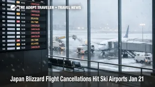
Strong winds and heavy snowfall are disrupting air travel across northern and western Japan, with All Nippon Airways and Japan Airlines canceling dozens of flights as runway capacity and deicing operations tighten. The most visible pinch point is New Chitose Airport (CTS) near Sapporo, Japan, a key gateway for Hokkaido ski trips and winter city breaks. Travelers with flexibility should shift travel dates away from the peak snow window, and everyone else should use airline waiver tools early, because same day reaccommodation can collapse quickly when winter loads are already high.
The Japan blizzard flight cancellations matter beyond a single airport because the Japan Meteorological Agency warns heavier snow risk from January 21, 2026, through January 25, 2026, which can keep disruption rolling and make recovery uneven by region and time of day.
Who Is Affected
Hokkaido bound travelers are the first group exposed, especially anyone transiting through New Chitose for onward flights, rail transfers, or resort buses into Niseko, Furano, Rusutsu, and other ski areas. When New Chitose loses capacity, the problem is not only cancellations, it is that available seats on later flights vanish quickly, and the remaining options often require rerouting through Tokyo or Osaka with longer layovers.
The second group is travelers using smaller northern and Sea of Japan side airports that airlines have flagged for disruption handling. ANA's special ticket handling list includes New Chitose, Hakodate Airport (HKD), Aomori Airport (AOJ), Akita Airport (AXT), Niigata Airport (KIJ), Komatsu Airport (KMQ), and other regional airports where winter weather can flip operations from normal to constrained within a few hours. JAL's domestic weather advisory similarly flags New Chitose, Sapporo Okadama Airport (OKD), Hakodate, Aomori, Niigata, and other northern airports as at risk on January 21, 2026, with additional southern island airports listed for strong winds.
A third group is anyone connecting through Tokyo on separate tickets. When aircraft and crews are stranded away from their next assignment, airlines often protect long haul banks by canceling or consolidating domestic feeder flights, which raises misconnect risk for travelers trying to stitch together domestic Japan and international segments. Reuters also noted that nearly all ANA cancellations in the initial burst were concentrated at New Chitose, which is a classic setup for aircraft and crew mispositioning that can take a full day or more to unwind if snowfall persists.
What Travelers Should Do
If you have not departed yet, treat January 21, 2026, through January 25, 2026, as a period where schedules can change multiple times per day. Use the airline's special handling options to proactively change flights or request refunds, and do it before airport lines form, because both carriers are signaling disruption risk even when an individual flight has not yet been canceled.
If you must travel during the window, set decision thresholds that protect fixed commitments. For ski trips with prepaid transfers or lift bookings, it is usually smarter to move the outbound flight earlier than to gamble on same day rebooking, because missing the first night can cascade into lost shuttle seats, missed lessons, and higher last minute hotel rates in Sapporo and resort bases. For flexible city stays, you can often wait longer, but you should still avoid tight same day domestic connections and avoid separate ticket itineraries that depend on a precise arrival time.
For the next 24 to 72 hours, monitor three signals rather than obsessing over a single forecast map. First, watch whether your airline expands the eligible airport list or date range for special handling, because that is a strong indicator they expect rolling disruption. Second, watch New Chitose arrival and departure performance, since a slowdown there often precedes knock on changes elsewhere. Third, watch whether rail operators begin suspending specific lines, because rail is the main backup when flights sell out, and it can also be constrained during heavy snow events.
Background
Japan winter flight disruption often spreads in layers. The first order constraint is runway throughput, deicing capacity, and crosswind limits, which reduce the number of departures an airport can safely launch per hour, even when the terminal looks calm. The second order effect is aircraft rotation breakage, an inbound aircraft arrives late or diverts, the next leg cancels, and the disruption moves forward through the day's schedule like falling dominoes.
The third layer is crew legality and positioning. When crews time out or cannot reach the next aircraft due to weather, airlines cancel additional flights to reset the system, and those cancellations can appear at airports that are not currently seeing the worst snowfall. This is why a New Chitose disruption can bleed into Tokyo flight banks, and why travelers connecting through Tokyo should expect late changes even if Tokyo weather itself looks manageable.
On the traveler side, the ripple hits hotels and ground transport. When passengers are stranded, they extend stays, which can compress Sapporo inventory and raise prices near the station and airport corridor. Resort transfers can also become the limiting factor after a rebooked flight, because shuttle seats, rental cars, and even baggage delivery slots can sell out during peak winter demand.