Storm Nils France Travel Disruptions February 12
Storm Nils is forecast to cross France from Wednesday night into Thursday, February 12, 2026, bringing very strong winds and heavy rain that can disrupt roads, rail, and flights. Travelers moving by train, driving long distances, or relying on airport transfers across western and southern France are most exposed, especially where services depend on wind sensitive infrastructure and flood prone approaches. The practical move is to treat Thursday as a conditional travel day, add buffer to every transfer, and decide early whether to move plans forward or pivot to a later departure.
The key update versus earlier outlooks is the storm timing and track detail that helps travelers choose between shifting earlier or holding. Multiple reports citing Météo France describe an Atlantic arrival Wednesday evening followed by a southeast sweep toward the Gulf of Lion and Corsica on Thursday, which increases the odds of staggered disruption that pops up in different regions over the course of the day.
Who Is Affected
Long distance rail travelers should plan for delays and selective suspensions, not just slower boarding. SNCF Connect has published an orange weather alert for Thursday, February 12, stating train circulation will be disrupted, with speed restrictions, altered routings, and suppressions possible, and advising passengers to check schedules before going to the station. In practice, wind drives the operational decision making, because speed limits and safety holds can arrive with little notice when gusts spike, trees fall, or signaling and power systems are stressed.
Regional rail is already flagging specific impacts in exposed corridors. In Centre-Val de Loire, Rémi reports that strong winds and heavy rain are disrupting rail movement on February 11 and February 12, with SNCF Réseau-imposed speed limitations and temporary service gaps on several lines during the overnight and morning windows. Even if your route is outside that region, these localized measures matter because rolling disruptions can strand passengers away from hubs, and that pushes late arrivals into the next layer of the system: missed onward trains, crowded rebooking lines, and extra hotel nights near key junctions.
Drivers should expect high friction on major highways, particularly in the first landfall zone and the southwest, where wind and localized flooding can make travel unsafe and trigger speed management or closures. VINCI Autoroutes warns that Météo France has placed several Atlantic and southwest departments on orange wind alert, and it lists a wide set of affected motorways across its network, with additional corridors expected to be drawn in on Thursday as the storm progresses. The travel consequence is not just slower driving, it is transfer chain failure, because one blocked approach road can break a rail to airport plan or a car to train plan even if your final segment is still running.
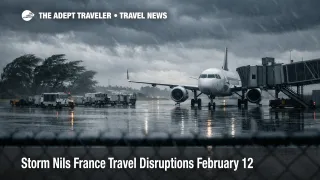
Air travelers should plan for knock on flight delays and occasional cancellations driven by late crews and late passengers as much as by runway operations. Strong wind periods can slow ground handling, constrain some ramp activity, and reduce arrival flow rates, but the bigger traveler risk is the cascading effect when surface transport disruptions keep people from reaching terminals on time. This is especially punishing for itineraries with separate tickets, last train dependencies, or tight same day connections through major gateways.
What Travelers Should Do
If you are traveling overnight February 11 into February 12, treat every transfer as a two step plan with a fallback. Build additional time into station and airport runs, and avoid committing to a single corridor, especially if it is an exposed motorway drive or a regional train that can be slowed by wind restrictions. If you must be at the airport for a long haul flight, leaving earlier is usually cheaper than trying to recover from one missed rail link or one closed approach road.
Set a decision threshold for rebooking versus waiting that matches your downstream penalties. If your itinerary has a non flexible flight, a cruise embarkation, or a timed event you cannot miss, the safer choice is to move the critical segment earlier on February 11, or to shift to a later day rather than gambling on day-of recovery. If you are flexible, you can hold, but only if you have a backup to reach your departure point without relying on one vulnerable link.
Over the next 24 to 72 hours, monitor the right sources in the right order. Start with Météo France vigilance for wind and heavy rain, then check Vigicrues for river level escalation that can force local road restrictions, then confirm your operator status updates, including SNCF alerts for your exact train number and regional networks that publish temporary service gaps. If you are driving, follow concessionaire and local authority updates for the corridors you will actually use, because the difference between a safe trip and a stranded trip is often one closure you learn about too late.
How It Works
Wind and flooding events like Storm Nils propagate through the travel system in layers, and the timing of those layers is why disruption often feels inconsistent across a single day. The first order effects are physical: high gusts trigger rail speed restrictions, tree fall risk, and occasional infrastructure faults, while heavy rain can flood low points and force road closures or detours. Those direct hits then spill into second order travel impacts, trains arrive late into hubs, passengers miss their onward legs, and rebooking queues expand faster than capacity can recover, especially when disruption hops region to region along the storm track.
The third layer is the operational cascade that shows up later in the day. When crews cannot reposition, aircraft rotations slip, and airports absorb waves of late passengers, airlines may be forced into targeted cancellations that are only indirectly related to the weather at the departure airport. Hotels near major stations and airports can tighten quickly when travelers choose to overnight rather than risk a broken transfer chain. For travelers transiting Paris, planned transit works can compound these weather risks by narrowing your backup options during the same week, so it can be useful to understand the current baseline constraints before you commit to a rail-first plan. Paris Transit Works Cut Metro and RER Feb 9 to 15 If your trip includes time in the capital and you want a routing approach that avoids overdependence on a single corridor, Paris Travel Guide: The Ultimate 7-10 Day First-Timer's Itinerary can help you pre-plan simpler station pairs and alternates.
Sources
- Vigilance Météo France, Carte de vigilance météorologique
- SNCF Connect, Alerte orange météo 12 février, passage de la tempête Nils
- Rémi Centre-Val de Loire, Vigilance Météo France, Tempête Nils
- VINCI Autoroutes, Tempête Nils, prudence sur le réseau
- Le Monde, Crues et tempête Nils, départements en vigilance