Australia Flood Road Closures Disrupt Outback Loops
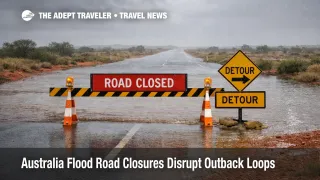
Australia's inland touring season just got narrower. On March 1, 2026, Australia flood road closures spread across multiple jurisdictions, with long term closures posted on key Queensland outback routes, active flood and severe weather warnings across parts of South Australia, Victoria, and New South Wales, and an emergency declaration in parts of the Northern Territory tied to a tropical low. The practical consequence is that popular self drive loops can fail mid route, detours can add a full day, and some remote towns can become functionally air access only until river systems fall.
The change since the last round of coverage is that this is no longer just a broad wet pattern. Queensland's road status network is listing multiple development roads as closed due to long term flooding from heavy rain, including segments that are central to Channel Country style routing. Northern Territory messaging has also moved into emergency management posture for parts of Central Australia and the Barkly region, which is the kind of escalation that can include lawful directions and wider movement constraints if conditions deteriorate.
Australia Flood Road Closures: What Changed For Travelers
Queensland's official road status reports show widespread "road closed to all traffic" entries on interior corridors on March 1, 2026, including multiple closures along the Diamantina Development Road and the Eyre Developmental Road, plus closures on the Donohue Highway within Queensland's border areas. Separate Queensland district reports also show development roads in the north and northwest listed as closed due to long term flooding. If your itinerary relies on those corridors for a loop, the risk is not "slow going," it is hard stop closure with limited alternates that are also vulnerable to washouts.
Across the south, the Bureau of Meteorology has an active Flood Watch for parts of South Australia, which is a planning signal that catchments may produce flooding as rain falls and drains. Victoria and New South Wales are also in a severe weather posture in some regions, with public warnings emphasizing intense rainfall and flash flooding risk, which is the condition that tends to close low crossings and surprise travelers who assume highways are the safe option.
In the Northern Territory, emergency messaging is tied to a tropical low, with SecureNT surfacing an emergency declaration for parts of Barkly and Central Australia. Even if you are not in the declared area, this matters because Central Australia routing is sparse. When one major segment goes down, the "detour" is often hundreds of miles, or it does not exist.
Which Itineraries Are Most Likely To Break
The highest exposure is any self drive plan that depends on interior development roads, unsealed connectors, or single bridge crossings. That includes Channel Country style touring, Birdsville area approaches, and any outback loop built around "we will decide on the day," because the decision point can arrive after you have already committed to a segment with no services and no alternate exits. Queensland reporting has described towns such as Birdsville becoming cut off by road when rivers rise, which is exactly the failure mode travelers need to plan around.
Second highest exposure is any itinerary that mixes long outback drives with fixed time commitments, for example, a booked regional flight, a liveaboard departure, a remote lodge check in window, or a pre paid tour start. When roads close, you do not just arrive late, you may arrive after the last viable rebooking window, and then you are buying expensive last minute inventory in the nearest town that still has beds.
The third exposure group is travelers using regional airports as the safety valve. In theory, flying out is the workaround when highways close. In practice, the same weather pattern that closes roads also disrupts regional operations, and the supply chain effects can tighten fuel, catering, and staffing resilience in remote locations. Queensland reports have already described air deliveries being used in some outback situations, which is a clue that normal logistics are strained.
What Travelers Should Do Now
The immediate action is to treat road status and warnings as a go or no go gate, not as background information. Before you leave cell coverage, check the relevant official road status service for every segment you plan to drive that day, plus the next day's exit segment, because you need an escape path, not just a destination. In Queensland, use the state road status reports as your baseline, and assume that "long term flooding" closures will not flip back quickly, even if rain eases.
The decision threshold is simple. If your route relies on one closed corridor with no paved alternate within a reasonable day's drive, do not start the loop. Reroute to a coastal or major highway itinerary, or compress into a hub and spoke plan where you return to the same base each night. If you are already on the ground and closures are ahead of you, prioritize getting to a town with accommodation, fuel, and medical access before nightfall, then reassess. The cost of one extra hotel night is usually lower than the cost of getting stuck between towns with limited services.
What to monitor over the next 24 to 72 hours depends on region. In South Australia, watch whether the Flood Watch escalates into more targeted warnings as catchments respond. In Victoria and New South Wales, monitor severe weather updates for the specific forecast districts you will cross, because flash flooding is the condition that changes road safety fastest. In the Northern Territory, monitor SecureNT for any expansion, extension, or specific travel direction language attached to the emergency declaration.
Why This Pattern Closes Roads, Then Breaks Schedules
Australia's interior disruption mechanism is different from coastal storm travel. Outback networks are sparse, and many routes depend on low lying crossings, causeways, and unsealed surfaces that can be damaged quickly, then take time to assess and repair. When Queensland posts "road closed to all traffic" for long term flooding, it signals not just water on the surface, but a risk that the road base is compromised.
The second order effect is that closures concentrate demand into fewer safe corridors. That creates crowding in the towns that remain accessible, pushes up last minute accommodation prices, and produces fuel availability stress when deliveries cannot move normally. It also turns "flexible touring" into a high stakes bet, because flexibility only helps if there are multiple viable routes, and in the interior there often are not.
The third order effect hits aviation and tours. When road closures isolate communities, air access becomes more important, but regional flight operations can become less reliable for the same reasons, weather, aircraft positioning, and resource constraints. Meanwhile, tours cancel not only due to immediate safety, but because guides, vehicles, and supplies cannot reposition across the closure line. That is why a road closure day can cascade into several days of reshuffled plans even after skies clear.
Sources
- Transport and Main Roads Road Status Update, Central West District (Queensland)
- Transport and Main Roads Road Status Update, Far North District (Queensland)
- Flood Watch for parts of South Australia (Bureau of Meteorology)
- Alerts and warnings (SecureNT)
- Advice, Riverina and Far Western NSW severe weather (ABC Emergency)
- Watch & Act, severe weather for parts of Victoria (ABC Emergency)
- Incidents and Warnings (VicEmergency)
- Flooding continues along Diamantina and Georgina rivers in Qld outback cutting off Birdsville by road (Courier Mail)