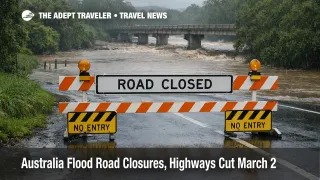
Australia Flood Road Closures, Highways Cut March 2
Australia flood road closures expanded again on March 2, 2026, and the practical change is that this is now a highway problem, not just "wet weather." Queensland's official road status shows the Bruce Highway closed between Ingham and Cardwell due to flooding at the Seymour River, a hard break on the main coastal spine that can strand drivers, disrupt bus schedules, and force detours that do not exist at scale. At the same time, flooding closures are showing up on key NSW corridors, and severe weather warnings in Victoria are reinforcing that even paved routes can flip from passable to closed fast when intense rainfall hits.
The updated traveler reality is that touring loops this week should be planned like a rolling access restriction, especially if they depend on a single crossing, a low causeway, or one "main road" to get you to the next overnight. When the spine routes close, the second order effect is immediate accommodation compression in the towns that remain accessible, plus a scramble for rental cars that can be repositioned, and for seats on any regional flights that still operate.
Australia Flood Road Closures: What Changed On March 2
The most decision useful update is confirmed, named closures on major corridors, plus a wider spread of official warning posture across multiple states. In Queensland, the Department of Transport and Main Roads listed the Bruce Highway closed between Ingham and Cardwell due to flooding at the Seymour River on the evening of March 2, which is one of the clearest "stop driving, plans must change" signals you can get. This matters because the Bruce Highway is not just a local road, it is the default north south lifeline for coastal itineraries, supply runs, and airport access in that section of North Queensland.
In New South Wales, the official Live Traffic incident list showed highway closures for flooding, including the Silver City Highway between Dareton and Buronga, which illustrates how quickly long distance road itineraries can break when water cuts a corridor that does not have easy alternates. In Victoria, official warnings highlighted the risk of locally intense rainfall and dangerous flash flooding impacting areas including Mildura and other districts, which is the kind of setup that closes local connectors and low bridges even when the "main highway" looks fine on a map.
Separately, Bureau of Meteorology reporting and major media coverage described record or near record rainfall impacts across parts of inland South Australia, Victoria, and New South Wales, reinforcing that the system is broad enough to produce simultaneous failures across regions, not a single contained flood zone.
Which Trips Are Most Likely To Get Trapped Or Rerouted
The highest risk segment is any self drive plan that stacks long distances with fixed commitments, for example a booked regional flight, a pre paid tour start, a cruise embarkation, or even a hotel check in that cannot be moved without penalty. Once a closure line forms, the "detour" may be a multi hour backtrack, a night drive, or no viable road route at all until water falls and engineers clear the road base.
The second risk segment is coastal and north Queensland travel that assumes the Bruce Highway will be available as the fallback for everything. When the Bruce closes in a key segment, it does not only delay your drive, it also changes what is possible for airport transfers, coach services, and supply access into towns on either side of the cut. In practice, that pushes more travelers into the same limited inventory of rooms, and it increases pressure on any remaining open routes, which can then fail under traffic, debris, or additional rainfall.
The third risk segment is outback and regional touring loops, especially those that rely on developmental roads, unsealed connectors, and single river crossings. Queensland's road status network on March 2 still showed numerous interior corridors with flood related restrictions and closures, which is a reminder that inland access can remain constrained even when the coastal news dominates. If a loop depends on one crossing, you should treat it as a one way commitment until you have verified your exit routes are open and forecast stable.
What Travelers Should Do Now
First, treat "road closed to all traffic" as a hard stop, not a suggestion, and do not plan to arrive at a closure and negotiate your way through. For Queensland coastal itineraries around the Ingham and Cardwell section, the Bruce Highway closure at the Seymour River is a trip breaker, so the right move is to re time the drive, shift the overnight, or reroute entirely based on the official status pages, not on social updates. For NSW and Victoria itineraries, check official traffic and emergency warnings before you depart and again before you commit to the longest segment of the day, because flash flooding is the condition that turns a normal drive into a stranded night.
Second, use a simple decision threshold: if your next overnight or fixed booking is within one closure or warning zone, and your schedule has less than one full extra night of buffer, rebook now. Waiting only makes sense if you can safely stay put, you have flexible accommodation, and your routing has multiple verified open alternates. If you are on a touring loop with limited alternates, the cost of moving early is often lower than the cost of being forced to buy the last rooms in a town that everyone else is also stuck in.
Third, protect your flight and rail connections by breaking the same day linkage. If you must catch a flight, plan to arrive in the airport city the night before, or build a buffer large enough to absorb a full road closure reroute, because once you miss the check in window you are competing for limited seats during a weather event that can also disrupt regional flight schedules. Keep screenshots of road closure notices, booking confirmations, and any operator cancellation messages, because documentation is what makes refunds, insurance claims, and fee waivers easier later.
Why This Flood Pattern Produces Town Isolation
The mechanism is simple and brutal in regional Australia: sparse networks, limited bridges, and long distances between services. When heavy rainfall saturates catchments, rivers rise quickly, and low lying crossings or approaches to bridges become impassable, forcing official closures that can last longer than travelers expect because roads need inspection and sometimes repairs to the base layer, not just a drop in water level.
Once a major corridor closes, demand concentrates into fewer open routes and fewer open towns. That creates second order impacts that matter to travelers even if they never drive through floodwater, hotel inventory tightens, rental car fleets cannot be repositioned, tours cancel because guides and vehicles cannot get to the start point, and regional airports can see knock on disruption as stranded travelers shift to air, or as supplies and staff movement becomes harder.
This is also why conditions can feel inconsistent, one town can be operational while the next one is effectively cut off. The right mental model is not "rain across a state," it is "a few critical crossings decide access." In the next 24 to 72 hours, the most useful signals are not general weather headlines, they are the official road status updates for your exact corridors, and whether severe weather and flood warnings are being expanded, extended, or downgraded in the districts you must cross.