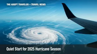
2025 Atlantic Hurricane Season Quiet But Expected to Ramp Up

With only a handful of June days left, the 2025 Atlantic hurricane season has yet to spin up its first named storm. That lull feels eerie after the fast-breaking seasons of 2023 and 2024, but scientists say it is more a pause than a promise. Wind shear, Saharan dust, and slightly cooler waters are tamping down early tropical waves, yet forecasters still expect above-normal activity once high summer heat builds. For travelers headed to the Gulf Coast or Caribbean, complacency is the real risk.
Key Points
- First named storm may not arrive until July, ending an 11-year June-storm streak.
- Wind shear, dust, and modest sea-surface temperatures are suppressing early systems.
- NOAA still predicts 13-19 named storms for 2025.
- Eastern Pacific already has five named storms, showing regional contrasts.
- Why it matters: A late start can lull travelers into skipping vital prep.
2025 Atlantic Hurricane Season Snapshot
Historically, only about two percent of tropical cyclone energy forms before July, so a June drought is unusual but not dire. In fact, 27 of the 59 satellite-era seasons since 1966 produced no June storms. The current quiet owes much to persistent upper-level winds that shred developing thunderstorms, as well as plumes of Saharan dust that stabilize the atmosphere. Once those inhibitors ease and sea-surface temperatures climb above 82 °F, the basin is primed to catch up fast.
Why Early Lulls Happen
June is the climatological shoulder season. High-latitude steering currents remain strong, El Niño's lingering jet-stream influence increases shear, and the main development region's waters have not reached midsummer warmth. Add in periodic dust outbreaks from Africa and you have a natural brake on tropical storm development. The same factors rarely last past mid-July, when the intertropical convergence zone surges north and atmospheric moisture deepens over the Caribbean and Gulf of Mexico.
Experts Warn Quiet Start Masks Active Outlook
Forecast offices from Miami to Boulder agree that the 2025 Atlantic hurricane season could still rival some of the busiest on record. NOAA gives a 60 percent chance of above-average activity, calling for 13 to 19 named storms, 6 to 10 hurricanes, and 3 to 5 majors. Colorado State University's June update echoes those numbers, citing exceptionally warm water in the eastern Atlantic, a trend toward La Niña conditions, and a weakened subtropical jet by late summer.
Even without a named system, the basin has teased its power. A broad gyre flooded parts of Central America in early June, and multiple easterly waves have marched across the Atlantic, only to be decapitated by shear near the islands. Meanwhile, the eastern Pacific has already logged Tropical Storm Dalila and Category 4 Hurricane Erick, proof that ocean heat fuel is available once atmospheric doors open.
Travel planners should note the difference between storm counts and travel impact. Years with no June storms-2014, 2018, and 2019-still produced land-falling catastrophes like Florence, Michael, and Dorian later on. Insurance claims data show that late-season storms account for the majority of payout dollars, partly because coastal occupancy is higher from August through October. Cruise lines are already adjusting fall itineraries, and airlines are reminding passengers to review waiver policies tied to named storms.
Preparation time is now. Evacuation routes, destination shelters, and backup lodging should be locked in while skies are blue. The Federal Alliance for Safe Homes recommends assembling a seven-day kit early and verifying wind-damage coverage on both homeowners and travel insurance policies. Travelers can find detailed planning guidance in our Hurricane Travel Prep Guide and monitor future systems via the National Hurricane Center and NOAA's 2025 outlook.
Analysis
A sluggish opening to the 2025 Atlantic hurricane season offers a fleeting gift: lead time. Hotels still have capacity, contractors can fortify beachfront properties without rushed markups, and supply shelves are full of generators and plywood. Yet history shows that a late start often compresses activity into August and September, shortening the booking window for shoulder-season getaways and raising the odds of itinerary changes.
For the tourism sector, messaging must bridge the gap between vigilance and alarm. Gulf Coast destinations can emphasize fair June weather while spotlighting cancellation-flexible packages. Caribbean islands, which rely on summer travel to offset winter peaks, should promote robust emergency protocols and encourage guests to add cancel-for-any-reason coverage. Airlines and cruise operators, already facing high fuel costs, can reduce future disruption expenses by offering no-penalty changes once the first storm forms.
In simple terms, the early calm is a planning dividend. Travelers who act before the season wakes up stand to save money, minimize stress, and stay safer if the forecasted surge materializes.
Final Thoughts
The 2025 Atlantic hurricane season will not stay quiet forever. When July's heat ramps up and wind shear relaxes, storms will follow the warm water. Book trips with flexible terms, build a personal readiness kit, and keep NOAA alerts on your phone. A little preparation now means far less scrambling when the cone of uncertainty eventually includes your vacation spot.
