Tropical Storm Crising: What Travelers to the Philippines and Hong Kong Need to Know
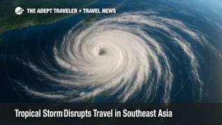
Tropical Storm Crising, known internationally as Wipha, is tracking northwest from the Philippine Sea toward Hong Kong, intensifying regional monsoon rains. As of July 18, the Philippine weather bureau reports sustained winds near 40 miles per hour and a forecast landfall along the Pearl River Delta by July 20. The system has already triggered flight cancellations, suspended inter-island ferries, and blocked mountain roads in Luzon and the Visayas. Travelers bound for the Philippines, Hong Kong, or southern China over the next several days should expect rolling disruptions and plan flexible itineraries.
Key Points
- Why it matters: Crising sits on a heavily traveled summer corridor linking Manila, Cebu, and Hong Kong.
- More than a dozen domestic flights and multiple Cebu Pacific, Cebgo, and PAL Express routes scrubbed on July 18.
- Philippine Coast Guard has grounded ferries on central-Visayas and western Luzon routes.
- Kennon Road and three national highways closed after rockfalls and flooding; detours add two to four hours.
- Hong Kong carriers have issued "no-penalty change" waivers for travel through July 22.
Snapshot
Tropical Storm Crising formed east of Catanduanes on July 17, reached tropical-storm strength early July 18, and is moving northwest at roughly 12 miles per hour. While the cyclone's core remains offshore, its broad rainbands are powering the southwest monsoon, dumping six to ten inches of rain across northern and central Luzon. Government agencies have hoisted Signal No. 2 warnings from Cagayan to Aurora, placed 44 regional airports on heightened alert, and ordered pre-emptive closures of low-lying seaports. Forecast models converge on a Hong Kong-adjacent landfall late July 20 before a second strike on northern Vietnam.
Background
The Philippines assigns local names to every tropical cyclone that enters its area of responsibility; "Crising" is the third named storm of the 2025 western-North-Pacific season. Internationally, the Japan Meteorological Agency lists the same system as Wipha, part of a rotating roster maintained by the World Meteorological Organization. July is peak southwest-monsoon season, so even moderate storms can amplify the warm, moisture-laden flow known locally as the Habagat. In past years, similar monsoon-enhanced storms-such as 2021's Fabian/In-fa-caused more damage through secondary flooding than from direct wind impacts, underscoring the travel risks now unfolding.
Latest Developments
Crising's footprint expanded rapidly during the 24 hours ending 18:00 PHT July 18.
Flights and Airports
- The Civil Aviation Authority canceled or diverted at least 14 domestic legs, including Manila-San Jose, Manila-Virac, Manila-Naga, and Manila-Busuanga. NAIA remained open, but pilots reported 20-minute holding patterns during afternoon squalls.
- Mactan-Cebu International warned of cascading delays as ground crews suspended ramp activities during lightning alerts.
- Cathay Pacific, Greater Bay Airlines, and Hong Kong Airlines issued travel waivers for tickets to/from Hong Kong between July 19 and 22, urging passengers to re-book online rather than queue at counters.
Sea and Land Transport
- The Philippine Coast Guard halted fast-craft service on the Iloilo-Guimaras, Dumaguete-Apo Island, and Batangas-Calapan corridors. Roll-on/roll-off operators advised cargo drivers to stage vehicles on higher ground.
- Three national highways-two in Bicol and one in Samar-were impassable as of noon July 18 due to shoulder collapse. Kennon Road, a popular tourist shortcut to Baguio, closed indefinitely after falling rocks damaged the Camp 6 rock shed.
- More than 7,500 families relocated to municipal shelters, increasing hotel demand in Benguet and Nueva Vizcaya as inbound travelers scrambled for rooms.
Next 72 Hours
Meteorologists expect Crising to gain strength over the South China Sea, with gale-force winds extending 150 miles from the center. Hong Kong's Observatory may raise Signal No. 8 early July 20, a move that historically shutters ferries, cable cars, and most outdoor attractions. Vietnam's Disaster Management Authority has pre-positioned flood-rescue units in Ha Long Bay and notified cruise operators of possible harbor closures on July 21. Travelers should monitor airline apps, enable SMS alerts, and keep hard copies of alternative routing options.
Analysis
Crising's timing-squarely in the heart of Asia's summer travel rush-multiplies its disruptive potential. Domestic leisure travelers heading to beach destinations often rely on single-daily flights; once those segments cancel, same-day overland substitutes may simply not exist. The grounding of inter-island ferries also severs vital links between resort hubs and their gateway airports, stranding visitors who expected quick crossings. Downline, grounded aircraft and crew misplacement ripple into international schedules; a morning cancellation in Manila can translate into evening equipment shortages on routes to Seoul, Singapore, or Los Angeles.
Hong Kong's highly choreographed airport and cruise-port ecosystems turn on tight turnaround times. A prolonged Signal 8 will empty terminal departure boards, forcing carriers to re-book thousands of passengers while juggling slot constraints once operations resume. Cruise lines home-porting in Kai Tak lose revenue each hour piers sit closed; some may opt to swap Hong Kong for Shenzhen or Kaohsiung turnarounds, straining land-transport capacity. Insurance with "named storm" coverage becomes critical, particularly cancel-for-any-reason policies that refund unused hotel nights and missed connections.
On the ground, flash floods hamper ride-share availability, and travelers unfamiliar with provincial bus systems face language hurdles rerouting through secondary airports. Advisers should push clients to pack extra medication, keep digital copies of passports, and budget an additional 24 hours on either side of fixed events such as weddings or conferences. The storm also underscores the value of working with locally embedded partners who can secure scarce hotel rooms and negotiate vehicle charters when public transport falters.
Final Thoughts
Tropical Storm Crising is a textbook reminder that weather, not price, often defines trip success. Travelers bound for storm-prone regions between July and October should build slack into itineraries, favor flexible airfares, and carry insurance that covers storm-related delays. Over the coming weekend, keep boarding passes handy, subscribe to real-time carrier alerts, and avoid overnight land travel in mountainous areas. When skies finally clear, check road conditions before resuming multi-leg journeys, and confirm that island resorts have restored power and water. Staying proactive and well informed converts a potential ordeal into a manageable hiccup-and protects your tropical-storm travel impact.
Sources
- Tropical Cyclone Bulletin No. 13: Tropical Storm Crising (Wipha), 5:00 PM PHT, July 18 2025
- Tropical Cyclone Update, Civil Defense PH, 8:00 PM PHT, July 18 2025
- CAAP Heightened-Alert Advisory for 44 Airports, PIA Bicol, July 18 2025
- DPWH: Three National Roads Closed by Monsoon Rains, July 18 2025
- Philippine Coast Guard: Boat Trips to Apo Island Suspended, July 18 2025
- Kennon Road Closure Notice, PTV Cordillera, July 18 2025
- Cathay Pacific Travel Advisory: Tropical Cyclone Approaching HKG, updated July 18 2025
- Greater Bay Airlines Flight-Service Updates: Severe Tropical Storm Wipha, July 18 2025