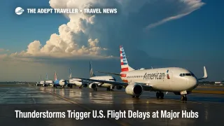
Thunderstorms Trigger U.S. Flight Delays at Major Hubs
Summer storms are once again squeezing America's air network. The Federal Aviation Administration's morning Daily Air Traffic Report and accompanying Operations Plan warn that fast-moving thunderstorm cells, low ceilings, and gusty winds could disrupt schedules from Chicago to San Francisco today. Ground-delay programs or outright ground stops are in play or on standby at several Tier-1 airports, and ripple delays are expected nationwide as airlines re-sequence crews and aircraft. Travelers booked through the affected hubs should prepare for rolling departure pushes, potential missed connections, and tight re-booking inventory as peak-season loads run near capacity.
Key Points
- Why it matters: More than 2 million seats cross the listed hubs today, so minor holds compound quickly.
- The FAA has an active ground-delay program at San Francisco International Airport (SFO) for low clouds.
- Thunderstorms may prompt ground stops or GDPs at Chicago O'Hare, Detroit Metro, Denver, Houston Intercontinental, Philadelphia, and all three Washington-area airports.
- Las Vegas faces high-wind operations, while Denver continues to manage a runway closure from an earlier incident.
- Re-routing traffic over the Great Lakes and Mid-Atlantic could lengthen block times by 30-90 minutes.
- Airlines must refund canceled flights, and the U.S. DOT dashboard shows which carriers guarantee meal or hotel vouchers during lengthy delays.
Snapshot
Thunderstorm complexes moving east from the Plains will collide with soupy air over the Midwest and Northeast, producing towering cumulus that exceed 40,000 feet. Chicago O'Hare (ORD) and Midway (MDW) are first in line for convective holds, followed by Detroit (DTW) and Philadelphia (PHL) as the storm line drifts east this afternoon. The Air Traffic Control System Command Center has already capped arrivals into San Francisco (SFO) because a persistent marine layer has dropped ceilings below 1,000 feet. Gusty south-southwest winds of 35 mph are forecast at Las Vegas (LAS), which can force single-runway operations and longer taxi queues. Houston Intercontinental (IAH) and Hobby (HOU) remain on a watch-status ground stop window beginning 11 a.m. CDT for embedded lightning cells north of the city.
Background
Summer is peak season for so-called pop-up thunderstorms that bloom along moisture boundaries from late morning through sunset. Because convective cells can explode rapidly and tower into flight levels, controllers often issue preventative ground-delay programs-metering departures to match reduced arrival rates-rather than waiting for an all-out ground stop. When a GDP is active, airlines receive calculated departure slots, frequently pushing flights 30-120 minutes beyond the original off-block time. Crews may time-out, gates fill quickly, and rolling delays propagate through the network long after the weather clears. According to the Bureau of Transportation Statistics, weather accounted for 63 percent of all U.S. departure delays last July. The FAA publishes daily traffic outlooks each morning and updates operational advisories every two hours, giving carriers a framework for schedule recovery.
Latest Developments
Midwest & Great Lakes Holds
The Command Center's 271331Z operations plan recommends Chicago terminal-area re-routes after 2 p.m. CDT, with C90 SWAP arrival paths likely. Detroit arrivals could also face capping measures as Lake-Erie weather shields slide east. Airlines have pre-loaded extra fuel for potential airborne holding but warn that turn-times at ORD are already averaging 70 minutes.
Gulf & Mountain Region Impacts
Houston's twin airports are on a possible ground stop beginning 1600 Z (11 a.m. CDT). Denver (DEN) removed its morning GDP, yet a runway-16L closure continues to limit arrival rates, making the field vulnerable if afternoon storm cells redevelop over the Front Range. Las Vegas remains clear of storms but must manage crosswind gusts topping 35 mph; single-runway patterns could shave capacity by 20 percent during peak push periods.
East Coast Constraints
Philadelphia (PHL) is tagged for a possible ground stop after 2 p.m. EDT, while the Potomac TRACON covering Washington National (DCA), Dulles (IAD), and Baltimore/Washington (BWI) is coded probable for similar restrictions. The Northeast Corridor may also impose escape routes and altitude capping to keep transcontinental traffic flowing, tightening available slots for late-day departures.
West Coast Weather Programs
San Francisco's low-cloud GDP is active through 1:59 p.m. PDT, trimming arrivals to 18 planes per hour. Southwest and United have started voluntary re-booking at no cost on earlier or later flights. Seattle-Tacoma is monitoring a shallow marine deck but remains under VFR minima for now.
Analysis
Multi-hub weather events strain airline recovery models because crews and aircraft ripple through interconnected banks. When Chicago or Washington stops accepting arrivals, planes already airborne may hold, divert, or land out of sequence, blowing published connection banks and increasing mis-connect risk. High load factors typical of late July leave little spare capacity for same-day reaccommodation, so proactive itinerary management becomes essential. Travelers should enable push notifications from airline apps, monitor the FAA Flight Delay Information map, and consider self-service re-booking tools that often unlock seats before phone agents are available. Flexible flyers might also exploit ground transport pivots-for example, Chicago's O'Hare to Milwaukee by train, or Reagan National to Philadelphia via Amtrak-when regional corridors gridlock. Finally, passengers should know that U.S. regulations require a full refund, not a credit, if the airline cancels and the passenger declines re-routing.
Final Thoughts
Today's convective threat underscores the cascading nature of U.S. flight delays and the value of real-time situational awareness. Smart planning, flexible routing, and a firm understanding of refund rights help mitigate frustration when thunderstorms tighten the country's airspace. Stay alert, and check airline tools often for the fastest path around U.S. flight delays.