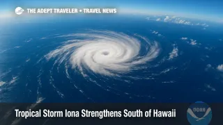
Tropical Storm Iona Strengthens South of Hawaii

Tropical Storm Iona, the first named cyclone of the 2025 central-Pacific hurricane season, spun to life Sunday far south of Hawaii and is expected to reach hurricane strength by tonight, according to the Central Pacific Hurricane Center. At 11 p.m. HST Sunday, the storm was located about 915 miles southeast of Honolulu with sustained winds near 50 mph and was moving west over open water. No coastal watches or warnings are in effect, but swells and rip currents could intensify mid-week.
Key Points
- Why it matters: Iona could raise swells and rip-current risk for Hawaii travelers later this week.
- Storm track keeps center roughly 900 miles south of Oahu with no watches or warnings issued so far.
- Forecast intensity: Iona likely becomes a Category 1 hurricane by Monday night before gradual weakening Tuesday onward.
- Airlines urge flexible rebooking for inter-island flyers if high surf forces coastal airport adjustments mid-week.
Snapshot
At 11 p.m. HST Sunday (0900 UTC Monday), the Central Pacific Hurricane Center placed Iona near latitude 10.9° N, longitude 149.3° W, about 915 miles (1 475 km) southeast of Honolulu. Maximum sustained winds were 50 mph with higher gusts, and the center was moving west at roughly 12 mph. Forecasters expect steady strengthening over 24-36 hours, reaching hurricane status by Monday night, before cooler water and wind shear trigger a slow fade beginning Tuesday night. Tropical-storm-force winds now extend 45 miles from the core, and no land impacts are expected through at least Thursday. Still, long-period swells and above-normal surf may reach south-facing shores of the Hawaiian Islands mid-week.
Background
Central-Pacific tropical cyclones are monitored by the Central Pacific Hurricane Center in Honolulu, which takes responsibility for systems that form or move between 140° W and the International Date Line. The basin's official hurricane season runs from June 1 to November 30, although off-season storms do occur. An average year sees four to five named systems; through late July 2025, Iona is the first. Light trade-wind shear and warm sea-surface temperatures above 82 °F (28 °C) can foster development far south of Hawaii, yet storms near 10° N usually track west into open water. NOAA's seasonal outlook in May called for two to four storms, citing neutral ENSO conditions.
Latest Developments
Intensity outlook and wind field
Overnight forecast cycles indicate a window of favorable conditions, including low shear, moist mid-levels, and 84 °F sea-surface temperatures, supporting steady intensification for at least 24 hours. The 0900 UTC forecast advisory raises maximum winds to 70 kt (80 mph) by late Monday, which would make Iona a Category 1 hurricane on the Saffir-Simpson Scale. Beyond 48 hours, the storm is projected to traverse cooler water and encounter drier air, prompting a downgrade back to tropical-storm strength by early Thursday. The gale-force wind radius is expected to expand modestly to roughly 80 nautical miles on the northern semicircle, broadening seas but still leaving the Hawaiian Islands outside the wind-hazard envelope. Mariners operating along shipping lanes between Hawaii and French Polynesia should remain alert for 12 to 15-foot seas and shifting squall lines through mid-week.
Hawaii travel impacts and airline policies
Although forecast guidance keeps Iona well south of the archipelago, visitors should still anticipate indirect effects. South-facing beaches on Kauai, Oahu, Molokai, Lanai, Maui, and Hawaiʻi Island may see surf heights climb above 6 feet beginning Wednesday night, potentially triggering high-surf advisories and localized beach closures. Operators of snorkel and dolphin-watch excursions on the Kona and Kohala coasts often cancel when long-period southerly swells top 5 feet, so travelers should reconfirm tours 24 hours out. Hawaiian Airlines and Southwest both allow no-fee changes on inter-island tickets when a National Weather Service advisory references hazardous surf, neither carrier has activated waivers yet, but customer-service agents advise booking refundable fares if traveling after Wednesday. Visitors planning offshore cruises or ferry crossings between Lahaina and Lāhainā Harbor should monitor marine forecasts for gale warnings.
Analysis
While Iona is unlikely to disrupt vacation itineraries this week, its appearance underscores how quickly the central-Pacific basin can awaken. Seasonal forecasts issued by NOAA in May anticipated a quieter-than-average year, pegging the probability of below-normal activity at 60 percent because of neutral El Niño-Southern Oscillation conditions and slightly cooler subsurface waters along the equator. That outlook still holds, yet Iona's rapid formation shows that localized pockets of warm water and weak trade-wind shear can override basin-wide signals for brief periods. For travelers, the takeaway is that even "quiet" seasons produce storms capable of influencing surf, rain, and flight operations. Hawaii's tourism infrastructure is resilient, but the state's geography funnels most major roads and airports close to the shoreline, making them sensitive to wave run-up and debris. Airlines increasingly tie flexible change policies to National Weather Service advisories rather than full hurricane watches, giving travelers more control but requiring vigilance. Cruise operators, especially those running repositioning voyages between North America and Australasia, now build extra sea days into itineraries to dodge late-forming cyclones. Iona's projected weakening later this week illustrates another regional trait: storms south of 15° N often lose strength once they exit the warm-water pool near 150° W. Nevertheless, travelers should monitor official bulletins until the remnant low crosses the International Date Line.
Final Thoughts
Travelers bound for Hawaii this week do not face the threat of landfall, yet Tropical Storm Iona is a timely reminder that ocean-generated hazards can materialize hundreds of miles away. Booking refundable activities, monitoring high-surf advisories, and confirming inter-island flights 24 hours ahead remain best practices through the heart of hurricane season. With forecasts showing Iona weakening by Thursday, most itineraries should proceed with only minor tweaks, but staying weather-aware will keep beach days carefree. For now, the biggest headline is simply the name: Tropical Storm Iona. And for travelers already in the islands, following lifeguard and county park guidance will ensure fun stays safe.
