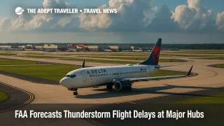
FAA Forecasts Thunderstorm Flight Delays at Major Hubs
The Federal Aviation Administration's daily operations forecast warns travelers to brace for weather-related flight delays this afternoon. Thunderstorms are expected to sweep the Southeast, Midwest, and Rockies, disrupting flights at Hartsfield-Jackson Atlanta International Airport (ATL), Charlotte Douglas International Airport (CLT), both Chicago hubs-O'Hare (ORD) and Midway (MDW)-Denver International Airport (DEN), and Houston's George Bush Intercontinental (IAH) and William P. Hobby (HOU). Orlando (MCO), Miami (MIA), Fort Lauderdale (FLL), Palm Beach (PBI), and Tampa (TPA) face similar storm risks, while a dense marine layer could slow arrivals into San Francisco International Airport (SFO). Travelers should enable airline alerts, arrive early, and, when possible, book change-flexible fares.
Key Points
- Why it matters: Summer storms can ripple nationwide, stranding travelers far from affected hubs.
- FAA highlights possible ground-delay programs for ATL, CLT, ORD, MDW, DEN, IAH, and HOU.
- Florida's MCO, MIA, FLL, PBI, and TPA may see taxi holds as thunderstorms build this afternoon.
- Low coastal clouds at SFO could cut arrival rates until midday, extending transcontinental flight times.
Snapshot
Thunderstorm clusters will fire along a slow-moving cold front stretching from Georgia to the Midwest, while daytime heating triggers convection across the Rockies and Gulf Coast. The FAA expects lightning, heavy rain, and gusty downdrafts to reduce airport-arrival rates, prompting potential ground-delay programs at the listed hubs. In California, a persistent marine layer is forecast to lower ceilings below 1 000 ft for several morning hours at SFO, delaying inbound flights until instrument conditions lift. Passengers on tight connections should monitor gate assignments closely and consider backup itineraries.
Background
Late-July is peak thunderstorm season for the United States. Warm, moist Gulf air collides with upper-level disturbances, spawning daily convection from Texas to the Carolinas. When storm tops punch into busy airway corridors, Air Traffic Control System Command Center managers trim scheduled arrival rates to preserve safety margins. Ground-delay programs stagger departures from origin airports, spreading disruptions nationwide. Marine stratus, common along California's coast, similarly forces reduced approach spacing at SFO until ceilings rise. Historically, these combined phenomena account for nearly 40 percent of summer flight delays, according to FAA performance metrics.
Latest Developments
Storm cells building over Southeast and Midwest
Radar at mid-morning shows towering cumulonimbus forming south of Atlanta and west of Charlotte. The FAA indicates that if echo tops exceed 40 000 ft, arrival rates at ATL and CLT could drop below 70 planes per hour, triggering metered departures across connected hubs. Chicago's dual airports face a secondary storm line expected after 4 p.m. local time. Airlines have pre-positioned spare aircraft, yet crews may time-out if delays exceed four hours, increasing the risk of cancellations.
Marine stratus threatens San Francisco arrivals
A cool Pacific surge overnight allowed coastal stratus to thicken, dropping visibility at SFO to one mile and ceilings to 600 ft just before dawn. The FAA's Traffic Flow Management System predicts single-runway operations until at least 10 a.m. Pacific. Transcontinental flights may hold over Nevada, while short-haul arrivals could be diverted to Oakland (OAK) or San José (SJC) until conditions improve.
Analysis
Weather-driven flow controls illustrate the fine balance between airport capacity and safety. Each thunderstorm tower forces wider aircraft separation to avoid turbulence and lightning strikes, reducing throughput at precisely the moment demand peaks. The hub-and-spoke nature of U.S. carrier networks magnifies those cuts: when Atlanta slows, dozens of spoke cities cascade into delay. Travelers can mitigate frustration by traveling with only carry-ons, bookmarking their airline's waiver page, and signing up for text pushes from both the FAA and individual carriers. App-based flight-tracking tools also help predict missed connections, giving travelers a head start on rebooking. For business travelers on same-day turns, virtual alternatives or an overnight stay may prove wiser than gambling on mid-afternoon returns. Meanwhile, airlines continue investing in advanced weather-radar mosaics and data-link communications, technologies that may shrink padding times as NextGen systems mature.
Final Thoughts
Today's FAA flight delay forecast underscores how quickly summer storms and coastal clouds can undermine even the best-planned itineraries. Building buffer time into schedules, choosing flexible fares, and staying informed remain the smartest strategies for avoiding weather-related travel headaches. Vigilance now ensures smoother skies once the FAA clears the backlog and normal operations resume under fair weather.