Hurricane Iona Becomes Category 3 South of Hawaii
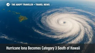
Major Hurricane Iona spun up to Category 3 strength overnight, packing 125 mph winds roughly 790 miles south-southeast of Honolulu, the National Hurricane Center said Wednesday. Forecast models keep the core of the storm well offshore as it tracks west across open ocean, yet long-period swells generated by Iona will arrive later this week and push surf heights on Hawaii's south-facing shores above the high-surf-advisory threshold. No coastal watches or warnings are active, but inter-island flyers should keep tickets flexible and monitor daily advisories.
Key Points
- Why it matters: Category 3 hurricane could send 10-foot south swells into Hawaiian ports by Thursday.
- Storm status: 125 mph winds, 957 mb pressure, moving west at 14 mph, 790 miles SSE of Honolulu.
- Watches: No coastal watches or warnings; inter-island flights operating normally but subject to weather waivers.
- Outlook: Iona may weaken Wednesday, yet dangerous rip currents and minor coastal flooding could persist into the weekend.
Snapshot
Iona is the first major hurricane of the 2025 Central Pacific season and the strongest July cyclone in the basin since 2022. While its wind field remains compact-hurricane-force gusts extend just 30 miles from the eye-the storm's fetch spans hundreds of miles, allowing swell energy to reach the islands long before any rain or wind. South-shore surf is forecast to rise steadily through Thursday, likely exceeding the 10-foot advisory trigger and creating powerful rip currents at popular beaches such as Waikīkī and Poʻipū. Travelers with beach outings or inter-island connections later this week should watch updated marine bulletins and airline advisories.
Background
Iona formed from a west-moving tropical disturbance that crossed 140° W on July 27. Within 48 hours it intensified from a 50 mph tropical storm to a 125 mph Category 3 hurricane-a rapid-strengthening burst rarely seen in midsummer Central Pacific waters. Yesterday's Adept Traveler report chronicled that surge and outlined early travel guidance. Overnight, satellite imagery revealed a pinhole eye ringed by deep convection, confirming major-hurricane status. The Central Pacific Hurricane Center expects cooler waters and increasing shear to erode the storm beginning late Wednesday, but it will still drive hazardous surf and rip currents toward the islands for several days.
Latest Developments
Surf Forecast and Travel Advice
National Weather Service Honolulu forecasters project south-shore sets of 8 to 12 feet by Thursday afternoon, peaking above advisory levels into Friday. Even without coastal flooding, elevated breakers can close small-boat channels, submerge shoreline roads during high tide, and delay harbor cargo operations. Airlines typically issue no-penalty changes when marine hazards threaten ground logistics or connecting ferries. Passengers bound for outer-island airports-especially Kona, Kahului, and Līhuʻe-should confirm weather waivers and consider flying earlier in the day before sea-breeze delays stack up. Beachgoers should heed lifeguard warnings and avoid rock jetties, where surges strike first.
Storm Track Outlook
At 11 a.m. HST Tuesday, the hurricane's center sat near 10.9° N, 155.7° W and continued on a due-west heading at 14 mph. Forecast guidance shifts Iona gradually north of due west later Wednesday, keeping it at least 500 miles south of the Big Island as it weakens into a Category 1 storm by Thursday. A trailing system, Tropical Storm Keli, follows a similar path but is not expected to intensify. The absence of steering ridges toward the islands and the lack of a recurvature trend mean Hawaii remains outside the cone of damaging winds. Still, travelers should stay alert; even a northward jog could tighten shipping lanes and prompt inter-island flight adjustments.
Analysis
Hawaii's travel infrastructure depends on reliable short-haul flights, particularly between Oʻahu and the outer islands. Although Iona's current track keeps it well south, the indirect effects-high surf, rip currents, and occasional harbor closures-can ripple across the network. Cargo delays at Honolulu Harbor may force airlines to adjust weight-and-balance loads if refueling trucks or catering shipments run late. Cruiselines transiting the Nā Pali Coast or Hilo will likely alter itineraries to avoid rough south-shore anchorage. Vacationers should build flexibility into island-hopping plans, choose refundable fares where possible, and monitor airline apps for schedule changes. Hotel guests should ask about coastal room relocations; even minor inundation can affect ground-level amenities like pools and beach walkways. Insurance claims tied to surf or harbor closures typically require documentation from the National Weather Service, so keep screenshots of advisories handy. While Iona is forecast to weaken, its swell will linger, emphasizing the lag between storm intensity and on-shore travel impacts.
Final Thoughts
Iona's rapid climb to Category 3 underscores how quickly Central Pacific storms can threaten Hawaiian travel without ever making landfall. With no watches posted, the immediate risk is rising surf, but that alone can disrupt ferries, cargo, and short-haul flights. Travelers who stay informed, keep itineraries flexible, and follow official guidance will minimize surprises from Hurricane Iona.