Tropical Storm Gil Eyes Hurricane Status; Insure Early
Tropical Storm Gil strengthened Thursday night 870 miles southwest of Mexico's Baja California Peninsula and is forecast to become the Pacific's first hurricane of 2025 by Friday. While the system should stay well out to sea, it kicks off what forecasters expect to be an active eastern Pacific season. The storm also resets the insurance clock: once a cyclone earns a name, new policies will not cover related disruptions. Travelers planning late-summer cruises or West Coast flights must act fast.
Key Points
- Why it matters: Named storms freeze new insurance coverage, exposing last-minute planners to costly losses.
- Travel impact: No landfall expected, but swells and airline reroutes are possible this weekend.
- What's next: Gil could reach Category 1 strength Friday before weakening over cooler water.
- Additional activity: A second disturbance south of Acapulco has a 40 percent chance of development within five days.
Snapshot
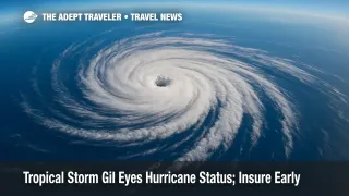
At 11 a.m. EDT Friday, Gil packed sustained winds of 65 mph and was moving west-northwest at 16 mph. The National Hurricane Center (NHC) predicts hurricane intensity within 24 hours, followed by gradual weakening as the storm passes over sub-80 °F water. No coastal watches or warnings are in effect, and shipping lanes remain open, but forecasters warn of eight-foot swells that could reach parts of the Mexican Riviera early next week. Travelers can monitor Gil's five-day forecast cone on the NHC website.
Background
Most U.S. trip-cancellation plans contain a "named-storm exclusion." According to the Insurance Information Institute, coverage must be in force before the National Weather Service assigns a storm name; once a system is christened, it becomes a known event and subsequent policies will not reimburse hurricane-related losses. The rule dates to the 1990s, when insurers began tightening language after a run of costly Atlantic seasons. Buying early not only avoids the exclusion but also satisfies the typical 14- to 21-day "time-sensitive" window for financial-default and pre-existing-condition waivers. Travelers who booked summer Pacific cruises but skipped coverage may now need a Cancel-For-Any-Reason upgrade at a higher premium.
Latest Developments
How to Track Gil's Cone Like a Pro
The NHC updates its advisory package every six hours - 03Z, 09Z, 15Z, and 21Z - with intermediates as needed. Each package includes:
- Public advisory outlining location, winds, and watches.
- Forecast discussion explaining model reasoning and key uncertainties.
- Graphics suite featuring the cone, wind-speed probabilities, and arrival-time diagrams. Cone width reflects historical forecast error: the white swath covers where the center is likely to track 60-70 percent of the time through day 5. Remember, hazardous weather often occurs outside the cone, particularly on the right-front quadrant of northern-hemisphere storms. For mobile alerts, add "EP072025" to the NOAA RSS feed or enable push notifications in the FEMA app.
Booking Insurance Before the Next Name
With Gil spoken for, the season's next Atlantic or Pacific storm will be Hanna (Atlantic) or Henriette (eastern Pacific). Travelers should purchase a plan as soon as a deposit is paid, locking in hurricane coverage and optional upgrades such as "Interruption for Any Reason." One internal resource worth bookmarking is our concise Travel Insurance guide explaining policy tiers, evacuation caps, and claim timelines. Expect premiums to rise modestly once Colorado State University releases its mid-season outlook next week.
Analysis
Gil's formation on August 1 fits climatology but still matters to travel planners. Eastern Pacific storms typically peak in late August, then recurve or dissipate harmlessly at sea. The danger lies in trip timing. Many West Coast cruisers embark from Los Angeles or San Diego in September, precisely when lingering swells from offshore storms can delay port calls, trigger nausea-inducing seas, or cancel shore excursions. Air travelers face ripple effects, too; airlines may waive change fees for airports hundreds of miles away if aircraft or crews are repositioned. Because named-storm exclusions close quickly, travel insurance behaves like a forward contract: early buyers lock in value, late buyers accept market risk. The lesson is clear - integrate insurance shopping into the booking workflow, not as an afterthought when a cone appears on social media. Meanwhile, Gil's west-northwest path underscores improved model consensus; the GFS, ECMWF, and HWRF agree on minimal coastal threat. Still, El Niño-warmed waters northwest of Hawaii could allow remnants to re-flare, a reminder that even "out-to-sea" systems warrant routine monitoring.
Final Thoughts
Gil may never threaten land, yet it offers a timely test of travel readiness. Buy coverage early, bookmark NHC advisories, and treat every named storm as a strategic drill. By acting before the next cyclone earns its title, travelers avoid financial squalls and stay a step ahead of Mother Nature - lessons underscored by Tropical Storm Gil.