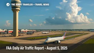
FAA Air Traffic Report - August 5, 2025
Atlanta bound flights, Florida hubs, and busy Northeast corridors could face weather driven slowdowns today as the FAA's latest Air Traffic Report highlights storm threats, low ceilings, and several airports on standby for ground stops.
Key Points
- Why it matters: Weather and staffing combine to threaten flight delay dominoes at major U.S. hubs.
- Travel impact: Afternoon ground stops are possible at Atlanta, Miami, Fort Lauderdale, Palm Beach, and Las Vegas.
- What's next: The FAA will update its plan after the 9 15 a.m. ET webinar; travelers should monitor airline alerts.
- En-route thunderstorms may reroute traffic over the Southeast and Gulf of Mexico.
- Low clouds in San Francisco and Denver could trim arrival rates through midday.
Snapshot
The Air Traffic Control System Command Center's 8 12 a.m. ET advisory flags thunderstorms across central and south Florida, stretching north toward Charlotte and Atlanta. Low ceilings blanket San Francisco, Denver, and parts of the Northeast, while smoke from Western wildfires may degrade visibility around Las Vegas. Ground-stop programs are possible, not certain, but the plan lists timing windows: Miami, Fort Lauderdale, and Palm Beach after 4 00 p.m. ET; Orlando and Tampa after 6 00 p.m.; Atlanta and Charlotte after 6 00 p.m.; Las Vegas and Newark/Teterboro after 5 00 p.m. Travelers should expect departure-management initiatives and taxi-out holds if convective cells linger.
Background
The FAA issues a Daily Air Traffic Report each morning, pairing National Weather Service data with traffic-flow modeling to warn carriers and dispatchers of likely constraints. Yesterday's update focused on Florida thunderstorms and Bay Area winds, disruptions that led to evening ground stops at Seattle, San Francisco, and Washington Reagan. Ground stops suspend inbound flights when runway capacity drops below safe thresholds, while delay programs meter departures toward affected airports. By previewing risks, the FAA hopes to spread traffic more evenly and reduce airborne holding that costs fuel and increases carbon output.
Latest Developments
Afternoon storm line threatens Southeast hubs
The FAA predicts a classic summer convective pattern: rapidly building cumulonimbus along the Interstate 75 corridor. When the storm line crosses Hartsfield-Jackson Atlanta International Airport (ATL), each arrival push may shrink by up to 30 percent, cascading across hub-and-spoke networks. Carriers are proactively swapping wide-body jets onto later banks and encouraging voluntary rebooking. Passengers connecting through ATL, Orlando International Airport (MCO), or Tampa International Airport (TPA) should allow extra layover time and monitor mobile app notifications.
Visibility issues hit West and Mountain airports
Marine stratus at San Francisco International Airport (SFO) and overnight haze over Denver International Airport (DEN) are lowering ceilings below 800 feet this morning. Instrument-only approaches lengthen the minimum spacing between arrivals, trimming hourly capacity. If the marine layer lingers past noon local, Ground Delay Programs could stack up westbound departures from Chicago and Dallas-Fort Worth International Airport (DFW), reinforcing the importance of early check-in even for late-day flights.
Analysis
Today's operational picture underscores how intertwined regional weather, staffing, and maintenance constraints have become. Thunderstorms in Florida do not merely delay beach vacationers; they ripple through cargo banks, international feeds, and premium transcontinental corridors. Charlotte Douglas International Airport (CLT) and ATL, both critical for East Coast redistribution, sit on the storm's northern edge, creating a knife-edge scenario: a slight southward drift and the hubs remain open, a northward wobble and both could face sequential ground stops. Meanwhile, the FAA's low-ceiling alerts for SFO and DEN illustrate the persistent challenge of balancing coastal marine layers and high-elevation smoke events with ever-tighter airline schedules. Infrastructure projects-from taxiway work at DEN to runway closures at Palm Beach International Airport (PBI)-remove slack just when flexibility is most needed. Travelers, particularly those on tight connections or same-day meetings, should consider booking earlier flights, packing essentials in carry-ons, and signing up for real-time carrier texts. With the busy late-summer travel surge in full swing, even modest weather can trigger outsized network effects.
Final Thoughts
While August skies often look calm at cruising altitude, today's FAA Air Traffic Report shows how quickly ground-level weather, smoke, and maintenance can squeeze capacity. Checking flight status before leaving for the airport-and again at the gate-remains the simplest hedge against missed connections and last-minute overnights. Stay flexible, and the primary disruptions flagged in the FAA Air Traffic Report may pass with minimal personal turbulence.