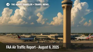
FAA Air Traffic Report - August 6, 2025
The Federal Aviation Administration's Daily Air Traffic Report for August 6 warns that convective storms over Florida, lingering smoke in Colorado, and widespread morning ceilings may snarl schedules from Fort Lauderdale-Hollywood International Airport (FLL) to Seattle-Tacoma International Airport (SEA). The daily operations plan, issued by the Air Traffic Control System Command Center (ATCSCC), urges carriers to expect airborne holding, ground delay programs, or reroutes across at least a dozen major hubs.
Key Points
- Why it matters: Weather could cause cascading delays and missed connections at major hubs.
- Travel impact: Thunderstorms over Florida and MSP; low clouds affect ATL, CLT, LAX, SAN, SEA.
- What's next: Watch DEN for wildfire-smoke slowdowns; check airline alerts before heading to the airport.
Snapshot
Thunderstorm clusters riding Gulf moisture will intensify by midday across South Florida, threatening arrival and departure rates at Fort Lauderdale-Hollywood International (FLL), Miami International (MIA), Orlando International (MCO), Palm Beach International (PBI), and Tampa International (TPA). Northwest of the system, a frontal boundary sparks convection near Minneapolis-St. Paul International (MSP). Farther west, wildfire smoke lowers visibility around Denver International (DEN). Early-morning marine layers blanket Hartsfield-Jackson Atlanta International (ATL), Charlotte Douglas International (CLT), Los Angeles International (LAX), San Diego International (SAN), and Seattle-Tacoma International (SEA). The FAA's daily air traffic report indicates potential ground stops or flow controls at these airports, with ripple effects on connecting banks nationwide.
Background
Published every morning, the FAA Daily Air Traffic Report distills the ATCSCC's national view into a concise forecast of operational threats. Meteorologists, traffic managers, and regional centers aggregate radar, terminal forecasts, and pilot reports to build the daily operations plan. Airlines then file flight-specific strategies-route adjustments, fuel loads, or crew swaps-to minimize passenger disruption. Although the report is updated hourly online, the first edition shapes carrier and traveler decisions for the rest of the day. Historically, thunderstorm-driven ground delays at Florida airports can exceed two hours, while wildfire smoke has cut Denver arrival rates by up to thirty percent. Today's combination of convection, ceilings, and smoke elevates the risk of extended flight delays.
Latest Developments
Storm Cells Track Across the Gulf and Southeast
Morning GOES imagery shows twin mesoscale convective systems pushing east toward South Florida. The daily operations plan projects peak lightning between noon and 6 p.m. local time, a window that overlaps with trans-Atlantic arrival banks at MIA and peak cruise departures at MCO. ATCSCC models suggest airborne holding near Nassau FIR waypoints and reroutes over the Gulf of Mexico. In Minnesota, a squall line along Interstate 94 threatens to box in MSP arrivals, likely prompting miles-in-trail restrictions on Chicago Center sectors. Carriers with narrow hub-to-hub padding should expect cascading delays of thirty to sixty minutes on mid-afternoon departures.
Smoke Continues to Blanket Colorado
The Bear Gulch Fire west of Boulder has pushed particulate levels at DEN into the moderate health-advisory range for a third straight day. While instrument landing systems keep the airport open, visibility reductions below five miles trigger longer runway separation. The FAA's daily air traffic report flags potential flow-rate cuts from eighty to sixty arrivals per hour during the 2 p.m.-8 p.m. period. Travelers on evening waves to the West Coast should monitor airline notifications and consider earlier flights.
Analysis
Multiple, overlapping hazards amplify risk. Convective activity in Florida creates gate-hold congestion that can pinch crews against duty-time limits, especially on evening turns. Thunderstorm-anchored ground delay programs often propagate northward as aircraft and crews miss their next legs; expect knock-on effects at connecting hubs like Chicago O'Hare International Airport (ORD) and Newark Liberty International Airport (EWR) even though they are not in today's primary impact list. Low morning ceilings at ATL and CLT compress departure banks, which could complicate recovery options once Florida weather clears. Meanwhile, persistent smoke at DEN reduces throughput just as carriers push late-summer leisure peaks. Smart travelers should build extra connection buffers, enroll in airline text alerts, and track real-time status via the FAA's NAS site. The daily operations plan and flight-specific delay data refresh every two hours, offering the best window for proactive rebooking.
Final Thoughts
With convective storms, low ceilings, and wildfire smoke converging on key hubs, August 6 may rank among the summer's more challenging travel days. Passengers who stay flexible-opting for morning departures, single-connection itineraries, and carry-on luggage-can dodge many disruptions. Checking the FAA's live tools at https://fly.faa.gov/?utm_source=adept.travel and the Aviation Weather Center's graphical forecasts at https://www.aviationweather.gov/?utm_source=adept.travel keeps you ahead of gate agents and in control of your schedule. Stay alert, and you will navigate today's skies despite the warnings in the FAA daily air traffic report.