Oceanwide adds real-time sea ice monitoring with IcySea
Oceanwide Expeditions has partnered with Drift+Noise Polar Services to bring real-time sea ice monitoring to the bridge on four ships, enhancing safety, reliability, and fuel efficiency on Arctic and Antarctic itineraries. Following successful trials, the IcySea platform now feeds near real time satellite imagery, ice charts, drift forecasts, sea temperatures, and concentration data directly into voyage planning. The company frames the rollout as both a guest-experience upgrade and an ESG-aligned step to cut unnecessary ice transits and detours.
Key Points
- Why it matters: Real-time sea ice monitoring sharpens route choices, supporting safer, more reliable expedition cruising.
- Travel impact: Fewer weather-driven detours, steadier daily operations, and better chances to maximize shore time.
- What's next: Wider industry adoption is likely as operators seek efficiency and sustainability wins.
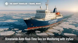
- Fleet status: IcySea is active on m/v Hondius, m/v Ortelius, m/v Plancius, and s/v Rembrandt van Rijn.
- Support: Crews receive 24/7 software and data-analysis assistance to interpret dynamic ice conditions.
Snapshot
Announced on August 5, 2025, the Oceanwide Expeditions and Drift+Noise Polar Services partnership brings IcySea's near real time sea ice layers and tools to Oceanwide's bridge teams. The software consolidates multiple ice-relevant feeds and interactive overlays to help officers evaluate vessel position and distances, then adjust courses as conditions evolve. Oceanwide says the upgrade strengthens its dynamic-expedition style, which prioritizes responsive itineraries and high-value landings. The line links the move to ESG goals by reducing unnecessary ice navigation, which can save fuel and time without compromising guest experience. Early coverage from trade outlets echoes the safety and efficiency benefits and notes the fleetwide deployment already underway.
Background
Polar navigation demands fast, low-bandwidth access to trustworthy ice intelligence. IcySea was designed for exactly that use case, delivering ice charts, NRT satellite imagery, drift forecasts, and sea-ice concentration data optimized for ships operating under Polar Code constraints. Oceanwide's fleet composition, with ice-strengthened vessels and small-ship capacities, already supports nimble operations and twice-daily landings in favorable conditions. Layering IcySea into the bridge toolkit formalizes a process that expedition officers have long done manually, often stitching together charts, pilot reports, and satellite snapshots. For travelers, the practical upside is steadier plans and fewer missed landings when the pack shifts. For the operator, fewer detours mean lower fuel burn and tighter schedule control.
Latest Developments
Real-time sea ice monitoring comes to the bridge
Oceanwide confirmed on August 5, 2025 that IcySea is now active on m/v Hondius, m/v Ortelius, m/v Plancius, and s/v Rembrandt van Rijn. The platform aggregates ice imagery and model outputs, then exposes interactive tools crews can use to measure ranges, evaluate micro-routes, and anticipate drift patterns that could close channels or complicate Zodiac operations. Oceanwide's chief vessel officer called IcySea a complement to existing navigation systems and crew expertise, highlighting value in medium- and short-term planning for both Arctic and Antarctic voyages. Company materials emphasize 24/7 support from the software provider's analysts, which matters when operations push into poorly charted or quickly changing areas. The line positions the tech as a guest-experience enhancer, preserving daily plans while maintaining a lighter environmental footprint.
ESG and operational efficiency, explained
Because ice conditions steer speed and routing, better information can reduce avoidable ice transits, loitering, or backtracking, all of which burn fuel. Oceanwide links IcySea's decision support to its ESG approach by targeting these inefficiencies. For travelers, the practical outcomes are clearer communications from the bridge, fewer last-minute wholesale changes, and improved odds of reaching marquee landing sites when nature allows. The move also aligns with broader polar-sector trends, where lines are investing in technology, pre- and post-cruise infrastructure, and science partnerships to keep itineraries resilient. For recent polar developments your clients may compare against, see Antarctica Level 2 Travel Advisory, Silversea's Cormorant at 55 South to Ease Antarctica Trips, and Atlas Ocean Voyages Arctic Expedition Adds 2026 Route and Scientists.
Analysis
For expedition cruising, information latency is the enemy. When a lead closes or a floe compacts, a captain needs minutes-old data, not last night's composite. IcySea's value proposition is that it collapses data hunting into one low-bandwidth interface, adding measuring tools that translate maps into actionable bridge decisions. That should reduce the gap between forecast and reality, a chronic pain point in the high latitudes. Oceanwide's small-ship model already supports rapid pivots and shore operations; integrating real-time sea ice monitoring should compound those strengths by trimming unproductive miles and preserving daylight for landings. The ESG framing is credible because fewer detours generally mean less fuel consumption, although actual savings will vary with season, region, and ice state. Limitations persist, including satellite gaps in heavy cloud and the need for skilled human interpretation, but the 24/7 analyst support mitigates that risk. Expect peers to follow, especially on itineraries that push into marginal, shoulder-season ice.
Final Thoughts
Oceanwide's adoption of IcySea looks like a pragmatic upgrade rather than a marketing flourish. It hardens itinerary reliability, supports crew decision-making, and aligns with traveler expectations for both safety and sustainability. As polar demand grows and routes extend into more dynamic ice, operators that fuse expert seamanship with modern decision tools will have an edge. For guests, that should translate into steadier plans and more time where it counts, on shore and among wildlife, while keeping environmental impacts in check. In a sector where conditions change by the hour, the differentiator is timely, trustworthy data, which is exactly what real-time sea ice monitoring provides.
Sources
- Oceanwide Expeditions to utilize ice report software IcySea aboard expedition vessels, Oceanwide Expeditions
- Press page, Oceanwide Expeditions
- The IcySea service, Drift+Noise Polar Services
- Oceanwide Expeditions to employ ice report software IcySea, Seatrade Cruise News
- Oceanwide Expeditions Uses IcySea Aboard Expedition Vessels, Cruise Industry News
- Oceanwide Expeditions Enhances Polar Navigation With Real-Time Sea Ice Monitoring, TravelPulse