Tropical Storm Fernand swells near Bermuda, East Coast
Tropical Storm Fernand remained about 360 miles east-northeast of Bermuda on August 25 with maximum sustained winds near 50 mph, according to the National Hurricane Center. No coastal watches or warnings are in effect. Even as the center tracks away, lingering long-period swell from Erin, augmented by Fernand's distant wind field, is keeping surf elevated and rip-current risk notable along portions of the U.S. East Coast. In Bermuda, seas of 4 to 7 feet outside the reef are forecast to gradually subside into midweek, which can still hinder tenders and small-boat excursions. Most cruise itineraries should operate normally.
Key Points
- Why it matters: Long-period swell drives rip currents and can pause tenders or water tours even without land impacts.
- Travel impact: East Coast beaches face rip-current statements; Bermuda marine operators may time pauses through Wednesday.
- What's next: Seas ease steadily into midweek as Fernand turns northeast and weakens over cooler water.
- Monitoring tips: Check local NWS surf forecasts and Bermuda marine bulletins before entering the water.
- Cruise note: For route-by-route changes, see our rolling tracker.
Snapshot
Fernand is moving north-northeast over the open Atlantic and is expected to turn northeast while weakening, with no direct land impacts forecast. Bermuda's marine forecast shows outside-reef seas decreasing from 4 to 7 feet today to 3 to 5 feet by Wednesday and 2 to 4 feet by Thursday, a pattern favorable for gradual resumption of shore-water activities. On the U.S. East Coast, lingering long-period swell from Erin, plus Fernand's distant circulation, continues to fuel rip-current statements from the Mid-Atlantic into parts of the Southeast. Expect continued lifeguard red-flag periods, periodic beach-hazard statements, and small-craft advisories to taper as seas fall below 6 feet by Tuesday. For broader storm context, see Tropical Storm Fernand to Stir Bermuda, East Coast Surf.
Background
Hurricane Erin's large wind field generated multi-day swell that impacted Bermuda, Atlantic Canada, and much of the Eastern Seaboard. As Erin transitioned and moved away, Fernand formed southeast of Bermuda and tracked north-northeast, remaining well offshore. Rip-current risk typically lags the closest storm approach because long-period swell travels great distances and organizes powerful, narrow seaward flows along beaches and near structures. Bermuda's exposure and reef line can funnel wave energy at the Royal Naval Dockyard and other west-end approaches, occasionally hampering tender and small-boat movements even under fair skies. U.S. lifeguard agencies and NWS offices responded with beach-hazard and rip-current statements across several coastal zones. With Fernand over cooler water and a continental trough bringing calmer winds, guidance points to improving marine conditions through midweek.
Latest Developments
NHC track keeps Fernand well east with no watches
At 5 a.m. AST, the NHC placed Fernand at 33.7°N, 58.8°W, about 360 miles east-northeast of Bermuda, moving north-northeast at 12 mph. No coastal watches or warnings are posted, and the forecast calls for a northeast turn, some additional strengthening today, then steady weakening beginning tonight, with post-tropical status likely by Wednesday. Tropical-storm-force winds extend roughly 60 miles from the center. The advisory clearly indicates hazards affecting land are not expected, underscoring that the primary traveler concern is surf and currents rather than wind. Travelers should track NHC updates for any change in forward speed or swell guidance, and rely on local marine products for near-shore specifics.
Rip-current statements linger along parts of the East Coast
Multiple NWS offices highlight sustained rip-current risk tied to lingering long-period swell. Mount Holly continues a High Rip Current Risk for Delaware and portions of the New Jersey shore through this evening. Newport-Morehead City's discussion notes post-Erin long-period swell gradually laying down, with most coastal waters falling below 6 feet by Tuesday. Virginia Beach maintains beach-hazard messaging with elevated surf early today. Expect risk levels to step down from high to moderate to low through midweek as swells decay and local winds ease. Visitors should swim near lifeguards, heed flag systems, and avoid inlets, jetties, and piers where currents accelerate.
Bermuda marine outlook improves, but timing matters
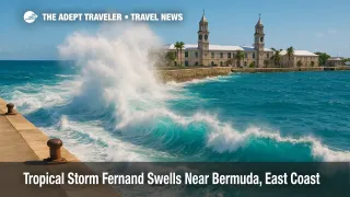
The Bermuda Weather Service marine forecast calls for seas outside the reef of 4 to 7 feet today, easing to 3 to 6 feet tonight, 3 to 5 feet Tuesday and Wednesday, then 2 to 4 feet Thursday. Inside the reef, seas remain 1 to 3 feet. That trajectory favors gradual normalization of snorkeling trips, dive boats, and resort water sports by midweek. Cruise calls at Royal Naval Dockyard typically proceed, but tender operations to smaller anchorages, shore-water rentals, and offshore fishing charters may be timed around lower swell periods. For line-by-line cruise changes still shaking out after Erin, see our Bermuda Cruise Itinerary Changes, Post Erin Tracker.
Analysis
For travelers, the distinction between wind impact and wave impact is crucial. Fernand's forecast keeps meaningful winds offshore, yet the ocean response, driven by long-period energy, arrives at beaches and harbor entrances for days. This energy organizes rip currents, which can persist even as skies clear and local winds relax. The pattern is classic for late August, when large, distant systems elevate surf without landfall. Risk is not uniform along the coast, since beach slope, offshore bars, and hard structures focus currents in certain corridors. That is why local NWS surf forecasts and lifeguard advisories remain the best last-mile check. In Bermuda, the reef-sheltered Great Sound moderates chop, but outside-reef excursions, dive boats, and tenders remain sensitive to residual swell and period. Given BWS guidance, operators should see improving windows through Wednesday, with broader normalization by Thursday. Cruise itineraries are not broadly at risk, yet shore-water activities may still be paused episodically for safety. Build flexibility into plans, and consider land-based tours until seas settle.
Final Thoughts
With Fernand tracking away and seas easing, the threat shifts from headlines to habits. Respect flag systems, choose guarded beaches, and confirm marine outings the morning of departure. In Bermuda, expect a staggered restart of water-based excursions as seas drop into the 3 to 5 foot range by midweek. On the East Coast, statements should step down as swell decays, but rip currents can persist near structures and inlets. Most cruises will keep to schedule, while tender-dependent stops and small-boat charters time around calmer periods. Keep situational updates handy, and you will navigate the lingering Tropical Storm Fernand swells with fewer surprises.