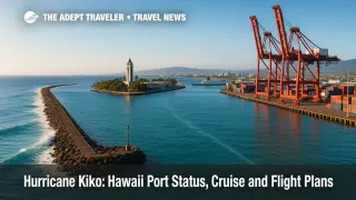
Hurricane Kiko: Hawaii port status, cruise and flight plans
Kiko is forecast to pass north of the main Hawaiian Islands between September 9 and 11, weakening but sending hazardous surf to east and north exposures. The Captain of the Port set Heavy Weather Condition WHISKEY for Island of Hawaii commercial harbors on September 5, with additional actions possible for Oahu and Maui County as the track evolves. Travelers on Norwegian's Pride of America and interisland flyers should expect itinerary or timing tweaks, monitor carrier alerts, and build extra slack into plans.
Key Points
- Why it matters: Port conditions shape cruise calls, tug and barge moves, and harbor closures.
- Travel impact: High surf on east, north shores, plus schedule buffers for interisland flights.
- What's next: Port status could escalate if Kiko tracks closer; airline waivers may update.
- WHISKEY is in effect for Island of Hawaii harbors; Oahu and Maui County were anticipated.
- No broad airline Kiko waivers posted as of September 7; check your carrier apps.
Snapshot
Forecast guidance keeps Kiko passing north of the islands around Tuesday into Thursday, September 9 to 11, with steady weakening but significant swell. National Weather Service Honolulu expects surf to build late September 8, peak near low end warning levels September 9 to 10, then ease. The U.S. Coast Guard's Heavy Weather Condition WHISKEY is in effect for Island of Hawaii ports, and harbor masters have warned Oahu and Maui County users to prepare. A statewide emergency proclamation is in place. For air travelers, check your airline's alerts several times per day. As of September 7, Southwest listed no active Hawaii advisories, and trade media noted no broad waivers earlier this week. For day-of flying, see our related FAA Daily Air Traffic Report: September 5, 2025.
Background
Heavy Weather Conditions are set by the Captain of the Port to stage commercial harbors for tropical systems. WHISKEY means sustained gale force winds are predicted within 72 hours, X-RAY within 48 hours, YANKEE within 24 hours, and ZULU within 12 hours. Under higher conditions, recreational traffic is curtailed, commercial vessels may be ordered to depart, and cargo operations can be limited or secured. With Kiko remaining compact and trending north, direct wind and rain impacts have decreased, but the swell risk is high. Pride of America turns weekly in Honolulu, calling at Kahului, Hilo, Kona, and Nawiliwili. That pattern can shift if port conditions tighten or harbor pilots suspend service. Airlines generally post event-based waivers when they expect material disruption, which can change quickly as confidence in a track improves.
Latest Developments
Port condition updates and what WHISKEY means for travelers
The Harbor Master for Island of Hawaii commercial harbors announced WHISKEY at 800 a.m. HST on September 5, directing pleasure craft to sheltered waters and advising ocean-going vessels to plan departures if they lack approved moorings. Harbor notices anticipated WHISKEY for Oahu at 800 a.m. HST on September 6, and for Maui County harbors the same day. If conditions escalate to X-RAY or YANKEE, expect cargo operations to scale down, cruise calls to adjust times, and small craft to remain in port. Tour boat operators may cancel or reroute. Travelers should watch terminal advisories, as port pilots and tug availability can dictate whether a ship can safely dock, even if weather looks manageable from shore.
Island-by-island surf outlook for September 9 to 11
NWS Honolulu calls for east-facing shores to rise late September 8, with peaks near low end High Surf Warning thresholds Monday night into Tuesday, then slow easing. Expect the largest sets on windward Big Island and Maui, with wrap into some north exposures across Maui County and Oahu. Kauai sees smaller but still hazardous surf, with strong rip currents statewide. South shores hold near seasonal levels under a separate south-southwest pulse. Even experienced swimmers should exercise caution and heed lifeguard guidance, particularly along Hilo, Puna, and Hana coasts, and windward Oahu.
Airline waiver check and cruise planning signals
As of September 7, Southwest's advisory page shows no active travel advisories, and earlier trade reporting indicated no broad Kiko-related change waivers across major U.S. carriers. That can change quickly if confidence grows in operational impact windows. Watch your airline's app for rebooking offers and gate-push adjustments, and consider moving to earlier departures if available. For Pride of America, Norwegian had not announced schedule changes in the most recent trade updates, but port conditions drive decisions. Guests should enable text alerts, confirm all independently booked tours are refundable, and be ready for early all-aboard or altered call times.
Analysis
Kiko's core is expected to pass well north, but its swell field is the practical threat for travelers. East-exposure harbors like Hilo and Kahului can become surge-sensitive even under clear skies, which complicates safe berthing for cruise ships and ferry-like excursions. The WHISKEY posture buys time for commercial harbors to stage tugs, confirm moorings, and move vulnerable assets. If confidence in stronger winds within 48 or 24 hours increases, X-RAY or YANKEE would trigger progressively tighter cargo limits and likely force itinerary edits. For flyers, interisland schedules are robust, but short runway occupancy spikes, slippery ramps, and crew duty clocks can ripple into delays. Airlines tend to issue waivers when they foresee widespread disruption; with Kiko trending north and weakening, carriers may wait for clearer signals. The smartest moves now are simple. Fly earlier in the day when possible, avoid tight connections at Daniel K. Inouye International Airport (HNL) and Kahului Airport (OGG), and download your cruise line and airline apps for push alerts. Shore plans on windward coasts should be considered tentative. If your itinerary depends on tender operations, have a Plan B.
Final Thoughts
Port status, surf, and timing are the levers to watch as Hurricane Kiko approaches. Expect pockets of disruption rather than a statewide shutdown, but give your plans room to breathe. If the Captain of the Port escalates conditions, cruise calls and small-craft tours will change first, followed by cargo priorities that can alter pier availability. Interisland flyers should build buffers, monitor apps, and move to earlier flights if offered. Keep a close eye on official updates through midweek, and travel smart around the evolving footprint of Hurricane Kiko.
Sources
- Harbor Master Notice HMN-O-01-04, Oahu District, WHISKEY guidance and Hawaii Island WHISKEY set Sept. 5, Hawaii DOT Harbors
- Harbor Master Notice HMN-H-01-91, Island of Hawaii WHISKEY effective Sept. 5, Hawaii DOT Harbors
- Harbor Master Notice HMN-M-01-26, Maui County WHISKEY anticipated Sept. 6, Hawaii DOT Harbors
- Surf Zone Forecast and discussion, NWS Honolulu
- Area Forecast Discussion, NWS Honolulu, Sept. 6
- Hurricane Kiko advisory, CPHC
- Projected track points, Kiko, NHC aggregated timeline
- AP: Kiko tracking north, emergency proclamation context
- Southwest Airlines travel advisory page, status check Sept. 7
- Airline waiver snapshot earlier this week, Travel Market Report
- Port condition definitions, 33 CFR §165.804