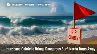
Hurricane Gabrielle brings dangerous surf; Narda turns away

Hurricane Gabrielle is strengthening southeast of Bermuda, pushing long-period swells toward the island, the U.S. East Coast, and Atlantic Canada. The National Hurricane Center issued a special advisory this morning highlighting rapid intensification potential and a track east of Bermuda. In the eastern Pacific, Tropical Storm Narda is strengthening but steering west-northwest away from Mexico.
Key Points
- Why it matters: Risky surf and strong rip currents are expected along East Coast and Atlantic Canada beaches.
- Travel impact: Bermuda flights and cruises may face schedule tweaks, with rough seas and occasional delays. No widespread closures reported.
- What's next: Gabrielle should pass east of Bermuda while intensifying; Narda remains offshore of Mexico.
- Special advisory issued for Gabrielle this morning by NHC.
- Rip-current risk remains elevated into early week for U.S. beaches from North Carolina northward.
Snapshot
As of 9:00 a.m. AST on September 22, Hurricane Gabrielle was about 210 miles southeast of Bermuda with maximum sustained winds near 90 mph, moving north-northwest at 10 mph. The center is forecast to pass east of the island while further strengthening, sending long-period swells that produce dangerous surf and life-threatening rip currents for Bermuda, the U.S. East Coast from North Carolina to New England, and Atlantic Canada. L.F. Wade International Airport (BDA) reports normal operations this morning, though airlines may adjust timings around squalls and high winds on approach corridors. In the eastern Pacific, Tropical Storm Narda has strengthened slightly and is turning west-northwest, remaining well offshore of Mexico.
Background
Gabrielle became a hurricane on September 21 after several days of organizing southeast of Bermuda. Forecast guidance indicates a turn north, then northeast, keeping the core winds east of the island while the swell field expands widely across the western Atlantic. The National Hurricane Center flagged rapid-intensification potential and issued a special advisory this morning to update track and intensity. Separately, Narda formed off the Guerrero and Michoacán coasts in Mexico and is tracking away from land under a strengthening ridge, with no coastal watches or warnings. While Narda's swell will stay focused over the open Pacific, Gabrielle's footprint is larger for North American travelers because of rip-current risk along popular beaches and possible knock-on effects for Bermuda schedules and Canada-New England cruising.
Latest Developments
Special advisory underscores rip-current risk and east-of-Bermuda track
The NHC's special advisory this morning keeps Gabrielle's center east of Bermuda while noting further strengthening. The hurricane's swell field is already reaching Bermuda and the U.S. East Coast from North Carolina northward, with Atlantic Canada impacted through the early part of this week. The Bermuda Weather Service calls out building southeasterly swells and possible rip currents, with intervals of stronger winds in showers. Airlines may pad block times or swap aircraft to protect on-time performance, and captains could request wider spacing during gusty periods. Cruise calls to Bermuda and Canada-New England itineraries may be adjusted for sea state and port approaches, even if the core remains offshore. Travelers should monitor airline and cruise apps and avoid entering the surf where red flags or high-risk statements are posted.
Narda strengthens while curving away from Pacific Mexico
In the eastern Pacific, Narda has strengthened slightly and is turning west-northwest, then west, guided by a mid-level ridge over northern Mexico. The NHC expects the cyclone to remain offshore for several days, with no coastal watches or warnings in effect. Swells should stay primarily over open water, with minimal direct impacts to coastal aviation or cruise operations in Mexico at this time. Mariners should still check offshore forecasts for localized rough seas along major shipping lanes.
Analysis
For aviation, Gabrielle's primary risks are convective bands and crosswinds near Bermuda arrivals and departures, plus en-route turbulence where jet-level outflow interacts with mid-latitude flow. While L.F. Wade International Airport (BDA) remained open this morning, airlines can implement ground holds, speed adjustments, or aircraft swaps to preserve schedule integrity. U.S. and Canadian coastal airports north of Cape Hatteras typically see minimal direct disruption from distant hurricanes, but low-level wind shear, ceilings from marine layers, and ATC spacing for oceanic arrivals can introduce small delays. The lack of watches or warnings does not remove surf hazards, which are a leading killer in otherwise "blue-sky" hurricane effects.
Cruise operators on Bermuda and Canada-New England runs will make port and routing decisions around sea state, not just wind forecasts. Even with a center passing east of Bermuda, long-period swells can force speed reductions, schedule shuffles, or port swaps to maintain safe gangway operations. Farther north, swell reflection in bays and approaches can complicate pilotage for call ports in Atlantic Canada. In the eastern Pacific, Narda's current trajectory lowers the probability of itinerary changes for Mexican Riviera sailings, although dispatch teams will watch for any swell trains reaching open-ocean segments. For travelers, the practical guidance is simple, and proven: obey local surf flags, choose lifeguarded beaches, and treat long-period sets with the same respect you would give a visible storm.
Final Thoughts
Gabrielle's center should remain east of Bermuda, but its waves will travel far. Expect rip-current dangers from the Carolinas to Atlantic Canada through the early week, even on fair-weather days. Airlines and cruise lines may adjust schedules at the margins in Bermuda and on Canada-New England routes to manage sea state and intermittent gusts. In the Pacific, Narda is a watch-but-not-worry system for now as it moves away from Mexico. If you are beachbound, treat surf advisories as hard rules, not suggestions. Keep plans flexible, use carrier apps, and check local beach reports while Hurricane Gabrielle evolves.
Sources
- Hurricane Gabrielle Public Advisory and surf impacts, National Hurricane Center
- Hurricane Gabrielle Special Advisory and forecast products, National Hurricane Center
- Bermuda forecast and marine notes, Bermuda Weather Service
- Tropical Storm Narda Public Advisory, National Hurricane Center
- Tropical Storm Narda Discussion, National Hurricane Center
