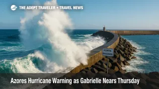
Azores hurricane warning as Gabrielle nears Thursday
A fast-moving Category 3 Hurricane Gabrielle is racing east-northeast toward the Azores, with hurricane conditions likely from Thursday night into Friday. Forecasters warn of destructive surf, significant coastal flooding, and heavy rain, especially across the central and western islands. Airlines and cruise lines are already evaluating schedule changes as the storm nears.
Key Points
- Why it matters: A rare direct hurricane threat to the Azores will disrupt flights and cruises September 25 to 26.
- Travel impact: Expect itinerary tweaks or dropped calls at Ponta Delgada, Horta, and Praia da Vitória, plus airport delays or cancellations.
- What's next: Gabrielle crosses the island chain Thursday night into Friday, then accelerates toward Europe while transitioning.
- Rainfall of 3 to 5 inches is possible in central and western groups, 1 to 2 inches in the east.
- Life-threatening surf and rip currents will affect the U.S. East Coast from North Carolina northward.
Snapshot
At 8 a.m. AST on September 24, Hurricane Gabrielle had maximum sustained winds near 115 mph and was moving east-northeast at 25 mph, about 1,285 miles west of the Azores. The National Hurricane Center says the center will approach the islands during the day on Thursday, September 25, and move across the chain Thursday night into Friday, September 26. Hurricane conditions are expected within the warning area, with tropical-storm conditions likely by Thursday evening. A dangerous storm surge, large destructive waves, and heavy rainfall are the main hazards. Travelers should expect ripple effects for flights and ferries, and cruise lines may adjust calls at Ponta Delgada, Horta, and Praia da Vitória as conditions deteriorate.
Background
The Azores archipelago sits roughly 850 to 1,200 miles west of mainland Portugal and includes three island groups. The western group is Flores and Corvo, the central group is Faial, Pico, São Jorge, Terceira, and Graciosa, and the eastern group is São Miguel and Santa Maria. Hurricanes occasionally impact the region, but direct hits remain uncommon. Gabrielle intensified rapidly earlier this week, then began weakening over cooler water and higher wind shear while accelerating toward the islands. Even as the storm starts transitioning to a non-tropical system, the wind field and swell remain dangerous. Large, long-period waves are forecast to pound west- and north-facing coasts, while heavy rain could trigger localized flooding and landslides on steep terrain. U.S. forecasters also flag rip-current danger along parts of the East Coast as Gabrielle's swells arrive.
Latest Developments
NHC timeline and hazards for the Azores
An intermediate advisory at 8 a.m. AST Wednesday confirms a Hurricane Warning for the entire Azores. The center of Gabrielle will approach during the day Thursday, September 25, and sweep across the islands Thursday night into Friday, September 26. Forecast rainfall totals are 3 to 5 inches for the central and western groups, and 1 to 2 inches for the eastern group. Hurricane-force winds extend outward up to 45 miles, with tropical-storm-force winds to 140 miles. The National Hurricane Center highlights significant coastal flooding from storm surge, combined with large destructive waves. Swell from Gabrielle will also produce life-threatening surf and rip currents along the U.S. East Coast from North Carolina northward, and across Atlantic Canada, over the next couple of days.
Azores hurricane warning, island-group specifics
Portugal's IPMA has issued red and orange alerts across the archipelago. For the central group, a red wind warning runs from 12 a.m. to 9 a.m. UTC Friday, with gusts that could reach 200 km/h, and a red marine warning from 3 a.m. to 12 p.m. UTC Friday with maximum waves of 14 to 18 meters. For the western group, red warnings cover heavy rain Thursday night into early Friday, hurricane-force gusts up to 150 km/h from 12 a.m. to 6 a.m. UTC Friday, and extreme seas from 12 a.m. to 9 a.m. UTC Friday. The eastern group holds yellow alerts for wind, rain, and hazardous seas during daylight hours Friday. All times are in UTC.
Airports, ports, and cruise calls
Operational impacts are likely at João Paulo II Airport (PDL) on São Miguel, Horta Airport (HOR) on Faial, and Lajes Airport (TER) on Terceira as winds increase and crosswinds exceed safe limits. Expect rolling delays or cancellations late Thursday through Friday, with recovery operations into Saturday. On the maritime side, extreme seas and surge may force temporary port closures or tender cancelations at Ponta Delgada, Horta, and Praia da Vitória, prompting cruise lines to adjust, drop, or reverse calls. Check carrier messages and port notices frequently, as status can change quickly within the warning window.
Analysis
Gabrielle's fast forward speed compresses the disruption window, but the intensity of wind and swell raises the stakes for aviation and cruise operations. For aviation, the key thresholds are sustained winds, peak gusts, and crosswind components on approach and departure, especially at Ponta Delgada and Horta where runway alignment and surrounding terrain can amplify turbulence and wind shear. Expect preemptive schedule thinning Thursday afternoon, tighter crew duty windows, and extended ground times for aircraft turns as handlers work in higher winds. If overnight gusts verify near forecasts, Friday morning departures may see the most concentrated cancelations.
Cruise itineraries in the central and western groups face the greatest risk of pier closures and tender limits under red marine warnings. Lines commonly swap a sea day, reverse a sequence, or skip the Azores entirely to preserve safety and schedule integrity. With wave heights modeled up to 14 to 18 meters in bursts, exposed berths and anchorages will likely be untenable during peak conditions. After passage, residual swell and port inspections can delay reopening for several hours. Travelers should monitor line apps and email alerts, and avoid booking tight same-day air connections.
In the United States, Gabrielle's swell train increases rip-current risk from the Outer Banks into New England, even without a close coastal track. Beach towns may see red-flag days and intermittent swim restrictions. Visitors should heed local lifeguard guidance and choose guarded beaches. The hazard can persist beyond the storm's closest approach, so plan conservatively for late-week and weekend shoreline activities.
Final Thoughts
Plan for a 36-hour disruption window from Thursday afternoon, September 25, through Friday evening, September 26, with lingering effects into Saturday. Build buffers into flight plans, and expect cruise changes at Ponta Delgada, Horta, and Praia da Vitória. On the U.S. East Coast, respect red-flag warnings and avoid unguarded beaches during the swell event. If you hold near-term bookings, enable airline and cruise notifications, and confirm hotel flexibility. Safety-driven adjustments are likely and prudent while the Azores hurricane warning remains in effect.
Sources
- Hurricane Gabrielle Intermediate Advisory 30A, NOAA NHC
- Tropical Cyclone Discussion, NOAA NHC
- IPMA warnings, Azores Central Group, IPMA
- IPMA warnings, Azores Western Group, IPMA
- IPMA warnings, Azores Eastern Group, IPMA
- AP update, hurricane warning issued for the Azores, AP News
- Reuters tracker, Hurricane Gabrielle, Reuters
- Portugal News, red alerts as hurricane approaches, The Portugal News