Flight delays and airport impacts: October 3, 2025
A relatively calm morning gives way to pinpoint trouble spots this afternoon. The FAA's daily planning notes low ceilings in the Bay Area and Seattle, pop-up storms in South Florida and along the central Gulf, and construction-related constraints at Boston. Ground stops or delay programs are possible at San Francisco and Boston during peak pushes, with brief holds possible at Miami and Fort Lauderdale as storms develop. New York and Washington, D.C., are expected to run smoothly.
Key points
- Why it matters: Targeted delays are likely at SFO and BOS during afternoon peaks.
- Travel impact: Brief ground stops possible at MIA and FLL when storms pulse.
- What's next: Watch for updated GDPs and Texas-to-EWR reroutes through the evening.
- Low ceilings may trim arrival rates at SFO and SEA.
- Atlantic and Gulf route closures are possible later today.
Snapshot
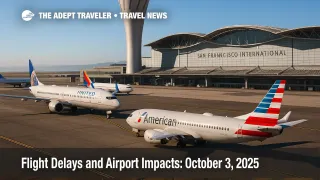
The Air Traffic Control System Command Center's morning plan keeps a conservative posture for the afternoon push. San Francisco International Airport (SFO) and Boston Logan International Airport (BOS) sit atop the watch list, with ground stops or delay programs possible after 1100 a.m. PDT at SFO and after 100 p.m. EDT at BOS as low ceilings and runway work squeeze arrival rates. In Florida, scattered thunderstorms could force intermittent holds at Miami International Airport (MIA) and Fort Lauderdale-Hollywood International Airport (FLL). Seattle-Tacoma International Airport (SEA) also has low ceilings, while an "Texas_ZME_to_EWR" initiative and later Atlantic/Y-route adjustments may affect flows into Newark Liberty International Airport (EWR). New York City and Washington, D.C., metro terminals otherwise look favorable. Keep checking your airline's app for gate-specific updates.
Background
The FAA's strategic plan pulls together forecast weather, field conditions, staffing triggers, and special-use airspace to anticipate constraints. Today's advisory cites potential GDPs at SFO and BOS; thunderstorms in South Florida and southern Louisiana; and route management across ZNY, ZJX, ZMA, ZHU, and ZLC airspace. Construction continues on key runways and taxiways at major hubs, including BOS Runway 9/27 and SFO Taxiway Z, which can reduce arrival acceptance rates during bank periods. The Storm Prediction Center outlines mainly marginal severe risk focused in the Intermountain West and Rockies, so for the big coastal hubs, the main risk is ceiling-and-visibility reductions and convective "pop-ups," not widespread severe storms. Expect incremental, localized programs rather than a nationwide meltdown.
Latest developments
SFO and BOS delay programs possible this afternoon
ATCSCC lists SFO and BOS as candidates for ground stops or ground delay programs as demand peaks meet reduced airport acceptance. Low ceilings are the primary driver at SFO, while runway construction constrains BOS. If a GDP is issued, expect controlled arrival slots with increasing delays for later flights in the bank. Monitor pushback holds and gate holds on departures headed into these airports.
South Florida pop-up storms may trigger brief stops
Scattered thunderstorms are forecast along Florida's east coast. ATCSCC flags MIA and FLL for possible temporary ground stops tied to cells over final approach fixes or ramp lightning alerts. Expect gate holds and taxi delays during lightning-in-the-vicinity alarms, which pause ramp work until the all-clear.
Northwest marine layers and SEA low ceilings under watch
Low ceilings at Seattle-Tacoma can trim arrival rates and require extra spacing this morning. Similar marine-layer issues at SFO may persist into midday before lifting, but updates will follow the 17Z-19Z trend. Keep an eye on revised TAFs that could adjust acceptance rates.
En-route tweaks: Texas to Newark and offshore flows
Expect route management between Memphis Center airspace and EWR through early afternoon, partial WATRS oceanic constraints, and potential Atlantic Y-route closures later today. Gulf route closures are possible if Louisiana convection expands, which can impose miles-in-trail, capping, or tunneling.
Analysis
Today's pattern favors localized programs instead of a coast-to-coast cascade. When ceilings sit near minima at complex hubs like San Francisco International Airport (SFO), even modest reductions in arrival acceptance rates ripple into departure holds upstream. Boston Logan International Airport (BOS) has less weather risk but ongoing runway work narrows operational flexibility; a small schedule surge can push it into a GDP. South Florida's convective regime is classic October: brief but intense cells that pause ramp work, then rapid recovery. New York and D.C. metros are well-positioned with favorable weather and normal staffing, which should keep flows stable into John F. Kennedy International Airport (JFK), LaGuardia Airport (LGA), and Ronald Reagan Washington National Airport (DCA). The biggest variable is en-route: Atlantic and Gulf route adjustments plus the Texas-to-EWR initiative can add airborne holding or reroutes, particularly for late-day banks. Travelers should build slack into tight connections at SFO and BOS, and consider earlier departures where possible.
Final thoughts
Plan conservatively for SFO and BOS this afternoon, allow extra time at MIA and FLL for convective pauses, and watch for Newark-bound reroutes that could stretch flight times. If you are eligible, expedited ID lanes can help you reclaim minutes on the ground, and digital boarding passes speed rebooking during irregular ops. Check flight status frequently and keep notifications on. Smart preparation turns today's forecast into manageable flight delays rather than trip-ending surprises. Stay flexible, and you will usually beat the crunch.