Philippines Watch, Uwan May Enter PAR This Weekend
A developing Western Pacific system, currently Tropical Storm Fung-Wong, is forecast to intensify over the Philippine Sea and could enter the Philippine Area of Responsibility, PAR, this weekend, at which point it would be locally named Uwan. In its 11:00 a.m. advisory on November 6, the Philippine weather agency, PAGASA, projected PAR entry late Friday or early Saturday, flagged rapid intensification through Saturday, and raised the possibility of landfall in Northern or Central Luzon on Monday with hazardous winds, rain, storm surge, and marine conditions from Sunday onward. Travelers with near-term plans across Luzon and the Visayas should monitor official bulletins and keep flexible itineraries as the forecast evolves.
PAGASA track and timing
PAGASA located Fung-Wong at 9.7°N, 140.9°E at 10:00 a.m. on Thursday, outside PAR and moving northwest at 10 kilometers per hour with maximum sustained winds of 75 km/h. The agency's track shows strengthening to typhoon status by Friday, then to super typhoon strength on Saturday while still offshore to the east, before a potential landfall Monday near Northern or Central Luzon. The advisory notes wind signals may be hoisted over eastern Luzon and portions of Samar as early as Friday evening or Saturday morning, with deteriorating weather from Sunday, and warns of potentially life-threatening conditions and storm surge for parts of Northern and Central Luzon early next week.
What model consensus is indicating
Independent trackers align with the agency's rapid-intensification signal and general west-northwest motion over the Philippine Sea into the PAR. Tropical Storm Risk guidance at 6:00 a.m. GMT shows Fung-Wong intensifying to a Category 3-4 equivalent over the next 48-72 hours while approaching eastern Luzon, then weakening inland and re-emerging west of Luzon around Tuesday. These model plots are best interpreted alongside official forecasts rather than as stand-alone predictions, but they support the window PAGASA is communicating to the public.
Early aviation and marine implications
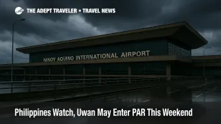
Before any wind signals or closures are issued, the first traveler impacts are likely to show up as rolling schedule buffers and selective cancellations, particularly at Manila's Ninoy Aquino International and regional airports that feed Northern and Central Luzon. PAGASA's advisory explicitly calls out roughening seas on the northern and eastern seaboards of Luzon and the eastern seaboards of the Visayas and Mindanao by Friday night into Saturday, with gale warnings likely on Saturday. That increases the probability of ferry suspensions and port holds along the Pacific-facing coastlines, escalating into broader restrictions if signals rise inland.
Background, how PAR naming works
The Japan Meteorological Agency, JMA, assigns international storm names in the western North Pacific, hence "Fung-Wong." Inside the Philippines, PAGASA assigns a separate domestic name once a system enters PAR or forms within it. For this season, the next local name on the list is Uwan, which would be applied upon entry. This dual-name system is normal and allows PAGASA to issue localized alerts and guidance using names familiar to the public.
Latest developments to watch
Through Thursday evening, PAGASA's public pages and bulletins were already listing Fung-Wong among "Tropical Cyclones Outside PAR," consistent with the official advisory timing and location east of Mindanao. Local and regional outlets also flagged the potential for super typhoon intensity and the early-week landfall window, while noting growing storm size and a widening hazard footprint. For travelers, the practical takeaway is simple, follow the national advisories first, then your carrier or ferry operator's updates.
Final thoughts
If PAGASA's timeline holds, Uwan may be named as early as late Friday and could become a high-end typhoon over the weekend. Build slack into Sunday and Monday movements across Luzon, watch for airline waivers and port notices, and refresh the forecast at least twice daily. In fast-changing periods like this, official local guidance from PAGASA is the anchor travelers should use to adjust plans.
Sources
- Tropical Cyclone Advisory No. 6, Tropical Storm Fung-Wong, 11:00 a.m., Nov. 6, 2025 (PDF)
- PAGASA, Daily Weather, Tropical Cyclones Outside PAR, Nov. 6, 2025
- Tropical Storm Risk, 32W Fung-Wong Dynamic Tracker
- ABS-CBN, "Tropical storm Fung-Wong slightly intensifies," Nov. 6, 2025
- ABS-CBN, "JTWC, Potential super typhoon Uwan to reach peak intensity off Bicol," Nov. 6, 2025
- RSMC Tokyo, JMA, Typhoon Center, Names of Tropical Cyclones