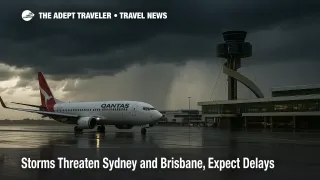
Storms Threaten Sydney and Brisbane, Expect Delays
Severe thunderstorms remain in the frame for eastern Australia as a spring storm pattern lingers over parts of New South Wales and southeast Queensland. Forecasters continue to flag damaging winds, large hail, and heavy rain in and around Sydney, the Hunter, and the populated southeast Queensland corridor that includes Brisbane. For travelers, this setup can translate into short-notice ground stops, arrival metering, and a ripple of delays across airport rail and coach links. Plans that depend on tight connections are most exposed.
What changed and why it matters
The Bureau of Meteorology maintains live warning pages for each state and city forecast hubs that update throughout the day. As storms pulse, cells can build quickly along sea breezes and trough lines, then collapse just as fast. That pattern is disruptive for airport operations. A heavy burst that passes over airfield approaches or the departure corridor often triggers a sequence of spacing programs, deicing style holds when hail threatens ground crews, and slow taxi flows while lightning is in the vicinity. Airlines will typically work the queue, prioritize long-haul banks, and push shorter sectors later in the day.
Sydney and New South Wales, local settings
Sydney's forecast keeps the chance of thunderstorms alive with showers in the mix. New South Wales warning summaries are the right place to verify if any severe thunderstorm advisories are current for the metropolitan area, the Hunter, or adjacent districts. In practice, Sydney's heaviest impacts arrive when cells line up over the approaches or when lightning risk halts ramp work. During those windows, expect pushbacks to pause, baggage to run late, and arrival metering to stretch taxi-in times. If you connect to regional flights, allow extra time and consider rebooking into a morning bank when convective risk is often lower. Airport rail can also slow during cloudbursts, so check service status before leaving for the terminal.
Brisbane and southeast Queensland, local settings
Brisbane's day to day forecast looks more stable between bursts, yet southeast Queensland storms can flare in the afternoon as sea breezes meet inland heat. The state warning board is the authoritative feed to track any severe thunderstorm issuances near Brisbane and the Gold Coast. When storms push over Moreton Bay and the river delta, arrival spacing into Brisbane tends to widen. If runway maintenance or single runway periods are scheduled, weather can amplify queues and extend taxi-out waits. That is another reason to verify flight status and to build buffers on airport rail or coach transfers across the Gateway corridors.
Why rail and coach links feel the pinch
Airport rail in Sydney and Brisbane is generally resilient, but localized flooding, debris on the right of way, or signal faults during heavy rain can slow or suspend sections. Transport for New South Wales maintains a consolidated travel alerts page that rolls up trackwork and incidents for trains, light rail, buses, and ferries. When storms are active, travel times to and from Sydney Airport frequently extend, and platform metering can occur. In Brisbane, airport rail and road access are similarly sensitive to intense downpours that reduce speeds on arterial approaches and can trigger temporary closures at low-lying underpasses. Always budget extra time and check alerts shortly before you leave for the airport.
Background, how convective weather affects airports
Thunderstorms create wind shear, crosswinds, microbursts, and lightning that directly affect runway selection and ramp safety. Air traffic control may institute ground stops to hold departures, miles-in-trail spacing to meter arrivals, or reroutes to thread aircraft around convective cores. On the ground, lightning within a safety radius pauses refueling and baggage handling. Hail risk moves crews and equipment under cover. Even after a cell exits, recovery can take an hour or more as airlines re-sequence banks, reposition crews, and clear the taxiway queues. The result is a rolling delay profile that can spill into the evening.
What to do next
If you are booked through Sydney or Brisbane on November 10 or 11, verify your flight status repeatedly on the day of travel and watch your airline's alerts for same-day flexibility. When forecasts show higher storm probabilities, move tight connections to earlier banks, especially for regional tag flights. If you connect through Melbourne, monitor that airport as well, since knock-on delays from Sydney and Brisbane sometimes slide into southern banks. For surface access, confirm airport rail status just before you depart, and keep a contingency plan for coach or rideshare if service slows. Leave with generous buffers, keep carry on baggage light, and bookmark the state warning pages for quick checks while in transit.
Final thoughts
Thunderstorms over eastern Australia can be brief, and they can be disruptive. With Sydney and Brisbane in the risk zone, travelers who verify warnings, flight status, and airport rail in real time will have the smoothest path through the storm window. Eastern Australia storms, Sydney and Brisbane delays, and rail checks all belong on today's preflight list.
Sources
- New South Wales Weather and Warnings Summary
- Current Warnings, New South Wales
- Queensland Weather and Warnings
- Queensland Warnings, Detailed List
- Sydney Forecast, Bureau of Meteorology
- Brisbane Forecast, Bureau of Meteorology
- Travel Alerts, Transport for NSW
- Brisbane Airport Updates, Runway Operations and Notices