Toronto Snow Bursts May Slow YYZ, YTZ Transfers
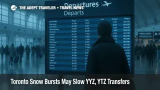
Bursts of heavy snow and low visibility affected travel across the Greater Toronto Area on November 11, 2025, with the sharpest impacts during the morning commute east of Highway 400. Conditions improved by late morning, however residual delays at Toronto Pearson International Airport (YYZ) and Billy Bishop Toronto City Airport (YTZ) remain possible as operations normalize. Flyers should allow time for deicing, expect slower highway speeds, and verify rail or rideshare options before leaving for the airport.
Toronto Pearson and Billy Bishop
Pearson moved significant traffic through its deicing facility after the weekend snowfall and continued winter ops today, which can add time on the ground even after skies brighten. The airport reported 9.8 centimeters over the weekend with more than 400 aircraft processed for deicing, a reminder that morning queues can ripple into midday banks. Billy Bishop reported improving conditions by late morning and no carrier specific travel advisories, although occasional visibility swings and ramp slowdowns can still occur.
Latest developments
The winter weather travel advisory affecting Toronto this morning warned of bursts of heavy snow and sudden drops in visibility, especially east of Highway 400. The advisory was lifted shortly after 11:00 a.m. ET, which should reduce further deterioration on afternoon operations while leaving some residual delay risk as schedules rebalance.
Analysis
Morning flurries plus weekend accumulation create a typical two step disruption pattern for Toronto aviation, first through runway and taxiway clearing, then through deicing bottlenecks that outlast precipitation. Even modest additional holds can cause missed inbound slots and light retimes for connectors. Air Canada's Daily Travel Outlook remains the most authoritative same day indicator of protected or at risk stations in the network, so travelers should check it before heading out and again upon arrival at the airport. Porter's advisory page, which covers Billy Bishop conditions, showed no specific alerts by midday.
Background
Environment and Climate Change Canada posts alert status for the City of Toronto and surrounding zones. Local media often summarize the timing, areas affected, and when advisories are lifted, which is useful for gauging road and visibility risk windows for airport transfers. Ontario 511 provides real time highway conditions and incidents for QEW, Highway 401, Highway 427, and other corridors that feed Pearson.
Final thoughts
The morning advisory has ended, but winter operations can trail the weather by hours. Build buffers for Pearson and Billy Bishop, verify carrier outlooks, and check UP Express or highway conditions before you leave.