Reykjanes Eruptions, Flights Largely Unaffected
Iceland's Reykjanes Peninsula stayed busy again in 2025. A fissure eruption began near the Sundhnúkur crater row before dawn on July 16, prompting fast evacuations at Grindavík and the Blue Lagoon. Aviation impact was limited, and Keflavík International Airport continued normal operations. Authorities caution that magma is still accumulating beneath the Svartsengi system, which means additional short notice events are possible. Travelers should avoid restricted zones, respect barriers, and follow Civil Protection alerts.
Reykjanes status in 2025
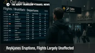
The July 16 eruption was the twelfth event on the peninsula since activity reawakened in 2021. Officials moved quickly, evacuating staff and visitors from Grindavík and the Blue Lagoon while monitoring lava flows along the fissure north of town. Reykjavik area infrastructure was not threatened, and runways, nav aids, and terminal operations at Keflavík remained available. Several agencies emphasized that these eruptions have been predominantly effusive fissure events, which emit limited ash, a key reason commercial flights were unaffected in contrast with the 2010 ash crisis.
Icelandic authorities maintain a layered approach to hazard management. The Department of Civil Protection and Emergency Management uses cell broadcast alerts that reach most capable phones inside targeted zones. Signs, road blocks, and staffed checkpoints are common near closures, and fines are enforced for unauthorized entry. Local governments publish detours and temporary road changes when ground deformation, steam vents, or lava cooling fields encroach on routes.
Latest developments
As of November 12, 2025, the Icelandic Meteorological Office reports continued but slower land uplift at Svartsengi, with low seismicity near Grindavík. Hazard assessments for the Reykjanes Peninsula remain in effect, and officials note that magma volumes since the July eruption are still significant. The regional tourism board states there is no ongoing eruption at present, a situation that can change with limited warning. National and international outlets confirm that the July event ended in early August after a roughly twenty day run, and that flight schedules through Keflavík were largely unaffected during that period.
Analysis
For air travelers, the operational picture differs markedly from 2010. Eyjafjallajökull produced sustained ash that intruded into busy North Atlantic routes, which drove wide airspace closures under then conservative thresholds. The recent Reykjanes sequence has been dominated by low ash output fissure eruptions, which tend to limit aviation hazards to localized airspace, and thus preserve scheduled operations. That said, volcanic activity is inherently dynamic. Waiver policies can appear if ash output increases or if authorities impose temporary airspace restrictions, so checking the airline's travel alert page before heading to the airport remains smart practice.
On the ground, the main traveler risks are proximity hazards, sudden gas exposure, unstable cooling crusts, and ground cracking. These are managed by staying on marked paths with guides where applicable, carrying basic hill gear even on short walks, and never crossing barriers for a closer photo. If your itinerary includes Reykjanes sights, add time to navigate any detours and consider flexible bookings so you can adjust plans without penalties. Tour operators often reroute or reschedule when alerts change, and many publish same day status on social channels.
Background
Iceland's Civil Protection system integrates seismology, deformation monitoring, gas sampling, and satellite data to set color coded hazard maps. The Icelandic Meteorological Office provides scientific assessments, while Keflavík International Airport and air navigation services coordinate with aviation stakeholders when conditions warrant. Mobile phone alerts are issued by Civil Protection to devices inside defined polygons, which helps tourists who may not follow local media stay informed.
Final thoughts
Reykjanes remains active, but commercial flights have continued with minimal interruption. Treat closed zones as hard boundaries, monitor official channels daily, and maintain flexible plans. This keeps your trip running smoothly while authorities do what they do best, manage evolving volcanic risks in one of the world's most closely watched geologic theaters.
Sources
- Volcanic Activity in Reykjanes
- A Volcanic Eruption on the Reykjanes Peninsula
- 2025 News, Icelandic Meteorological Office
- Iceland Volcano Erupts Twelfth Time Since 2021, Flights Unaffected
- Two Years Since First Evacuation of Grindavík
- No Ongoing Eruption in Reykjanes Today
- Mobile Phone Alerts, Civil Protection
- Impact of the 2010 Eyjafjallajökull Eruption on Air Routes