SoCal Storm Brings Flood Risk And Flight Delays
An incoming atmospheric river is moving from forecast to reality across Southern California, with the National Weather Service placing much of the region under flood watches from Friday, November 14, through at least Saturday night. Forecasters are calling for roughly 2 to 5 inches of rain in many coastal and valley areas from Los Angeles, California, to San Diego, California, with higher totals in the foothills and mountains, enough to trigger flash flooding, mudslides, and widespread travel delays on roads and in the air.
Weather for Los Angeles, Los Angeles County:
Current Conditions: Rain, 61°F (16°C)
Daily Forecast:
- Friday, November 14: Low: 59°F (15°C), High: 65°F (18°C), Description: Cooler with rain; there can be ponding on streets and highways
- Saturday, November 15: Low: 53°F (12°C), High: 62°F (17°C), Description: Cool with rain, some heavy, and a thunderstorm; risk of significant flash flooding; watch for and avoid rapidly rising water
- Sunday, November 16: Low: 57°F (14°C), High: 62°F (17°C), Description: Cloudy and cool with a couple of showers; lingering flooding still possible
The storm arrives at a time when Los Angeles International Airport (LAX) and other major hubs are already operating under a federal order that forces airlines to cut at least 6 percent of domestic flights because of reduced air traffic control staffing during the ongoing government shutdown. That thinner schedule reduces slack in the system, so even modest weather related slowdowns can ripple into missed connections and rolling delays.
Southern California Storm Timeline And Risk Zones
Forecasts from the National Weather Service offices in Los Angeles and San Diego show light to moderate rain spreading across the region on Friday, then intensifying into heavier bands with embedded thunderstorms from late Friday into Saturday. In many coastal and valley zones, totals of 2 to 4 inches are expected by Sunday, with 4 to 6 inches or more possible in the mountains, especially along southwest facing slopes that squeeze extra moisture out of the incoming plume.
For Los Angeles County and surrounding areas, a broad flood watch covers the coast, valleys, and lower mountains, with the most intense rainfall expected from Friday afternoon through Saturday morning Pacific Time. Downtown Los Angeles could see nearly 3 inches of rain in this early phase alone, and some neighborhoods could approach a typical month of November rain within a single day.
Farther south, San Diego County is bracing for a similar pattern, with a cooling trend, gusty winds, and periods of heavy rain that may bring around 2.5 inches near the coast and higher amounts in the foothills and mountains. Hydrologists are already warning of rising rivers, saturated soils, and the potential for debris flows, especially in canyons and along steep terrain.
Evacuation warnings are in place for several burn scar areas in Los Angeles County, where previous wildfires have stripped hillsides of vegetation, making them more prone to fast moving mud and debris flows. Local officials have pre positioned barriers and K rails in some high risk corridors, but they are also warning residents that any upgrade from warnings to mandatory evacuation orders could happen quickly if rainfall rates spike to an inch per hour or more.
Latest Developments
By Friday midday, light rain had already reached parts of the Los Angeles Basin, and early bands were beginning to wet freeways and create ponding in low spots. The more serious phase of the storm is expected to build through Friday evening and peak overnight into Saturday, with strong onshore winds that can topple tree limbs and knock out power, especially near the coast and on exposed ridges.
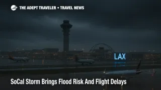
Flood watches now extend across much of coastal and valley Southern California, encompassing the main urban corridors that feed Los Angeles International Airport, Hollywood Burbank Airport (BUR), Long Beach Airport (LGB), John Wayne Airport (SNA), and San Diego International Airport (SAN). In practice, that means any freeway linking the airports to downtowns and suburbs, including Interstate 5, US 101, and a web of cross town connectors and canyon routes into the San Gabriel and Santa Monica mountains, will be vulnerable to standing water, spin outs, and short notice closures.
On the aviation side, the Federal Aviation Administration's Daily Air Traffic Report already flags reduced arrival rates at high impact airports because of staffing constraints, and the emergency order in effect since November 13 requires airlines at those airports to trim at least 6 percent of scheduled domestic operations between 600 a.m. and 1000 p.m. local time. Los Angeles International is on the high impact list, and prior modeling suggests that roughly 70 or more daily flights could be cut there under tighter caps, affecting tens of thousands of passengers.
Layer heavy rain, low ceilings, and gusty onshore winds on top of that structure, and ground delay programs, arrival meter ing, and go arounds become far more likely at the same time padded recovery options are scarcer. Even if your individual flight is not canceled outright, it may taxi for longer, hold in the air, or land late enough to put tight connections at risk.
Analysis
This article updates Adept Traveler's broader coverage of national flight delays and airport impacts by shifting the Southern California storm risk from a medium term concern into a live operational hazard. Travelers who saw Los Angeles and San Diego highlighted as potential trouble spots in recent days should now treat the atmospheric river as a concrete factor in their plans for the November 14 to 16 window.
Background, what an atmospheric river is An atmospheric river is a long, narrow band of deep tropical moisture in the atmosphere that can transport more water than the Amazon River when it makes landfall. When one of these plumes slams into the mountains along the West Coast, the result is often prolonged, intense rainfall and, in some cases, damaging winds. These systems are responsible for a large share of extreme precipitation and flood events along the Pacific coast, and their intensity has been creeping upward in recent decades.
In this case, the incoming plume is oriented to feed directly into Southern California, then stall for long enough to wring out several inches of rain over a broad area. Because soils are already moist in some locations and burn scars remain fragile, it does not take much additional rain to tilt conditions from nuisance flooding into dangerous mudflows, especially overnight when people may be asleep or less likely to be watching alerts.
Why this storm is a bigger problem for flights than a typical winter system Under normal conditions, Los Angeles International functions with a healthy buffer of extra flights and gate capacity, which allows airlines to re route aircraft and crews around weather. The current environment is different. The FAA's emergency order, issued in response to controller shortages during the federal shutdown, forces carriers at designated high impact airports to keep at least a 6 percent cut in domestic departures in place until the order is canceled. Airlines must plan those cuts days in advance, and they have limited room to maneuver once a storm arrives.
The combination of pre cut schedules and poor weather means that some flights that might otherwise have been added as recovery sections after a storm simply do not exist in the timetable. When a late evening arrival from Southern California mis connects, the next viable option may be one of a few remaining flights instead of a long list. That risk is highest at hubs like Los Angeles International and San Diego International that feed large onward networks.
Practical strategies for travelers If you are flying into or out of Southern California between Friday afternoon and Sunday, treat your itinerary as vulnerable and make decisions as if a delay is more likely than not. Whenever possible, move flights out of the peak storm window, for example shifting from a Friday evening departure to a Saturday afternoon or Sunday slot once the heaviest bands have passed, or pulling critical trips forward into Friday morning before rain intensity peaks.
Allow at least two to three extra hours for any airport transfer in the Los Angeles or San Diego areas during the watch period. That means leaving for the airport earlier than usual and assuming that freeway speeds will be lower because of spray, low visibility, and accidents, particularly along I 5, US 101, and canyon routes that connect foothill communities to coastal terminals. For early morning flights, consider staying at an airport hotel within shuttle distance to avoid driving across the region in the dark while rain bands are strongest.
For connections, avoid building same day itineraries that hinge on a short layover at Los Angeles International or San Diego International while the storm is active. If you can rebook into a longer connection, a midcontinent hub, or a more direct routing, that trade off is often worth a slightly longer total journey in exchange for a much higher chance of arriving on the planned day. Monitor your airline's app and opt in to alerts, since carriers sometimes offer voluntary change waivers ahead of adverse weather even if formal system wide waivers are not posted.
On the ground, keep an eye on local emergency alerts, especially if you live in or are driving near burn scar canyons. If authorities issue a mandatory evacuation order because a debris flow is imminent, leaving promptly is safer than waiting to see what happens. Never drive through water covering a road, and be wary of side streets that dip under rail lines or freeways, where flooding can be deeper than it appears from a distance.
Final Thoughts
The Southern California storm is no longer a distant forecast line item. It is an atmospheric river event unfolding over one of the country's busiest travel corridors at a time when federal flight caps already leave little room for error. Travelers who add buffers, avoid tight connections through Los Angeles and San Diego, and follow local weather and evacuation guidance will be in a far better position to ride out the next few days with manageable disruptions. The core message now is simple, treat this as a serious, but navigable, travel hazard rather than business as usual rain.
Sources
- NWS Los Angeles, Forecast And Flood Watch Products
- NWS San Diego Forecast And Hydrology Updates
- Los Angeles Times, Southern California Atmospheric River Storm Coverage
- CBS Los Angeles, Rain And Debris Flow Warnings For Southern California
- WBZ NewsRadio, Heavy Rain To Dump Up To A Month's Worth Of Rain In A Day In Los Angeles
- CW3E Atmospheric River Update, November 12 2025
- FAA Emergency Order On Reductions At High Impact Airports
- FAA Daily Air Traffic Report