South Pacific Cyclone Season Puts Vanuatu Cruises At Risk
South Pacific cyclone season Vanuatu outlooks now put real numbers on the risk that cruises and island hopping trips will face from November 1, 2025 through April 30, 2026, especially around Vanuatu and New Caledonia. New regional forecasts from climate and meteorological agencies call for a normal to slightly quieter storm count overall, but a higher chance that stronger systems will track near Vanuatu, the Coral Sea, and northern New Zealand, with Fiji sitting in a near normal belt where at least one severe system is still likely. For travelers, that shifts cyclone planning from a vague background concern to a central factor in deciding when to sail, which routes to favor, and how much buffer to build into flights and ferries.
The core outlook from Earth Sciences New Zealand, which works with New Zealand's National Institute of Water and Atmospheric Research, NIWA, and MetService, projects about five to nine named tropical cyclones across the Southwest Pacific basin between November 2025 and April 2026, of which two to four are expected to reach severe category three or higher. Within that total, the risk is not evenly spread. Vanuatu, New Caledonia, and northern New Zealand are tagged for normal or elevated cyclone activity, while Fiji is forecast to see near normal activity and several eastern and central Pacific island groups sit in a reduced risk zone.
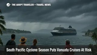
Island level outlooks sharpen that picture for travelers heading to Vanuatu and its neighbors. The Vanuatu Meteorology and Geo Hazards Department expects about two to four tropical cyclones to develop in or pass through Vanuatu's Area of Responsibility between November 2025 and April 2026, at least one of which is likely to reach category three or higher. Officials describe this as normal to slightly above normal activity compared with the country's long term average of two to three cyclones per season. For cruise ships calling at Port Vila, Luganville, or outer island anchorages, that means multiple windows each season when heavy seas, gale force winds, and port closures are credible threats rather than remote possibilities.
Fiji, which sits on many South Pacific cruise routes and serves as a major hub for inter island flights, is expected to see fewer direct hits but still faces meaningful risk. The Fiji Meteorological Service's 2025 to 2026 tropical cyclone outlook warns that one to two cyclones are likely to pass through Fiji's Exclusive Economic Zone, and that one of those systems is likely to reach severe category three or higher. The agency notes that peak activity usually falls between January and February, but that cyclones can form at any time during the season and that out of season storms cannot be ruled out. That pattern favors cruise itineraries that retain flexibility around the New Year peak, and it underlines the importance of not assuming that November or April trips are completely risk free.
For New Caledonia and northern New Zealand, the story is more about elevated impact risk than raw storm counts. Summary guidance from Noonsite and other sailing focused advisories, drawing on the NIWA outlook, notes that although overall cyclone numbers may be normal or slightly reduced, the risk of damaging weather is higher in the Coral Sea corridor and around New Caledonia and Vanuatu in particular. At the southern edge of the basin, northern New Zealand has an above normal chance of experiencing one or two ex tropical cyclones or strong subtropical lows tracking close enough to disrupt ferry and flight schedules.
How It Works
Southwest Pacific cyclone outlooks blend climate models with the history of similar seasons to estimate how many storms are likely and where they might track. A key driver is the El Niño Southern Oscillation pattern in the tropical Pacific. This season, agencies such as NIWA and the Fiji Meteorological Service expect a weak to moderate La Niña phase to develop or persist, which tends to favor more cyclone activity in the western part of the basin, closer to Vanuatu, New Caledonia, and the Coral Sea, and relatively fewer systems near French Polynesia and the eastern islands. The Pacific cyclone season is formally defined as running from November 1 to April 30, but historical records and recent outlooks both stress that cyclones can form slightly outside these bounds.
For New Zealanders and other visitors using Auckland or Wellington as long haul gateways into the islands, the country's official SafeTravel advisory frames the practical implications. It notes that the Pacific cyclone season runs from November 1 until April 30 and urges travelers heading to Pacific destinations to register their details, so officials can push alerts and guidance if a major storm approaches. That registration step is especially important for yacht crews, long stay cruisers, and slow travelers who may be off the main tourist radar for weeks at a time.
Planning Cruises And Island Hopping Routes
For cruise passengers, the main operational risk is not a direct cyclone hit, but last minute itinerary changes as lines steer ships away from danger. Around Vanuatu and New Caledonia, where the outlook points to normal or elevated activity, ships may skip smaller outer island calls in favor of more sheltered ports such as Port Vila or Nouméa when systems form within a few days' sailing time. Travelers considering a South Pacific voyage that hops between Fiji, Vanuatu, and New Caledonia should assume that at least one port on a mid season itinerary could be swapped or dropped and should weigh routes that offer multiple scenic alternatives rather than a single headline stop.
Fly and cruise combinations that rely on same day arrivals and departures need extra scrutiny this season. If a cyclone or strong tropical low forces ports to close or ships to slow down, vessels may arrive late or be held offshore, which can break tight connections. A safer pattern is to arrive at the embarkation port at least one day early and to plan a buffer night after disembarkation before any long haul flights, especially when sailing from Vanuatu or New Caledonia during the January to February peak. Travelers booking packages out of Australia that focus on the broader South Pacific cruise season in 2027 will find that many lines already build some flexibility into itineraries, but cyclone aware planning can still reduce stress when forecasts change. For example, readers can compare options in pieces like Australia And South Pacific Cruise Season 2027 and choose sailings with multiple regional ports rather than a single high stakes call.
Independent island hoppers face a different set of trade offs. Multi stop routings that string together Fiji, Vanuatu, and New Caledonia over several weeks should be built with spare days between domestic flights and with at least one city that can absorb an extra night without blowing the budget. Port Vila, Nouméa, Nadi, and Suva all have more hotel inventory than outer islands, which makes them better buffer points than isolated atolls where a canceled flight can leave travelers sleeping in terminals or community halls. A broader evergreen overview, such as a future Guide To Tropical Cyclone Season Travel Planning, can help travelers combine local forecasts, booking rules, and route choices into a single plan.
Refundable Bookings, Insurance, And On The Ground Choices
Across the South Pacific, the most useful hedge against cyclone disruption is flexibility. On the air side, that means preferring fares that allow no fee date changes or that pair with airline waivers when official warnings are issued. For accommodation, refundable or partially refundable rates at key transit points, even if they cost a little more upfront, can save money when storms force last minute changes. Given that Vanuatu alone expects up to four cyclones in its area this season, at least one of which could be severe, it is reasonable to assume that a longer trip touching multiple islands has a meaningful chance of being affected, even in a season that is near normal in total storm count.
Travel insurance needs to be chosen carefully. Policies should explicitly cover weather related delays and cancellations, extra accommodation costs when travelers are stranded, and missed cruise departures due to airline delays or port closures. Some insurers classify cyclones as named events and may limit coverage if the policy is bought after a system is on the forecast maps, so it is safer to secure coverage well before departure. Travelers planning bareboat charters or extended yacht cruising in the region should also confirm how cyclone warnings affect their obligations to secure vessels or move them out of designated danger zones.
On the ground, the advice from national meteorological and disaster agencies is consistent. When a cyclone warning is in effect, people should stay off the sea and away from rivers, heed local evacuation and shelter instructions, and avoid sightseeing that requires driving through flood prone areas. That applies just as much to short term visitors as to residents. Even a moderate cyclone can produce flash floods, landslides, and hazardous surf far from the center, and many island roads are vulnerable to washouts and fallen trees. Staying put in structurally sound accommodation and waiting for all clear messages is almost always safer than trying to outrun the system once warnings are raised.
In practical terms, the 2025 to 2026 South Pacific cyclone season does not mean travelers need to avoid Vanuatu, Fiji, New Caledonia, or northern New Zealand altogether. It does mean that planning has to start with the assumption that storms will happen, that some of them will be severe, and that routes in and around Vanuatu in particular have a higher probability of disruption this year. By building buffer days, choosing flexible tickets, registering with advisory services such as New Zealand's SafeTravel, and watching local forecasts closely in the week before departure, travelers can still enjoy cruises and island stays while giving themselves room to adapt if the outlook shifts.
Sources
- Southwest Pacific Tropical Cyclone Outlook October 2025, NIWA
- 2025 to 26 Southwest Pacific Tropical Cyclone Outlook, Earth Sciences New Zealand
- Tropical Cyclone Seasonal Outlook 2025 to 2026, Fiji Meteorological Service
- Official Statement, Vanuatu 2025 to 26 Tropical Cyclone Season Outlook, VMGD
- Pacific Cyclone Season, SafeTravel New Zealand
- South Pacific Tropical Cyclone Season, Higher Risk For Vanuatu And New Caledonia, Noonsite