Cyclone Senyar To Threaten Andaman And South India Trips
Cyclone Senyar Andaman travel plans are entering a less predictable phase this week, as India's meteorological agency tracks a strengthening system in the Bay of Bengal that is expected to bring heavy rain, rough seas, and gusty winds to the Andaman and Nicobar Islands and parts of southern India from November 23 onward. The developing storm matters most for visitors who are combining flights into Port Blair with inter island ferries, dive trips, or coastal itineraries through Tamil Nadu, Kerala, and Karnataka, where monsoon season style downpours can quickly flood roads. Travelers with fixed cruise departures, tight domestic connections, or must make events should now build in extra margin, shift dates if they can, or be ready to ride out delays in place rather than chase separate tickets.
In simple terms, a well marked low pressure area over the Strait of Malacca and the south Andaman Sea is forecast to intensify into a depression over the southeast Bay of Bengal on November 24, then into a cyclonic storm over the Bay during the following 48 hours, at which point it will be named Senyar. India Meteorological Department, IMD, guidance and Indian media summaries point to heavy to very heavy rainfall over the Andaman and Nicobar Islands around November 23 to 25, along with squally conditions and winds that can reach or exceed 40 to 50 kilometres per hour over surrounding waters. Forecasts also call for widespread rain and thunderstorms over coastal Tamil Nadu and Kerala through at least November 25, and into parts of coastal Karnataka as the system moves west northwest over warm Bay of Bengal waters.
What remains uncertain is exactly how strong Senyar will become and where it will make landfall once it leaves the Andaman region. Early outlooks from national outlets suggest a range of scenarios, including a storm that curves toward the northern Bay and comes ashore closer to Andhra Pradesh, Odisha, or even further north toward West Bengal or Bangladesh between roughly November 27 and 30, but IMD has not yet pinned down a definitive track or peak intensity. For travelers, that means the most reliable elements of the forecast are the near term marine conditions and rainfall over the islands, not the eventual landfall point on the mainland coast.
For the Andaman and Nicobar Islands, the main operational risks center on ferries, small boats, and adventure activities. IMD and state level advisories are already warning fishermen and other small craft to remain in port on key days, because strong winds and rough seas across the Andaman Sea and the adjoining Bay of Bengal will make crossings dangerous. Tour operators are likely to follow the same signals, which means inter island services between Port Blair, Havelock Island, Neil Island, and more remote locations may be suspended or cut back with limited notice. Snorkeling, diving, and other open water excursions are frequently paused entirely under these conditions, even before any formal cyclone warning, simply because visibility drops, currents strengthen, and lightning risk rises.
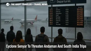
Flights into Veer Savarkar International Airport (IXZ) at Port Blair are more resilient than ferries, and both domestic and international carriers are still operating normal schedules as of November 23. However, even without a direct airport closure, heavy convective storms can trigger holding patterns, diversions to mainland alternates such as Chennai International Airport (MAA), or outright cancellations when cloud tops and crosswinds exceed aircraft or crew limits. Airlines also tend to adjust rotations preemptively when a named cyclone is expected in their operating area, which can affect flights on otherwise clear days, especially for smaller fleets that concentrate aircraft on a few trunk routes. The experience of Cyclone Fina in Australia, which briefly closed Darwin International Airport and disrupted flights across the Top End, is a useful reminder of how fast aviation plans can change once winds and rain intensify. For more background on that event, see Adept Traveler's coverage of Cyclone Fina and its effect on Darwin travel.
On the South India mainland, the risk profile is somewhat different. Forecasts highlight days of heavy to very heavy rain over parts of Tamil Nadu and Kerala tied to both the evolving Senyar system and the broader northeast monsoon pattern. In cities such as Chennai, Kochi, and Thiruvananthapuram, the most likely impacts are waterlogged streets, slower traffic to and from airports, localized flash flooding in low lying areas, and possible short term power cuts. Mountain roads through the Western Ghats and hill destinations can also face landslide risk when rain intensity spikes, which can disrupt both long distance buses and private transfers. Even if the eventual cyclone center stays offshore or makes landfall further north, feeder bands can still deliver hours of intense rain well ahead of the core circulation.
From a historical context, Bay of Bengal cyclones such as Senyar are climatologically most common during May and November, when sea surface temperatures, moisture, and broader atmospheric patterns favor cyclogenesis over the northern Indian Ocean. The post monsoon window that produced Cyclone Montha in October is now yielding a second system, which increases the importance of paying attention to IMD's dedicated cyclone bulletins, rather than treating Senyar as a one off anomaly. Travelers used to calmer December and January conditions in the Andaman Sea should recognize that this is still an active time of year for serious storms.
Practical planning over the next week depends on how fixed a trip is. For travelers who have not yet booked, the simplest option is to push new Andaman itineraries back into early or mid December, once the storm has formed, tracked, and cleared, and once ferry operators have had a chance to fully inspect vessels and piers. Those who already hold tickets into Port Blair in the November 23 to 27 window should resist the temptation to stack tight same day connections between long haul arrivals into mainland hubs and onward domestic flights or ferries, and instead consider an overnight in Chennai, Bengaluru, or another gateway before continuing. Flexible hotel and airline fares, or points bookings that can be cancelled without penalty, are especially valuable in this kind of evolving weather pattern.
Once on the islands or along the South India coast, health and safety should guide day to day decisions. Floodwater in streets and fields can conceal open manholes and sharp debris, and in rural or peri urban areas it can also be contaminated by sewage or animal waste, so wading through standing water is best avoided. Strong surf and rip currents during and after a cyclone related swell can catch even experienced swimmers, and lifeguard coverage is uneven outside major urban beaches. Lightning risk also increases with the kind of intense thunderstorms that accompany cyclones, which means rooftop bars, exposed viewpoints, and long walks along ridgelines are better deferred until the weather stabilizes.
For travelers who want to understand how storms translate into real disruptions, it may help to look at recent coverage of flood related road and rail problems in Southeast Asia and other parts of the Indian Ocean basin, such as Thailand's Hat Yai floods that stranded tourists and cut key highways. These cases show how even non catastrophic events can snarl buses, trains, and transfers for days because water takes time to recede and infrastructure inspections must be completed. Senyar need not be a worst case landfalling cyclone to produce similarly stubborn knock on effects if it delivers days of heavy rain over fragile road networks or ports with limited redundancy.
In the near term, the most important tools for anyone with upcoming trips are official bulletins and flexible plans. IMD's cyclone and rainfall updates, state disaster management authority advisories, port and ferry notices, and airline travel alerts will give the clearest picture of how close Senyar is coming to any given route or island. Travelers should build a habit of checking these at least once per day, and more frequently as the depression forms and converts into a named cyclonic storm around November 26. With that information in hand, it becomes much easier to make rational choices about whether to go, adjust, or stay put without either underestimating or overdramatizing the risks.
Sources
- [India Meteorological Department press release, November 23, 2025][1]
- [Economic Times, Cyclone likely to form over Bay of Bengal, IMD warns of heavy rainfall][2]
- [Times of India, Cyclone Senyar likely to form over Bay of Bengal, 10 key points][3]
- [Indian Express, Cyclone Senyar to develop in the Bay of Bengal around November 26][4]
- [Livemint, IMD shares update on Bay of Bengal cyclone and heavy rain alerts][5]
- [Outlook India, IMD warns of Cyclone Senyar formation over Bay of Bengal][6]