Cyclone Ditwah To Disrupt Sri Lanka And South India Travel
Cyclone Ditwah Sri Lanka travel plans and south Indian itineraries now face several days of elevated risk, as the storm sits over coastal Sri Lanka and the southwest Bay of Bengal and tracks toward the shores of Tamil Nadu, Puducherry, and coastal Andhra Pradesh between November 28 and December 1, 2025. Travelers with flights, trains, and coastal trips touching Colombo, Chennai, Jaffna, Puducherry, or south coastal Andhra need to plan for cancellations, diversions, and closed sea routes as the system strengthens. Anyone who can move a discretionary trip off this weekend should do so, and those who must travel should add long buffers, keep backup routes in mind, and be ready to accept last minute changes.
In plain terms, Cyclone Ditwah Sri Lanka travel and south India travel will be shaped by a slow moving tropical system that has already caused deadly flooding in Sri Lanka and is forecast to bring heavy to extremely heavy rain, strong winds, and storm surge along parts of India's southeast coast through December 1.
Storm Track And Timeline For Sri Lanka And South India
According to the India Meteorological Department, IMD, a deep depression over the southwest Bay of Bengal intensified into Cyclonic Storm Ditwah on November 27, then moved north northwest over coastal Sri Lanka, remaining near the island's eastern and northern shoreline on November 28. IMD's latest advisory places the center near Trincomalee and Batticaloa and indicates that the system is likely to continue tracking north northwest, emerging fully into the Bay of Bengal before reaching waters off north Tamil Nadu, Puducherry, and adjoining south Andhra Pradesh by early morning on November 30.
The same IMD guidance calls for heavy to extremely heavy rainfall over Tamil Nadu and Puducherry from November 28 through November 30, then over coastal Andhra Pradesh and Rayalaseema from November 29 through December 1, alongside strong surface winds and rough to very rough sea conditions along the Bay of Bengal coast. In Sri Lanka, national meteorological and disaster management officials report that large areas of the island have already received more than 300 millimeters of rain, with rivers rising and further intense showers forecast as the circulation lingers nearby.
For travelers, that timing means Friday November 28 through Sunday November 30 are the highest risk days for direct cyclone impacts, with lingering flood and landslide risk in both countries likely to affect roads and rail corridors into early next week, even after winds ease.
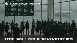
Airports And Flight Disruptions
Sri Lanka's main international gateway, Bandaranaike International Airport (CMB), remains open but has already seen significant disruption. Local airport authorities and Sri Lankan media report at least 15 inbound international flights diverted overnight and through Friday midday because of convective weather and crosswinds as Ditwah's rain bands swept across the island. Some diversions have gone to Thiruvananthapuram International Airport (TRV) in neighboring Kerala, which is currently outside the highest impact corridor but still under heavy rain at times.
Regional connectivity is also under strain. Flights linking Chennai International Airport (MAA) and Colombo, Sri Lanka have been partially disrupted, with Indian outlets noting cancellations and delays on routes between Chennai and Sri Lankan destinations as the storm has battered the island and complicated operations on both sides of the Palk Strait. The UK's Independent and other travel focused outlets report that multiple Colombo bound flights have diverted to south Indian cities or have faced extended holding and arrival delays, and they urge passengers to check flight status before heading to the airport.
On the Indian side, IMD and national disaster response coverage highlight that north Tamil Nadu coastal districts, including the Chennai metropolitan area, are under orange alerts, and that National Disaster Response Force teams have been staged in both Tamil Nadu and Puducherry ahead of Ditwah's approach. While Chennai airport had not yet closed as of the latest updates, recent cyclones in the region show that authorities will suspend operations if wind and visibility thresholds are exceeded, and travelers should treat late Saturday and Sunday arrivals or departures as high risk of disruption.
Low cost carrier IndiGo has issued a focused travel advisory stating that flights operating from Jaffna, Puducherry, Tuticorin, and Tiruchirappalli could see delays and schedule changes as Ditwah nears, and it is asking passengers to monitor their flight status and allow extra time at the airport. That list captures many of the secondary gateways in Ditwah's likely impact zone, including Jaffna International Airport (JAF), Puducherry Airport (PNY), Tuticorin's Thoothukudi Airport (TCR), and Tiruchirappalli International Airport (TRZ).
Travelers booked on separate tickets that connect through Colombo or Chennai should assume that misconnect risk is high over the weekend and that same day rebooking may be limited, especially on regional routes where aircraft may be out of position after diversions.
Rail, Road, And Coastal Impacts
Sri Lankan authorities report that widespread flooding and landslides have already killed dozens of people, left tens of thousands displaced, and forced officials to close schools, suspend select train services, and even halt trading at the Colombo Stock Exchange as emergency crews prioritize rescues and flood defense. Several reports mention landslides in central and eastern districts, water levels rising along key river basins, and rural road networks cut by overflowing streams. In practice, that means inland transfers by car or bus to and from Colombo and hill country destinations may be slowed or impossible on some routes, particularly where roads run close to rivers or along unstable slopes.
Coastal operations are also constrained. IMD, the Indian Coast Guard, and tourism oriented outlets have all noted warnings for fishermen and small craft to avoid heading out to sea in the southwest and west central Bay of Bengal, including off Tamil Nadu, Puducherry, and coastal Andhra, because of very rough seas and high waves. Even where scheduled passenger ferries are not a major part of the transport mix, many informal boat services and water based tours are likely to be suspended in Sri Lanka's affected coastal districts and along India's southeast shoreline.
Rail operations in India's southern states are more resilient to rain, but very heavy downpours and localized flooding can still bring speed restrictions, delays, or short notice cancellations, particularly on low lying coastal stretches and in yards around Chennai and other major junctions. Travelers relying on late evening trains as backups for delayed flights should plan for uncertainty and consider earlier departures where possible.
How To Reroute Or Rebook Around Cyclone Ditwah
For travelers whose trips are flexible, the simplest option is to shift any nonessential travel touching Sri Lanka, Tamil Nadu, Puducherry, or coastal Andhra to dates after December 1, when the worst of Ditwah's rain and wind should have passed and cleanup will be more advanced. Many airlines will issue weather waivers during high profile cyclones, allowing date changes or route changes without change fees, although fare differences can still apply.
If a trip cannot be moved, routing strategy matters. Where possible, travelers bound for Sri Lanka might consider routing through more distant hubs like Doha, Dubai, or Mumbai, then taking a later connecting flight into Bandaranaike International Airport once conditions improve, rather than insisting on tight daytime connections during the peak of the storm. Within India, it may be safer to route via Bengaluru or Hyderabad and connect onto shorter segments into Chennai or other coastal cities as schedules stabilize, rather than relying on early arrivals into those coastal hubs on November 30.
On the ground, it is safer to avoid overnight drives on secondary roads in flood affected districts and to keep hotel bookings flexible, particularly in Colombo, Chennai, and other coastal urban centers that may see localized flooding of low lying neighborhoods. Travelers already in Sri Lanka should keep important documents and essentials in waterproof bags, follow local instructions about evacuations or river flood warnings, and prioritize personal safety over keeping excursions or intercity transfers.
Background: Bay Of Bengal Cyclones And Travel
Cyclones in the Bay of Bengal can be deceptively disruptive for travel because the strongest winds and heaviest rain often sit offshore while long rain bands and pressure gradients extend across hundreds of kilometers of coastline. That pattern means airports such as Bandaranaike International Airport, Chennai International Airport, and Thiruvananthapuram International Airport may appear to be outside a narrow landfall cone yet still suffer low cloud ceilings, wind shear, and repeated thunderstorms that complicate operations.
Historically, late November and early December are active periods for Sri Lanka and south India cyclones, and each major system tends to leave a footprint of damaged infrastructure and eroded coastlines that can amplify the effect of later heavy rain. For this reason, travelers targeting shoulder season bargains in Sri Lanka or Tamil Nadu should always check seasonal cyclone outlooks and, when possible, avoid very tight itineraries built around a single day's margin for international connections or key events during peak storm windows.
Sources
- IMD Press Release, Cyclonic Storm Ditwah Over Coastal Sri Lanka And Adjoining Southwest Bay Of Bengal
- IMD National Bulletin No 23, Cyclone Ditwah
- Cyclone Ditwah Kills Dozens In Sri Lanka As Flooding Spreads
- Cyclone Ditwah Tracker, Projected Landfall Near Tamil Nadu And Puducherry
- Cyclone Ditwah To Bring Heavy Rain To Eastern Coast Till December 1
- Cyclone Ditwah, NDRF Teams Deployed In Tamil Nadu And Puducherry
- Ditwah Disrupts Air Travel, Diversions At Bandaranaike International Airport
- Cyclone Ditwah, Sri Lanka Floods And Travel Disruption Explainer
- IndiGo Travel Advisory On Flights From Jaffna, Puducherry, Tuticorin And Trichy
- Travel Advisory, Cyclonic Storm Ditwah, U S Embassy In Sri Lanka
- Travel Advisory, IMD Red And Orange Alerts In Tamil Nadu And Puducherry