UAE Rain, Fog, Rough Seas Risk Through Dec 16
UAE rain fog rough seas risk through December 16, 2025 can slow trips in Dubai and Abu Dhabi, from airport runs to beach boats. Travelers using Dubai International Airport (DXB), Al Maktoum International Airport (DWC), Zayed International Airport (AUH), and Sharjah International Airport (SHJ) should expect occasional low visibility friction, longer turnarounds, and knock on schedule drift when cloud, humidity, or dust sets in. The safest play is simple, add time for transfers, avoid stacking tight connections, and keep coastal activities flexible, especially across Saturday, December 13, 2025, and Sunday, December 14, 2025.
The UAE rain fog rough seas pattern matters because it hits the same parts of an itinerary at once, airport access roads, arrival spacing in the air, and small craft limits along the coast. A forecast that looks manageable on paper can still create a string of small delays that turn into missed dinners, rebooked tours, or a blown connection.
Highest Risk Windows Through December 16
For Friday, December 12, 2025, the National Center of Meteorology (NCM) outlook calls for fair to partly cloudy conditions, trending cloudier by night and into Saturday morning over islands and coastal areas, with a probability of rainfall. This is the kind of setup where late evening arrivals can be smoother than pre dawn runs, because the overnight humidity cycle is when visibility is most likely to wobble.
Saturday, December 13, 2025 is the first day travelers should treat as operationally sensitive. NCM flags partly cloudy to cloudy conditions with a chance of rainfall, especially over the islands, coasts, and some northern areas, plus humidity by night and Sunday morning. Winds may freshen, and the sea can become rough at times with clouds in the Arabian Gulf, which is when dhow cruises, speedboat tours, and smaller water activities are most likely to be curtailed.
Sunday, December 14, 2025 is the second key day, partly cloudy to cloudy at times, with a chance of rainfall over scattered areas, especially coastal and northern areas, and a decrease in temperatures. NCM also notes winds that can become fresh to strong at times with clouds, causing blowing dust. That combination, cloud plus dust plus the morning humidity carryover, is the day where low visibility procedures at major airports are most plausible, and where desert drives can become less forgiving.
Monday, December 15, 2025 keeps the pattern in play with partly cloudy to cloudy conditions at times and a chance of rainfall over some coastal and northern areas, and seas that may become rough at times in the Arabian Gulf. Tuesday, December 16, 2025 extends the risk window with another chance of rainfall over scattered areas, and seas that NCM describes as moderate to rough, especially with clouds, across both the Arabian Gulf and the Sea of Oman.
If a traveler is trying to be maximally conservative, the highest leverage move is to treat late night to mid morning as the fragile band on Saturday through Tuesday, and to treat Sunday and Tuesday as the most likely days for compounded visibility plus wind impacts.
What This Means for Airports, Roads, and Coastlines
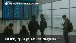
Airports do not need thunderstorms to slow down. In the Gulf, low cloud, mist, or fog, even in patches, can trigger low visibility spacing on approaches and departures. When that happens, arrival rates drop, aircraft spend more time in holds or slow flows, and gate schedules get ragged. That is why a traveler can see a seemingly minor weather headline translate into a long line at immigration, a delayed baggage belt, or a missed car pickup window, especially during peak seasonal loads.
NCM's marine guidance reinforces why coastal plans should stay flexible. The Al Bahar marine bulletin shows wave heights in the Arabian Gulf that can reach several feet higher during cloudy periods, with the most elevated sea states showing up around Sunday, December 14, 2025, and Tuesday, December 16, 2025, while the eastern coast also trends rougher into Tuesday. Operators tend to pause smaller craft first, then resume quickly once conditions ease, so travelers who can shift a boat plan by a few hours usually do better than travelers who lock into a single sailing.
On the roads, the most common failure mode is not flooding, it is visibility and speed management. Humid nights can turn into sudden patches of fog or mist, and winds can loft dust in exposed areas. When that happens, police often enforce lower speeds on major corridors, and travel times can jump, even if the route is technically clear. That is why airport transfers should be planned as if the drive could take materially longer than mapping apps predict.
Practical Checklist Without Overreacting
The practical checklist for this UAE rain fog rough seas window is about reducing cascading risk, not canceling plans. Travelers should monitor flight status inside the airline app, not only via third party trackers, because gate changes and retimes propagate there first. They should also check NCM updates before leaving for the airport, especially on Saturday, December 13, 2025, and Sunday, December 14, 2025, when the forecast is most changeable. For road safety, drivers should avoid setting a fixed arrival target that forces speed in low visibility, and should plan a buffer that protects hotel check in, tours, and dining reservations. For coastal activities, travelers should book refundable, or easily re timed, operators when possible, and keep an indoor backup plan ready.
For travelers who want more context on how Gulf hub delays can ripple through connections, see Adept Traveler's earlier reporting on Dubai Fog And Gulf Hub Delays. For a nearby example of how regional weather can become operational quickly, see Saudi Storms Flood Jeddah And Threaten Makkah Trips. For evergreen planning context on timing outdoor activities around winter weather patterns, see the Dubai destination guide at Dubai, United Arab Emirates.
The bottom line is that UAE rain fog rough seas risk through December 16, 2025 is manageable for most trips, but it is the kind of pattern that punishes tight timing. Add transfer buffer, avoid stacking fragile morning connections, and keep water and desert plans flexible, and the disruption risk usually stays in the annoyance tier rather than turning into a missed flight or a lost day.