Pineapple Express Pacific Northwest Travel Delays
Multiple storm systems are lining up to complicate early holiday trips across the United States, with the most consequential impacts stretching from the Pacific Northwest into Northern California, and a separate round of rain and wind affecting the eastern U.S. Travelers flying, driving, or taking ferries in the Northwest are most exposed to flooding, high wind warnings, and uneven road conditions. The practical move is to pad timelines, lock in flexible rebooking options, and decide now which connections or same day drives you will not attempt if conditions deteriorate.
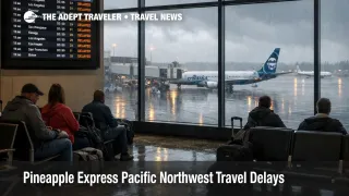
The Pineapple Express Pacific Northwest travel setup matters because heavy rain, flooding potential, and wind can compress capacity across airports and highways at the same time, which makes small disruptions harder to recover from.
On the West Coast, the atmospheric river signal is straightforward, deep Pacific moisture is aimed at Washington and Oregon, with the axis shifting south into Northern California as the event evolves. That combination raises the risk of rapid runoff in steeper terrain, and slower, longer lasting river flooding where water spreads into flatter lowlands. Even when airports are technically open, the system effects show up as late inbound aircraft, crew and aircraft out of position, and more last minute gate changes when schedules slip.
At the same time, high winds in parts of the Northwest and the interior West are a separate failure mode that can quickly become a travel problem even outside the heaviest rain bands. Wind can bring localized power outages, downed trees, and road restrictions, and it can also reduce airport arrival rates when crosswinds force operational changes. Travelers planning regional road legs through exposed corridors in the Rockies should treat the drive itself as the critical path, not the flight arrival time.
On the East Coast, a different storm track is bringing a mix of rain and gusty winds that can make late week travel messy, especially when it overlaps with peak holiday departure banks. The travel impact is less about one specific airport closing, and more about a broad reduction in on time performance, longer taxi and holding patterns, and slower highway travel during the busiest hours.
Who Is Affected
Travelers in Washington, Oregon, and Northern California are the most exposed to the first order impacts, which include heavy rain, elevated river responses, localized flooding, and travel delays that can last beyond the heaviest precipitation. If your plan includes a coastal drive, a mountain pass, or a late day arrival followed by a long onward drive, your itinerary is more fragile than it looks because the easiest recovery options, alternate roads, alternate flights, and last minute hotel rooms tend to tighten quickly once a storm is already underway.
Travelers moving through the Rockies and adjacent High Plains during high wind warnings face a different constraint, the trip can become unsafe or impractical even when skies are relatively clear. High profile vehicles are most vulnerable, and so are itineraries with time boxed transfers, such as landing and immediately driving into mountain areas, or attempting long overnight road segments.
East Coast flyers and drivers are affected by the overlap of adverse weather and peak holiday volume. Wind and rain can degrade airport throughput and road conditions just enough to break tight connections, and the downstream ripple is amplified by full flights and limited same day reaccommodation inventory.
Across all regions, anyone traveling on separate tickets, or stacking a flight plus a long drive plus a timed check in, is at higher risk. Weather disruptions tend to arrive as clusters, not single isolated delays, so a schedule that can absorb one slip often fails after the second one.
What Travelers Should Do
Take immediate steps to reduce brittle timing. Confirm your airline's change options, screenshot or save reminders of any waiver language you see in the app, and add buffer to airport arrival, connection windows, and rental car pickup timelines. If you have a long drive after landing, prioritize daylight driving, and pre identify a safe stopover town where you could spend the night if wind, flooding, or closures make the route unsafe.
Use clear decision thresholds for rebooking versus waiting. If your itinerary depends on a same day connection under 90 minutes, or a late arrival followed by a multi hour drive, treat that plan as conditional, and be ready to move to an earlier departure, an earlier arrival day, or an overnight at. If your trip's success depends on one specific segment, for example a ferry sailing, or a single mountain corridor, decide in advance the time when you will stop waiting and switch to an alternate routing.
Monitor the next 24 to 72 hours with operational signals, not just forecast maps. Watch for flood watches and wind warnings from the National Weather Service, and track airport delay programs, gate holds, and rolling cancellations in your airline app. For travelers in the Seattle area ferry network, High Winds, Low Tides Disrupt Washington Ferries Dec 18 is a good template for how quickly service can compress once multiple sailings fall out. For travelers routing through the Front Range and heading into the mountains, High Winds Denver Airport Delays, I 70 Transfer Risk shows the most common failure mode, landing on time, then losing the drive window.
How It Works
Atmospheric rivers disrupt travel by stacking multiple operational constraints at once. The first order effect is water, heavy rain over saturated or steep basins can trigger fast runoff, debris flows, and localized flooding that slows highway travel and occasionally closes key corridors. In mountainous terrain, rising snow levels can push precipitation into rain at mid elevations, which increases runoff into rivers and shortens the warning window for downstream impacts.
The second order ripple hits aviation. When weather reduces arrival rates at one or two key nodes, airlines protect the network by canceling some flights early, and delaying others, which then strands crews and aircraft in the wrong places. That ripple is why a storm focused on the Pacific Northwest can still show up as late aircraft on unrelated routes, and why East Coast wind and rain can cascade into missed connections even when your origin airport looks fine.
The third order ripple is traveler behavior and capacity compression. When millions of people travel during a fixed holiday window, late flights and closed roads push demand into fewer open alternatives, which raises hotel prices, tightens rental car inventory, and increases the odds that the "backup plan" is either expensive, or unavailable. AAA's year end travel projection beginning December 20, 2025 is a useful reminder that recovery options get worse as the peak days begin.
Sources
- Pineapple Express to bring new surge of major flooding amid ongoing Pacific Northwest recovery (AccuWeather)
- Early Christmas travel at risk as eastern US storm brings rain and gusty winds (AccuWeather)
- CW3E AR Update: 17 December 2025 Outlook (Center for Western Weather and Water Extremes)
- WWA Summary for High Wind Warning Issued by RIW (National Weather Service)
- Year End Holiday Travel Expected to Set New Record (AAA Newsroom)
- White Christmas hopes hinge on holiday week storm and warmer air (AccuWeather Press)
- Powerful Storm System Threatens to Disrupt Christmas Travel (Travel + Leisure)