Houston Hobby Ground Stop Signals Texas Storm Risk
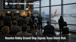
A brief ground stop at William P. Hobby Airport (HOU) on Wednesday, March 4, was lifted the same evening, but it is a clean reminder of how fragile metro airport operations can get when demand stacks up faster than arrivals can be safely accepted. Houston news coverage, citing an FAA advisory, said the ground stop began shortly after 430 p.m. local time and was lifted around 600 p.m., with "volume" and procedural adjustments cited as the driver.
This matters for March 5 and March 6 because Texas is moving into another severe weather window where timing, not just intensity, determines how many itineraries break. NOAA's Storm Prediction Center forecast discussion for Thursday, March 5, called out an enhanced risk of severe thunderstorms across parts of the eastern Texas Panhandle into western Oklahoma, with large to very large hail, a few tornadoes, and damaging winds all on the table. Even if Houston itself is not the bullseye of the highest hail risk corridor, Texas hubs absorb the schedule shock when storms disrupt flows to Dallas, Austin, San Antonio, and the broader south central network.
Which Texas Itineraries Are Most Exposed
Trips that rely on tight, same day connections through Texas are the most exposed, especially when the connection is the "only viable" option to make a cruise embarkation, a meeting, a wedding, or a late evening arrival. The failure mode is simple: a ground stop or metering program holds departures at origin, which delays the inbound aircraft your next flight needs, and once a hub misses its bank timing, recovery options shrink.
The riskiest pattern for March 5 and March 6 is connecting late afternoon or evening through Houston, Dallas, or Austin after starting the day elsewhere. Storms that initiate near the dryline in northwest Texas can cause reroutes and spacing delays that bleed into ZFW and neighboring facilities, and then propagate into hub turn times and crew legality. That is why a seemingly "local" disruption can strand a traveler far from the weather.
If you are already flying into or out of Houston this week, treat Hobby as a short connection trap when the system is busy. Hobby's network is heavily short haul and high frequency, which is great when the clock is stable, and brutal when it is not, because the whole plan depends on fast turns and on time inbound arrivals.
What Travelers Should Do Now
For travel on March 5 and March 6, do not connect tight through Texas if the trip matters. In practical terms, that means choosing a longer connection than you normally tolerate, prioritizing earlier departures, and avoiding itineraries that require everything to be on time after mid afternoon.
Rebook early if your connection buffer is thin and your first flight starts slipping. A ground stop is the extreme version, but even a smaller slowdown can remove your margin. The tradeoff is straightforward: waiting may preserve the original fare and routing, but acting earlier can preserve the itinerary, especially when later options sell out or arrive too late to be useful.
Monitor the right signals, not just the generic forecast. Start with the SPC outlook updates for where storms are most likely to fire and how the risk area shifts during the day. Then, check for FAA traffic flow initiatives and constraints that indicate demand is outpacing capacity. Finally, watch your inbound aircraft assignment in the airline app, because it is often the earliest indication that your flight is about to slip into the next bank.
For more background on how these FAA tools show up in real traveler outcomes, see Ground Delay Program: Evening Hotspots and Ground Stops and the longer systems context in U.S. Air Traffic Control Privatization: Reality Check. For the broader storm setup that Adept flagged earlier this week, see Central US Storms Threaten Flight Banks March 4 to 7.
Why Ground Stops Happen, and How Storm Risk Spreads
A ground stop is one of the FAA's bluntest flow tools: it temporarily stops certain departures from leaving their origin airport when the destination airport cannot accept arrivals at the needed rate, or when a procedural or safety constraint demands an immediate reduction in demand. The traveler facing detail is that the waiting time gets pushed back to the departure airport, which is usually better than holding in the air, but it also scrambles gate plans, aircraft rotations, and connection timing. Industry explainer guidance describes how these traffic management initiatives are used to reconcile demand with reduced capacity.
Severe weather risk amplifies this because weather does not have to sit directly over the runway to cut capacity. Thunderstorms near arrival and departure corridors force spacing, reroutes, and ground delay programs, and once an airport misses its arrival bank, departures start leaving late, which then causes the next set of arrivals to miss their windows. That is the first order effect. The second order effect is crew and aircraft mispositioning, which is where Texas hub travel gets especially fragile, because short haul networks depend on precise timing to keep both aircraft and crews in the right place for the next leg.
Thursday's SPC outlook made the core risk plain, storms capable of very large hail and a few tornadoes are expected in a corridor that starts in northwest Texas and the Panhandle region, then pushes into western Oklahoma and beyond. Even if you never go near Amarillo, the schedule you are relying on may, and that is why a confirmed operational clampdown at Hobby on March 4 should change how aggressively you optimize connections through Texas on March 5 and March 6.