Dutch & Belgian Waterways Water Levels Outlook, Week Of April 20, 2026
Dutch & Belgian Waterways water levels look broadly workable for the week of April 20, 2026, and the current official picture does not support a network-wide disruption call. This product is not one river, it is a canal, lock, estuary, and port network that typically depends more on local control points than on one headline gauge. Rijkswaterstaat's current Dutch water report says the river system has no special issues and the IJsselmeer area also has no special issues, while Flanders' official VisuRIS portal currently shows no notifications in its notices-to-skippers table. That supports a Normal traveler-facing risk label for the next 7 days, with the caveat that localized bridge or lock notices can still matter more here than basin-scale hydrology.
Dutch & Belgian Waterways Water Levels: What Changed
What changed this week is mostly the absence of a broad negative signal. On the Dutch side, Rijkswaterstaat's live water report shows "Rivieren, Geen bijzonderheden," and "IJsselmeergebied, Geen bijzonderheden," while only the coast and Rijnmond area are flagged for low water. That is useful context, but it does not automatically translate into a cruise problem for Holland and Belgium itineraries, because those cruises rely heavily on inland canals, managed waterways, locks, and urban approaches rather than one exposed open-water segment.
On the Belgian side, the official VisuRIS portal is more important than any single flow number this week. Its current notices-to-skippers page says "No notifications," which is a stronger near-term operational signal for this product than trying to force one Dutch or Belgian gauge into a river-wide story. That does not prove every sailing will run to brochure timing, but it does argue against a current lock or canal control-point crisis across the Flemish network.
Which Reach Faces the Most River Cruise Risk
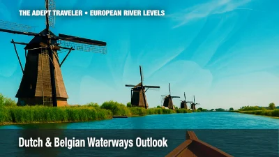
The most exposed parts of this product are usually the control-point stretches, Amsterdam-area canal access, Rotterdam linked passages, the Brussels-Scheldt corridor, and the Flemish canal and lock system toward Antwerp, Ghent, or Bruges connections. Viking's Holland & Belgium itinerary describes the trip as a journey through a "vast network of canals and rivers" between Amsterdam and Antwerp, which is exactly the right planning frame for travelers. The risk here is usually not one river going too high or too low. It is local closures, lock timing, or route substitutions inside the network.
For this week, though, I did not find a current official Dutch or Flemish signal of a network-wide operating problem, and I did not find a current public operator-specific advisory confirming active bussing, rerouting, or major itinerary disruption for Holland and Belgium cruises in this exact window. That leaves the main exposure with travelers who have brittle same-day transfers, fixed private touring, or very little tolerance for last-minute port-sequencing changes in Amsterdam, Rotterdam, Antwerp, or Bruges-linked programs.
What Travelers Should Do This Week
For departures in the next 7 days, the practical move is to proceed, but verify final embarkation, docking, and transfer details rather than assume exact brochure timing. The weather pattern is supportive. KNMI says the Netherlands is sunny and dry on April 21, with more sun and dry weather on April 22, and the Belgian RMI forecast also shows mainly fair to partly cloudy, dry conditions through the coming days with light rainfall amounts. That does not look like the kind of short-range setup that usually reloads the Dutch and Belgian inland network with a fresh weather-driven navigation problem.
The next decision threshold is straightforward. Recheck quickly if Rijkswaterstaat's shipping notices start showing Dutch closures or restrictions on commercially relevant routes, if VisuRIS moves away from "No notifications," or if an operator begins publicly confirming altered docking, coach substitutions, or route changes. Without one of those signals, there is not a strong basis to rebuild a Dutch and Belgian waterways cruise this week.
Beyond 7 days, confidence should fall even though the current picture is calm. This is a network product, not a single river. That means one bridge, one lock, or one local traffic issue can still create friction faster than a basin-wide water map would suggest. Travelers should therefore keep flexibility around transfer timing and exact port sequencing even in a Normal week.
Why This River Outlook Is Shifting
The near-term outlook is stable because the two main drivers are aligned, official network operations look calm, and the weather is not obviously trying to break that calm. Rijkswaterstaat's live water report does not show special problems on Dutch rivers or the IJsselmeer area, and VisuRIS is not showing current Flemish notices to skippers. At the same time, KNMI and the Belgian RMI both point to a mostly dry, fair weather pattern rather than a sharp rainfall or storm signal. In plain language, the Dutch and Belgian waterways do not have an obvious short-term trigger for a broad worsening this week.
This is also why the correct traveler framing is calm, but not lazy. Dutch and Belgian itineraries can still pick up local friction from lock operations, canal management, or urban access even when the broader hydrologic picture looks fine. For the week of April 20, 2026, though, the verified evidence supports a functioning Low Countries network with low near-term disruption risk, not an active systemwide problem.
| Period | Likelihood Of Disruption | Confidence |
|---|---|---|
| Days 1 To 7 | Low | High |
| Days 8 To 14 | Low | Medium |
| Days 15 To 21 | Low | Low |
Sources
- Rijkswaterstaat shipping notices and water information hub
- Rijkswaterstaat home page, current water report
- Rijkswaterstaat drought and water shortage page, current water report module
- VisuRIS, Flanders official RIS portal
- VisuRIS notices to skippers table
- KNMI weather forecast
- Belgian RMI weather forecast
- Viking Holland & Belgium 2026 itinerary