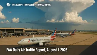
FAA Daily Air Traffic Report, August 1 2025: Thunderstorm-Related Flight Delays
The Federal Aviation Administration's Air Traffic Control System Command Center warns travelers to brace for weather-related flight delays today. Potent thunderstorms are building over Texas, the Mid-South, and the Northeast. Dallas/Fort Worth International Airport (DFW), Memphis International (MEM), and New York's three major fields top the risk list, with ground-delay programs possible if storm cells intensify. Low ceilings from Boston to San Diego and a SpaceX launch window could add further pressure to the National Airspace System.
Key Points
- Why it matters: Thunderstorms and low ceilings are already slowing flights at major U.S. hubs.
- Travel impact: Dallas/Fort Worth, Memphis, and New York-area airports face the biggest ripple-effect delays.
- What's next: The FAA warns ground-stop programs may expand this evening if storm cells intensify.
- Low clouds are hampering Boston, Philadelphia, D.C., San Francisco, and San Diego operations.
- ATCSCC planners list possible ground stops for ATL, CLT, MCO, and IAH after 18 00 ET.
Snapshot
The Federal Aviation Administration's morning outlook shows a classic summer pattern: scattered but potent thunderstorms across the South and Mid-Atlantic, with low clouds blanketing parts of the Northeast and California coasts. Dallas/Fort Worth International (DFW) and Memphis International (MEM) are highlighted for convective weather, while New York's three major airports (JFK, LGA, EWR) could see wind-related flow restrictions. Travelers should prepare for rolling departure holds of 30 to 90 minutes and potential diversions as the system evolves through the afternoon.
Background
The FAA Daily Air Traffic Report is issued by the Air Traffic Control System Command Center (ATCSCC) each morning to flag expected disruptions nationwide. It aggregates National Weather Service radar, airline schedules, and field reports to create a baseline plan for the National Airspace System. While airlines ultimately decide whether to delay or cancel individual flights, the report offers the earliest official signal of likely pressure points-especially useful during the peak summer thunderstorm season, when convective activity can ground thousands of flights in minutes.
Latest Developments
ATCSCC Operations-Plan Highlights
A 13:45 Z operations-plan advisory warns that thunderstorms will affect en-route centers from New York (ZNY) to Houston (ZHU), with ground stops "possible" after 17 00 ET for BOS, EWR, ATL, CLT, and multiple Florida gateways. Controllers are also watching volume spikes tied to a SpaceX Crew-11 launch window at Kennedy Space Center, which could further compress East Coast traffic flows.
Northeast Route Advisory
The latest SERMN_SOUTH routing advisory reroutes New York-area departures bound for Washington-area airports to avoid storm-laden sectors in ZNY and ZDC airspace, citing weather as the sole constraint. Turbojet crews must accept initial altitudes of 8 000 ft with mandatory step-downs-a tell-tale sign of convective towers topping 30 000 ft along the coastal corridor.
Analysis
Today's pattern underscores how localized thunderstorms can ripple across the continental system. Dallas/Fort Worth handles roughly 1 900 daily operations; a one-hour ground stop there can displace more than 70 000 seats and create rolling aircraft imbalances that spill into morning banks on August 2. New York's trio of slot-controlled airports, meanwhile, operate at notoriously slim margins-wind-induced runway swaps can cut arrival throughput by 20 percent. Add afternoon convective cells, and ground delay programs become almost inevitable.
The pivot point will be storm movement between 15 00 and 21 00 ET. If cells drift north toward Atlanta and Charlotte, the Southeast hub-and-spoke network could seize, forcing airlines to scramble for crew-duty-time exemptions. Passengers booked through affected hubs should monitor airline apps for re-booking options and consider voluntary waivers already posted for Texas and Mid-South routes. International connections may face compounded mis-connects as evening trans-Atlantic departures cluster in the 17 00-20 00 ET window.
Final Thoughts
With convective weather dominating today's FAA Daily Air Traffic Report, expect reactive-and possibly cascading-flight delays throughout the afternoon. Building extra buffer time into connections and acting on re-booking offers early can mitigate the worst impacts. The agency's next planning webinar at 15 15 Z will reveal whether the thunderstorm threat intensifies or relents; either way, travelers should stay nimble.