Midwest flooding fuels flight delays & alerts
Torrential rain soaked the Upper Midwest overnight, sending rivers over their banks and prompting fresh flood alerts from Kansas to Wisconsin. Milwaukee logged one of its wettest days on record, forcing the Wisconsin State Fair to cancel its finale and stretching emergency services as high water shut roads. FAA planners warned of potential routing constraints into Chicago this afternoon as thunderstorms threaten key Midwest airspace. Travelers headed to or through Chicago, Milwaukee, Detroit, Minneapolis, and St. Louis should expect delays and plan backup options. Authorities continue to urge drivers to avoid flooded streets.
Key Points
- Why it matters: Flooding has closed roads and strained transit, and FAA flags Chicago routing constraints later today.
- Travel impact: Hundreds of U.S. flights were delayed early today, with flood alerts across KS, IA, NE, MO, IL, and WI.
- What's next: Additional heavy rain is possible into Tuesday per NOAA's Excessive Rainfall Outlook.
Snapshot
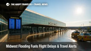
Millions remain under flood alerts as slow-moving thunderstorms continue across the Upper Midwest. Milwaukee reported roughly a foot of rain in spots and more than 5 inches at the airport on Saturday, making it the city's second-wettest day on record. The Wisconsin State Fair canceled its final day as power outages and water rescues mounted. Nationally, early-morning flight tracking showed hundreds of delays and dozens of cancellations, and the FAA's daily plan highlights potential routing programs for Chicago later today if storms persist. Expect knock-on delays at hubs including Chicago O'Hare International Airport (ORD), Chicago Midway International Airport (MDW), Milwaukee Mitchell International Airport (MKE), Detroit Metropolitan Wayne County Airport (DTW), and Minneapolis St. Paul International Airport (MSP).
Background
The current setup features repeated rounds of thunderstorms along a stalled boundary, a pattern that can produce training storms and flash flooding. Over the weekend, southeastern Wisconsin bore the brunt, with Milwaukee recording 5.74 inches in hours at the airport and localized totals near or above a foot. That combination shattered a daily rainfall record and delivered the city's second-wettest day on record, according to local officials and meteorologists. Regional impacts extended into Nebraska, Iowa, Illinois, and Missouri, where emergency services responded to water rescues and power outages. NOAA's Weather Prediction Center continues to outline areas of elevated flash-flood risk into Tuesday. While each event is unique, scientists and forecasters note that extreme precipitation episodes are occurring more often, a concern for cities with aging drainage systems and low-lying infrastructure.
Latest Developments
Flood alerts expand as high water closes roads
Flood watches and warnings are posted from Kansas and Nebraska through Iowa, Missouri, Illinois, and Wisconsin, with forecasters calling for additional heavy rain and isolated severe storms through tonight. Milwaukee's flooding prompted the early closure of Saturday's activities and the full cancellation of Sunday at the Wisconsin State Fair, where fairgrounds and nearby roads were inundated. Officials urged residents to avoid floodwaters and keep devices charged in case of renewed power outages. Travelers should allow extra time for detours to Milwaukee Mitchell International Airport (MKE) while neighborhood streets and river crossings dry out. NOAA's Excessive Rainfall Outlook remains a useful day-by-day guide to counties at greatest risk. See the Weather Prediction Center's interactive map for current risk areas: https://www.wpc.ncep.noaa.gov/qpf/excessive_rainfall_outlook_ero.php?utm_source=adept.travel.
Air travel: FAA flags possible Chicago programs this afternoon
The FAA's Current Operations Plan highlights thunderstorm impacts across multiple centers, including Chicago's airspace, with potential CDRs, SWAP, and arrival-route restrictions for Chicago O'Hare International Airport (ORD) and Chicago Midway International Airport (MDW) after 300 p.m. Central. Detroit and other Great Lakes hubs are also listed for thunderstorm constraints, which can ripple into longer taxi-out times, airborne holding, and diversions. Early today, flight tracking showed hundreds of delays and dozens of cancellations nationwide, a total that can climb quickly when convective weather stalls over the Midwest. Before you head to the airport, confirm your flight status directly with your airline and consider re-routing via Minneapolis St. Paul International Airport (MSP), Detroit Metropolitan Wayne County Airport (DTW), or St. Louis Lambert International Airport (STL) if Chicago ground programs materialize. FAA operations plan https://www.fly.faa.gov/adv/adv_spt.jsp?utm_source=adept.travel.
Milwaukee closures, outages, and event impacts
Milwaukee officials reported widespread flooding, hundreds of emergency calls, and thousands of customers without power during the height of the storm. The city closed the final day of the Wisconsin State Fair as access roads and parking areas flooded, and nearby rivers rose out of their banks. Local media documented water rescues and roadway shutdowns across Wauwatosa and West Allis, with cleanup efforts continuing as additional rains threaten saturated ground. Event organizers are directing ticketholders to official channels for refund and rescheduling information. For the latest fair updates, visit: https://wistatefair.com/fair/updates/?utm_source=adept.travel.
Analysis
For air travelers, the operational picture hinges on how storms fire along and north of the boundary this afternoon. If cells anchor near Chicago, FAA traffic managers can deploy CDRs and SWAP routes, slowing arrivals into Chicago O'Hare International Airport (ORD) and Chicago Midway International Airport (MDW), then rippling delays to connections across the network. That risk often peaks in the mid to late afternoon bank, when convective coverage is widest. Check your flight status early, build a longer connection buffer, and move any nonessential same-day meetings to virtual. If you hold a tight connection through Chicago, ask your airline about an earlier feeder into Minneapolis St. Paul International Airport (MSP) or Detroit Metropolitan Wayne County Airport (DTW), then onward to your destination.
On the ground, highway flooding remains the main safety issue. Never try to drive through standing water, which can conceal washed-out pavement and strong currents. If you must reach Milwaukee Mitchell International Airport (MKE), stick to main arterials with better drainage and avoid underpasses where water ponds quickly. Keep a battery pack handy for alerts, and plan extra time for parking and security as staffing can be challenged after overnight weather. If storms are forecast where you are staying, photograph belongings and keep receipts, since many travel insurance policies cover trip delays and lost nights when flooding makes roads impassable. Finally, watch NOAA's Excessive Rainfall Outlook for your county before deciding whether to push a road trip into Tuesday.
Final Thoughts
Today's Midwest travel picture is fluid, and the ceiling for disruption is tied to how long storms linger over the Chicago-Milwaukee corridor. If FAA route restrictions go live at Chicago O'Hare International Airport (ORD) or Chicago Midway International Airport (MDW), expect a late-day bulge of delays that can cascade nationwide. Build extra time into airport transfers, avoid flooded roads, and consider rebooking if your itinerary depends on a tight connection through Chicago. Keep checking official updates until conditions improve and water recedes. With more rain in the forecast, stay flexible and treat safety as your first filter during this round of Midwest flooding.
Sources
- Current Operations Plan Advisory, FAA
- Excessive Rainfall Outlook, NOAA WPC
- NWS Milwaukee/Sullivan, National Weather Service
- Flooding cancels last day of Wisconsin State Fair, AP News
- Historic flash floods hit Milwaukee, Axios
- Flash flooding hits the Midwest, ABC News
- Flooding hits midwest as Milwaukee sees second wettest day, The Guardian
- Millions face travel delays amid historic flooding, iHeart/WGCI citing FlightAware