Typhoon Podul Slams Southern Taiwan; 400+ Flights Canceled
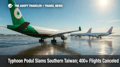
Southern Taiwan shut down on August 13, 2025, as Typhoon Podul made landfall near Taitung, about a one hour flight from Taipei, with peak winds reported near 191 kph. Authorities suspended work and school across nine cities and counties, evacuated more than 5,500 residents, and warned of landslides and flooding. Airlines canceled more than 400 flights across Taiwan, with Taiwan Taoyuan International Airport (TPE) and Kaohsiung International Airport (KHH) seeing the most disruption. Podul exited into the Taiwan Strait late afternoon local time, with forecasters expecting impacts along China's Fujian and Guangdong coasts into August 14.
Key Points
- Why it matters: Same day air, rail, and ferry disruption across East Asia, with ripple effects to Hong Kong and southern China.
- Travel impact: 252 domestic and 155 international flights canceled, plus rail and ferry suspensions in multiple counties.
- What's next: Second landfall possible from Xiamen to Shantou late August 13 into August 14, with heavy rain and coastal gales.
- Winds up to about 191 kph at landfall near Taitung, early afternoon local time.
- 5,500+ residents evacuated, work and school suspended in at least nine jurisdictions.
Snapshot
Podul struck southeastern Taiwan near Taitung early afternoon on August 13, then tracked quickly across the south and into the Taiwan Strait. Officials suspended work and classes in nine cities and counties, including Kaohsiung and Tainan, and carried out more than 5,500 precautionary evacuations, many in areas still recovering from July's flooding. Airlines canceled more than 400 flights systemwide as operations concentrated at Taiwan Taoyuan International Airport (TPE) and Kaohsiung International Airport (KHH) were curtailed. Taiwan High Speed Rail shifted to reduced, all stop service after 2 p.m., while conventional rail lines and several inter island ferries paused operations. Forecast models point to renewed impacts along China's Fujian and Guangdong coasts through August 14, with a risk of additional flight delays, ferry suspensions, and localized landslides.
Background
Taiwan's mountainous southeast, including Taitung, is particularly exposed to cyclone wind fields that accelerate over nearby terrain. The region endured severe July rains that triggered landslides, damaged roads, and left some communities vulnerable. Podul arrived with a compact core but strong gusts near 191 kph, concentrating the worst conditions from Taitung across Pingtung and into Kaohsiung and Tainan. Airlines preemptively thinned schedules and then canceled departures as the eyewall approached, leaving ground handlers to secure equipment and tow aircraft to safer stands at TPE and KHH. With multiple ferry routes linking outlying islands to the main island, maritime authorities also moved quickly to suspend crossings in exposed channels. Recent regional storms, including Typhoon Wipha Grounds Flights and Disrupts Asia Travel and Tropical Storm Krosa Disrupts Narita, Haneda Flights, underscore how quickly summer systems can upend air and sea schedules across the Western Pacific.
Latest Developments
Flights, rail, and ferries across Taiwan trimmed or paused
Airlines canceled 252 domestic and 155 international flights for a combined 407, with the largest impacts at Taiwan Taoyuan International Airport (TPE) and Kaohsiung International Airport (KHH). China Airlines and EVA Air focused cancellations on southern routes, while some long haul and regional operations at TPE were also affected. Taiwan High Speed Rail operated reduced, all stop trains after 2 p.m., prioritizing safety and keeping essential connectivity. Taiwan Railways Administration curtailed segments in the southeast where slopes are prone to slides, and ports reported multiple ferry suspensions, including links to Penghu and other islands. Travelers should anticipate rolling delays into August 14 as crews and equipment reset, aircraft reposition, and inspection backlogs clear.
China coastal outlook, Hong Kong knock on effects
Forecast guidance and official bulletins indicate Podul will weaken somewhat over water, then drive toward China's coastline between Xiamen and Shantou late August 13 into August 14. Fujian and Guangdong raised emergency response levels, recalled fishing fleets, and warned of gale force gusts along exposed capes and in the northern Pearl River Delta. While Hong Kong International Airport (HKG) was outside Taiwan's core wind field, feeder flights and cargo rotations transiting the Taiwan Strait may face secondary delays, especially if storm bands clip coastal air corridors or if mainland airports meter arrivals. Expect potential ferry pauses on sensitive straits and selective high speed rail slow orders until rain bands pass.
Landslides and flooding risk in southern mountains
Taiwan's Central Weather Administration projected 400 to 600 millimeters of rain in the southern ranges from Tuesday through Thursday. After July's slope failures, officials urged continued caution in Kaohsiung, Tainan, and Pingtung districts where saturated soils could let go with little warning. Road managers may implement rolling closures on mountain highways for rockfall clearance, and rural outages are possible if winds topple spans or poles. Authorities asked visitors in national parks and coastal recreation areas to heed closures, stay off wave battered promenades, and monitor county updates before attempting overland travel.
Analysis
The immediate shock to Taiwan's aviation network from Typhoon Podul is significant, but the operational hangover will determine traveler experience through the next 24 to 36 hours. With 400 plus cancellations, airlines must re thread aircraft and crews to restore rotations, a process constrained by crew duty limits, gate availability, and overnight maintenance windows. KHH's recovery could lag TPE's because southern airfields absorbed stronger winds and heavier rain for longer, which complicates ramp inspections and ground power checks. On the ground, the combination of reduced high speed rail frequencies and selective TRA suspensions will funnel more travelers into fewer seats, so standby and rebooking queues will lengthen even after the storm clears. Maritime links amplify the ripple effect, since ferry suspensions isolate secondary destinations and strand crews needed to restart tourism operations. Regionally, any second landfall along the Fujian Guangdong arc will propagate delays along coastal routes that interconnect Taiwan, Hong Kong, and mainland hubs, repeating patterns seen with Wipha and Krosa. For tour operators and cruise planners, the narrow decision window, hours not days, favors conservative reroutes that protect safety, schedules, and port slots.
Final Thoughts
Taiwan's preparedness limited damage, but Podul's fast crossing still fractured the daily choreography of flights, trains, and ferries. If you are booked through TPE or KHH, build a flexible buffer, track airline and rail alerts, and avoid unprotected waterfronts until seas calm. Travelers headed to southern China should watch for slot controls and weather holds through August 14. As with any Western Pacific storm, patience and contingency planning pay off, especially during peak summer travel. Expect lingering ripple effects, but a steady normalization once ground inspections finish and crew rosters reset after Typhoon Podul.
Sources
- Typhoon Podul blows through southern Taiwan leaving one person missing, Reuters
- Southern Taiwan shuts down ahead of arrival of Typhoon Podul, Reuters
- Hundreds of international flights canceled due to typhoon, Focus Taiwan
- Rail, ferry services suspended due to Typhoon Podul, Focus Taiwan
- High-speed rail services adjusted from 2 p.m. amid typhoon, Focus Taiwan
- Tropical Cyclone Position, Hong Kong Observatory
- Fujian, Guangdong upgrade emergency typhoon response, China Daily