FAA Daily Air Traffic Report: September 4, 2025
Morning planning points to a mostly smooth start in the East and Central U.S., with wind gusts around Boston and New York, and improving ceilings in California. The FAA's Air Traffic Control System Command Center lists possible afternoon ground stops or Ground Delay Programs for Miami, Fort Lauderdale, San Francisco, Atlanta, Boston, and the New York complex, with Florida storms lingering through the day. Washington area hubs slide into the evening watch window. Reroutes are possible over Lake Erie and the Gulf, with oceanic changes on standby. A Boston runway closure remains a notable constraint.
Key Points
- Why it matters: Delay programs and reroutes can cascade into missed connections.
- Travel impact: BOS, SFO, MIA, FLL, ATL, JFK, and EWR face possible programs.
- What's next: FAA strategy updates follow the 6:15 a.m. CDT webinar.
- Florida storms could trigger afternoon metering across MCO and TPA.
- DC-area hubs IAD, DCA, and BWI move into a late day watch.
Snapshot
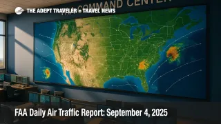
The FAA's current plan, effective mid-morning UTC, calls for mostly visual conditions in the East and Central U.S., then a more active afternoon. Low ceilings at San Francisco International Airport, SFO, and San Diego International Airport, SAN, should lift after 1:00 p.m. UTC. Afternoon storms carry a low probability for the Washington region and Atlanta, while vicinity storms may brush Las Vegas and Phoenix. Florida hubs, notably Miami International Airport, MIA, Fort Lauderdale-Hollywood International Airport, FLL, Orlando International Airport, MCO, and Tampa International Airport, TPA, sit under thunderstorm risk most of the day. New York and Boston could see wind-driven initiatives. Reroute planners are eyeing Lake Erie west, Gulf corridors, and potential oceanic route changes, with Canada capping possible in the afternoon.
Background
The FAA's daily operations plan summarizes weather, construction, staffing, and special activity that compress airport acceptance rates. When demand exceeds rate, traffic managers meter arrivals with Ground Delay Programs, using Estimated Departure Clearance Times to smooth inbound banks. Short surges or safety margins can also trigger brief ground stops. As a traveler, expect these tools to show up first at busy hubs with convective weather or strong winds, or where runway work trims arrival options. Today's watch list includes Boston Logan International Airport, BOS, where Runway 9, 27 remains closed for safety work, and San Francisco, where morning ceilings often slow arrivals. For context and trend lines, see our recent coverage in FAA Daily Air Traffic Report: September 3, 2025 and FAA Daily Air Traffic Report, August 27, 2025.
Latest Developments
FAA Daily Air Traffic Report highlights terminal watch windows
Planners list possible ground stops or Ground Delay Programs after late morning at Miami International Airport, MIA, and Fort Lauderdale-Hollywood International Airport, FLL. San Francisco International Airport, SFO, follows for low ceilings if improvements lag. Hartsfield-Jackson Atlanta International Airport, ATL, may face a late afternoon window as storms pop. Boston Logan International Airport, BOS, is the lone terminal marked probable in the evening bank because of wind and the Runway 9, 27 closure. In New York, John F. Kennedy International Airport, JFK, and Newark Liberty International Airport, EWR, sit on a possible list, with LaGuardia Airport, LGA, monitored for winds. Orlando International Airport, MCO, and Tampa International Airport, TPA, round out the Florida risks.
En route constraints and likely reroutes this afternoon
Thunderstorms across the Ohio and Tennessee Valley are moving east. That sets up potential Severe Weather Avoidance Plan activity and customer-preferred departure route changes across facilities serving the Northeast and Mid-Atlantic. Lake Erie west partial restrictions are possible. Gulf route closures are on the table, with oceanic route adjustments possible in the early afternoon. Expect tailored routing from the Ohio Valley to Florida, and escape routes around New York, Boston, Philadelphia, and Potomac sectors as needed. Canadian capping is possible later, which can limit overflights and push flows onto alternates.
Construction, special activity, and checks to note
Runway and taxiway projects continue at several hubs, including Philadelphia International Airport, PHL, O'Hare International Airport, ORD, and San Francisco International Airport, SFO. BOS Runway 9, 27 remains closed through mid November. Houston's William P. Hobby Airport, HOU, and George Bush Intercontinental Airport, IAH, both have active runway work that can trim rates in weather. Flight checks are scheduled today for PHL, Minneapolis-Saint Paul International Airport, MSP, LaGuardia Airport, LGA, and Salt Lake City International Airport, SLC. The plan also lists upcoming Starlink launch windows at Cape Canaveral and Vandenberg that could nudge coastal routes on September 5 and 6.
Analysis
Today looks like a classic shoulder-season setup, with a benign morning flipping to weather-driven constraints along the Eastern Seaboard and Florida peninsula. The biggest traveler risk sits at BOS as wind intersects a runway closure, then at SFO if marine ceilings linger past the anticipated burn-off. Florida's convective pattern can flip quickly, so MIA, FLL, MCO, and TPA may see pop-up programs that cascade into the evening. New York's airports, JFK and EWR, have less certainty, but winds plus upstream storms in the Ohio Valley can force escape routes or metering that ripple into connections. If your itinerary touches these hubs, favor earlier arrivals, add buffer to tight layovers, and monitor your airline's app for reroute or re-bank notices. For afternoon departures to Florida or the Northeast, anticipate revised push times, and have a plan to move to earlier flights if your carrier offers fee-free changes tied to the FAA Daily Air Traffic Report.
Final Thoughts
Expect a quiet first act, then a busy afternoon with spot programs across Florida, Boston, San Francisco, and possibly New York and Atlanta. Proactive travelers will bank on earlier flights, watch for re-routes, and pack patience as storms march east. If you are heading to or through BOS, allow extra time and expect unusual runway configurations to extend taxi times. Keep an eye on the midday and mid-afternoon FAA webinars for strategy changes, and refresh official sources before leaving for the airport. Our coverage will track updates and compare them with historical patterns in the FAA Daily Air Traffic Report.