FAA updates D.C. helicopter routes and zones
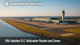
The Federal Aviation Administration has published updated helicopter route charts for the Washington, D.C. area, adding new buffers and clarifying procedures at Ronald Reagan Washington National Airport (DCA), Washington Dulles International Airport (IAD), and Baltimore/Washington International Thurgood Marshall Airport (BWI). The October 2 update follows the January 29 midair collision near DCA that killed 67 people, and formalizes restrictions the agency first put in place immediately after the crash.
Key points
- Why it matters: Changes reduce helicopter-airplane conflict near short-final paths to DCA.
- Travel impact: Helicopter routes shift or restrict; airline flows gain added separation margins.
- What's next: NTSB investigation continues; FAA says more refinements are possible.
- Route 12 at BWI moved north of I-95; IAD Route 7 crossing altitude raised 500 feet.
- DCA Routes 1 and 5 remain restricted to priority medical and law enforcement flights.
Snapshot
At DCA, Helicopter Routes 1 and 5 remain limited to priority aircraft-medical and law enforcement-unless air traffic control specifically authorizes otherwise. The FAA also reduced the boundaries of Zones 1, 2, and 5 and added chart notes to clarify altitude and operational instructions. Region-wide tweaks aim to add lateral and vertical buffers between rotorcraft and fixed-wing traffic during busy push periods. At BWI, Route 12 shifted north of I-95 to increase separation from arrival and departure streams. At IAD, officials raised Route 7's crossing altitude by 500 feet to preserve clearance during go-arounds. The agency says these adjustments are part of its regular 52-day chart cycle but include permanent safety changes stemming from the DCA crash.
Background
On January 29, a PSA Airlines-operated American Eagle jet on approach to DCA collided with a U.S. Army Black Hawk helicopter over the Potomac River, killing all 67 aboard both aircraft. Public hearings this summer detailed a combination of equipment issues and airspace-management risks in the tightly constrained National Capital Region. In the weeks after the accident, the FAA curtailed helicopter activity on key DCA corridors and began pushing helicopter traffic farther from short-final paths. Lawmakers and the Department of Transportation's Inspector General also opened reviews into DCA airspace design and ADS-B policies. For readers tracking the policy arc, see our prior coverage: DOT opens DCA airspace audit after fatal crash and our daily ops lens in Flight delays and airport impacts.
Latest developments
FAA tightens DCA chart notes and preserves route restrictions
The October 2 chart release codifies several post-crash safety measures. At DCA, Routes 1 and 5 stay restricted to priority missions unless ATC authorizes otherwise. The FAA trims the footprints of Zones 1, 2, and 5, and inserts additional chart notes to remove ambiguity around mandatory altitudes and operating procedures. Beyond DCA, BWI's Route 12 now tracks north of I-95 to keep helicopters farther from arrival and departure corridors, while IAD's Route 7 crossing altitude rises by 500 feet to better protect separation during missed approaches. The FAA also listed complementary steps already in force: eliminating visual separation within five miles of DCA, permanently closing Route 4 between Hains Point and the Wilson Bridge, moving helicopter routes farther from DCA flight paths, requiring ADS-B Out for military operations, pausing Pentagon heliport departures until procedures and technical issues are resolved, and boosting staffing and oversight at DCA.
Analysis
For airline and rotorcraft operators, the Washington area has long been a choreography challenge: converging runway geometry at DCA, presidential and security-related airspace overlays, and high helicopter utilization along the Potomac corridor. The FAA's adjustments address three risk vectors highlighted after January 29. First, geometry: keeping rotorcraft corridors farther from short-final to Runway 33 reduces reliance on last-second visual separation. Second, vertical margins: a 500-foot increase on IAD Route 7 and clarified altitudes on the DCA chart add deterministic buffers when go-arounds or non-standard sequences occur. Third, surveillance: requiring ADS-B Out for military flights near DCA improves track quality for controllers and traffic-alerting systems. None of these moves meaningfully slow commercial schedules on their own; rather, they aim to lower the probability of rare but catastrophic conflict events. As the NTSB investigation progresses, additional procedural harmonization-particularly around mixed helicopter/fixed-wing operations close to thresholds-could follow. The Washington basin remains complex, but these changes should incrementally improve the safety envelope without eroding capacity.
Final thoughts
Travelers are unlikely to notice day-to-day differences, but the airspace will. By preserving restrictions on DCA Routes 1 and 5, shrinking select zones, and refining altitudes at BWI and IAD, the FAA is hard-wiring additional separation into charted procedures. Pending NTSB findings may prompt further updates, yet the current package delivers near-term risk reduction where it matters most. For now, the Washington region's intricate mix of airline banks and rotorcraft missions should flow with wider margins-exactly the intent behind these D.C. helicopter routes changes.