Flight delays and airport impacts: October 8, 2025
Gusty winds in the Northeast, thunderstorms in South Florida, and low ceilings in parts of the West are combining to slow the system today. The Federal Aviation Administration signaled a Ground Delay Program for Boston Logan International Airport (BOS), with additional ground stops or delay programs possible this afternoon for Ronald Reagan Washington National (DCA), Philadelphia International (PHL), Miami International (MIA), Fort Lauderdale-Hollywood International (FLL), San Francisco International (SFO), and others. Airlines are urging travelers to monitor apps and recheck departure times.
Key points
- Why it matters: Weather and staffing triggers are prompting flight delays across several U.S. hubs.
- Travel impact: A Boston GDP is active; additional programs are possible for DCA, PHL, MIA, FLL, SFO, LGA, and EWR.
- What's next: FAA will reassess after the 11:15 a.m. ET planning webinar, with updates through the evening.
- Runway and taxiway work continues at ORD, IAH, MCO, BOS, and others; expect routine flow constraints.
- Government shutdown staffing pressure remains a background risk for terminal initiatives.
Snapshot
The Air Traffic Control System Command Center's morning Operations Plan cites gusty Northeast winds and South Florida thunderstorms as primary drivers. A Ground Delay Program for Boston is scheduled for arrivals beginning mid-afternoon, and the plan flags possible terminal programs for the New York metro, Washington National, Philadelphia, and South Florida. Low ceilings may slow flows at San Francisco and Seattle-Tacoma International (SEA). On the operations side, runway or taxiway projects continue at Chicago O'Hare International Airport (ORD), George Bush Intercontinental Airport (IAH), Orlando International Airport (MCO), and BOS, among others, which can cap arrival rates during peak periods. Travelers heading through these nodes should pad connections and watch for gate or runway swaps.
Background
FAA advisories note a published staffing trigger at PHL's Area C during the morning, with Northeast winds likely to force arrival-rate reductions at BOS and the New York terminals. In South Florida, scattered thunderstorms around MIA and FLL can produce ground stops or reroutes during convective peaks. Out West, a marine layer is keeping ceilings low near SFO, with occasional instrument approaches that stretch spacing. Nashville International Airport (BNA) experienced a Ground Delay Program last evening due to staffing constraints, which lifted overnight; lingering rotations may ripple into today's schedules. Broader controller staffing pressure associated with the ongoing federal funding lapse continues to add fragility when weather hits. If you are connecting through these hubs, enable flight alerts and consider earlier departures.
Latest developments
Boston GDP and Northeast winds
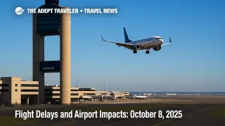
FAA issued a Ground Delay Program for Boston Logan with arrivals metered from approximately 3:00 p.m. to overnight, reflecting sustained winds and visibility limits. The morning plan also lists potential programs for LaGuardia (LGA) and Newark Liberty International (EWR) if crosswinds and ceiling trends hold. Expect periodic miles-in-trail and reroutes in New York Center sectors to balance demand with reduced arrival rates. Travelers bound for BOS should anticipate holding, minor airborne delays, or departure holds from origin stations, and consider later-evening alternatives if schedules are flexible.
South Florida thunderstorms
Convective cells are expected to impact terminal and en-route flows around Miami International and Fort Lauderdale-Hollywood International this afternoon. The plan includes possible ground stops or delay programs and use of coded departure routes or SWAP actions to steer traffic around storm tops in ZMA and neighboring centers. If you are connecting via MIA or FLL, build in buffer time and keep an eye on gate changes as lightning holds can pause ramp operations.
West Coast low ceilings
Low ceilings near San Francisco International may trigger a late-day terminal initiative, with instrument approach spacing reducing the arrival rate below schedule peaks. Seattle-Tacoma International could see similar ceiling-related spacing at times. Expect modest departure delays from feeder airports when metering is active, especially during the afternoon push.
Runway and taxiway work to note
Runway and taxiway projects remain active at ORD, IAH, MCO, BOS, Tampa International Airport (TPA), Indianapolis International Airport (IND), and Phoenix Sky Harbor International Airport (PHX). These constraints rarely cancel flights, but they can lower acceptance rates during the busiest banks, adding 15 to 45 minutes of delay when coupled with weather programs.
Related coverage: Government shutdown and controller sick calls: What travelers should know
Analysis
Today's pattern is classic shoulder-season complexity: marginal Northeast wind and vis conditions, afternoon convection in South Florida, and stubborn marine stratus on the West Coast. None of these alone would cripple the system, but layered together-and with a documented staffing trigger at Philadelphia-they reduce the margin to absorb schedule peaks. The Boston GDP anchors the day; when BOS slows, New England and New York flows often cascade because of shared routings and tight runway configurations. South Florida storms are typically pulsed; short ground stops can clear quickly, but they still disrupt crew and aircraft rotations. Out West, SFO's ILS-driven spacing can add steady, low-grade delays that push misconnects on short San Francisco turns. Add ongoing runway work at ORD, IAH, MCO, and BOS, and the network's ability to recover between banks narrows. Practical traveler moves today are simple: arrive early, carry-on if possible, and target longer connection windows through BOS, New York, Washington National, Miami, Fort Lauderdale, and San Francisco. If your itinerary allows, earlier departures often beat the afternoon programs.
Final thoughts
Plan for pockets of flight delays centered on Boston, the New York area, South Florida, and San Francisco into the evening. If you can, build extra time into connections and enable airline alerts. With weather and staffing both in play, proactive rebooking and carry-on travel are your best defenses against rolling airport impacts and extended flight delays.
Sources
- ATCSCC Advisory 010, Operations Plan for October 8, 2025, FAA
- ATCSCC Advisory, BOS Ground Delay Program, issued 12:23Z Oct. 8, 2025, FAA
- National Airspace System Status, FAA
- Day 1 Convective Outlook, Oct. 8, 2025, NOAA Storm Prediction Center
- GFA and TCF pages, Aviation Weather Center, NOAA
- Ground delay lifted overnight at BNA, WSMV Nashville