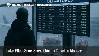
Lake-Effect Snow Slows Chicago Travel on Monday
A focused lake-effect band swept across the Chicago, Illinois, metro overnight into Monday, November 10, producing sharp snowfall gradients and rapidly changing visibility. The National Weather Service kept Winter Storm Warnings in effect for lakeshore counties while inland zones shifted to Winter Weather Advisories as bands wobbled and narrowed. Travelers through Chicago O'Hare International Airport (ORD) and Chicago Midway International Airport (MDW) should plan for deicing, periodic taxi delays, and connection risk as operations climb out of morning peaks.
How it works
Lake-effect snow forms when cold air crosses relatively warmer lake water, generating narrow, intense bands that can bury one neighborhood while leaving another mostly dry. The placement and persistence of a band depend on wind direction, wind shear, and subtle mesoscale features, so airport approaches near the lake can swing from VFR to very low visibility within minutes. NWS aviation guidance for Monday flagged periods of VFR to LIFR at the Chicago terminals with gusty northwest winds and brief bursts of heavy snow as bands pivoted south and east.
Latest developments
Forecasters in Romeoville reported dangerous, wind-blown lake-effect snow through the morning commute, with impacts generally along and east of I-57 and I-355 in Illinois and into northwest Indiana. A dawn Decision Support packet extended the Warning in Lake County, Illinois, to 9:00 a.m. CT, and noted gradual diminishment from west to east by midday. Spot totals topped a foot in localized bands while parts of the western suburbs saw little accumulation.
Airports and delay programs
The FAA's Air Traffic Control System Command Center carried national programs across the weekend tied to staffing constraints from the shutdown, including a Saturday ground stop at O'Hare from 1124 a.m. to 1245 p.m. CT. Weather-driven effects layered on Monday as deicing and band-related visibility drops slowed surface movement, with intermittent ground delay tools possible to meter outbound flows during peak pushes. Early morning media tallies showed several hundred cancellations across both airports, with delays fluctuating as bands pulsed and crews cycled through deicing. Check your specific flight and reverify connection times; even small holds can break tight itineraries.
Highway pinch points
Road conditions mirrored the band structure. Police and local media reported spin-outs and multi-vehicle incidents during the morning rush, including on DuSable Lake Shore Drive, as winds lofted snow and created slick patches near the shoreline. Expect slower travel on I-90 and I-94 where lake-side feeders merge, plus spotty backups on arterials approaching both airports. Allow conservative buffers for drop-offs, pickup windows, and employee commutes.
What to watch next
Guidance points to a tapering eastward shift of the dominant band by late morning into early afternoon with lingering gusts, followed by a weak clipper bringing light snow Tuesday. As the band migrates toward northwest Indiana, watch for short-notice runway configuration changes, runway condition code updates, and deicing throughput impacts, which can ripple into the early afternoon push. If you must connect through Chicago today, move to earlier flights where possible, or build in at least one bank of buffer between arrivals and departures.
Final thoughts
Lake-effect events punish tight schedules because impacts are hyper-local and time-sensitive. With warnings near the lake and advisory-level impacts inland, the safest play is to over-buffer both your drive and your connection at O'Hare or Midway. As bands fade, operations should stabilize, but residual mismatches between aircraft, crews, and gates can extend delays into the afternoon.
Sources
- Area Forecast Discussion, NWS Chicago/Romeoville
- NWS Chicago Decision Support Packet, Nov. 10, 2025
- FAA ATCSCC Advisory Database, Nov. 9-10, 2025
- Ground Stop Lifted at O'Hare, NBC Chicago
- Winter Storm Warning Continues Across Chicago, NBC Chicago
- NAS Status, Federal Aviation Administration
- Road Crashes Amid Lake-Effect Snow, NBC Chicago