Western Australia Storm Advice For Kimberley, Watch Broome Transfers
A low pressure trough and unstable airmass are firing squally thunderstorms across the Kimberley, and emergency services have issued a Storm Advice for parts of the region. The Department of Fire and Emergency Services, DFES, posted an advice level warning late on November 10 AWST, then updated its coverage area later in the evening. The Bureau of Meteorology, BoM, continues to signal heavy rain, lightning, and gusty winds in the warning district. Travelers should add buffers for Broome International Airport transfers, verify road conditions on the Great Northern Highway, and be prepared for short notice changes to flights or airport shuttles. Emergency WA hosts the live warning status and DFES remains the control authority for this event.
Kimberley, Broome, and nearby corridors
DFES issued a Storm Advice for parts of the Kimberley on Monday night, November 10, with the first post time stamped 900 p.m. and a subsequent update at 1010 p.m., both AWST. These advisories tell the community to monitor conditions, secure property, and avoid flooded areas. The Emergency WA listing confirms DFES as the control authority and notes the advisory size and current status. This framework matters to travelers because advice level warnings can still coincide with intense local downpours, quick water over roads, and lightning that slows airport ground operations.
BoM's severe thunderstorm warning for the Kimberley district highlights the risk of heavy rainfall leading to flash flooding, with specific locations named based on radar and forecast analysis. These warnings also carry practical steps such as avoiding trees and power lines, staying clear of storm water drains, and unplugging appliances during lightning. For travel planning, the key is volatility. Cells can pulse quickly, which means a clear hour at Broome can be followed by a squall that triggers a ground delay or a short diversion.
Road pinch points and transfers
The Great Northern Highway is the primary spine for Broome region transfers and regional logistics. During Kimberley storms, the weak links are low lying sections, floodways, and unsealed approaches to depots, stations, or tour pickups. While conditions vary by cell, surface water, debris, or traffic management can appear with little lead time. The Main Roads WA Travel Map is the official source of closures and traffic control notices, and it should be checked before any departure, especially for night driving or early morning airport runs. Visitor portals for the region reinforce that the Travel Map is the live source travelers should rely on.
If your route includes long gaps between services, plan fuel and water stops ahead of time. Avoid detours onto unsealed roads after heavy rain, and build redundancy into the plan, for example a secondary window to reach the terminal if the first attempt is slowed by a traffic control point. If a tour operator is collecting you curbside at the airport, share live location and agree on a wider pickup window.
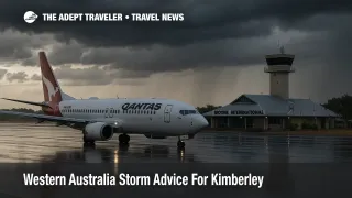
Airline options and buffers
Broome International Airport publishes live arrivals and departures that can help you confirm status once you are in range. When storms are active, expect metering on the apron, slower turnarounds for baggage and fueling, and lightning stand downs that pause ramp work. Airlines may offer same day moves to earlier flights on the same route when capacity allows. If a formal waiver is posted, change fees are usually waived, and fare differences may be reduced for a limited window, which makes it easier to move into a safer weather gap. If no waiver appears, call or message the airline anyway. Carriers often allow courtesy moves during weather operations even without a published bulletin.
Add buffers on both sides of a flight. For departing passengers, arrive earlier than usual, secure transport well ahead of time, and avoid cutting it close after dinner reservations or sunset activities. For arriving passengers, consider a flexible airport transfer rather than a fixed time shuttle when thunderstorms are in the forecast. For regional connectors using the Great Northern Highway, keep a wide margin for safety and assume that an otherwise simple ninety minute leg can take considerably longer during storm bursts.
Background
Western Australia uses a consistent warning framework across hazards. DFES issues community warnings and sets the alert level, and Emergency WA aggregates and displays those warnings in a single place. BoM provides the meteorological forecasts and thunderstorm warnings that describe the hazards, such as heavy rainfall, damaging winds, and frequent lightning. In the Kimberley, storms and cyclones are most likely from November to April, which is why even an advice level post deserves attention from travelers on tight itineraries.
Latest developments
As of late evening on Monday, November 10, the DFES Storm Advice for parts of the Kimberley remained active, with DFES posts at 900 p.m. and 1010 p.m. noting the warning area and an update to coverage. The Emergency WA listing showed the event details, including the advice level and DFES control authority. BoM maintained thunderstorm warnings for the Kimberley forecast district with a focus on heavy rainfall and flash flooding risk. Travelers should continue to monitor both Emergency WA and BoM while planning Tuesday morning transfers.
Final thoughts
Western Australia has issued storm advice for parts of the Kimberley, and squally storms can change airport and highway conditions with little notice. If you are moving through Broome, add time, verify the Great Northern Highway on the Main Roads WA Travel Map, and refresh BoM and Emergency WA pages before you roll. This is a developing weather pattern, and flexible plans will keep trips on track.
Sources
- Storm Advice, parts of the Kimberley, 9:00 p.m. AWST, DFES
- Storm Advice update, parts of the Kimberley, 10:10 p.m. AWST, DFES
- Emergency WA, Storm Advice, parts of the Kimberley
- Severe Thunderstorm Warning, Kimberley forecast district, BoM via ABC Emergency
- Main Roads WA, Travel Map
- Broome International Airport, Arrivals
- Broome International Airport, Departures