Western Australia Storm Advice Holds, Broome Transfers Remain Tight
A Department of Fire and Emergency Services, DFES, storm advisory remains in place for parts of Western Australia's Kimberley after a late night reduced threat note on November 10. Emergency services posted new advice on November 11 that keeps attention on squally thunderstorms and heavy rain across the region. The Bureau of Meteorology, BoM, continues to warn of severe thunderstorms that can cause short notice road and airport knock ons. Travelers using Broome International Airport should build buffers for terminal transfers and check Great Northern Highway status before they commit to tight connections.
Kimberley advisory status
DFES issued a "monitor conditions" advisory for parts of the Kimberley on Monday night with an update later that evening. The agency then published a fresh "monitor conditions" post after midday Tuesday, November 11, keeping communities alert to storm potential as cells redevelop. The official Emergency WA feed lists DFES as the control authority and shows the advisory status, time stamps, and coverage description when active.
Latest developments
BoM's severe thunderstorm messaging on Tuesday highlights damaging wind risk and heavy rain that may lead to flash flooding in parts of the Kimberley and adjacent interior districts. These signatures are enough to slow ground handling during downpours and to add taxi time if lightning holds are issued on the ramp. Keep in mind that convective footprints shift by the hour, so what looks clear in the morning can become active in the afternoon peak.
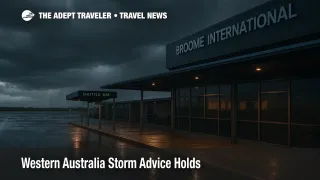
Broome transfers and airport flow
Broome's curb and shuttle ecosystem is sensitive to squalls, since brief cloudbursts can bottleneck curb space and extend wait times for vehicles. The airport's guidance points travelers to pre booked shuttle services, which is prudent when weather may lengthen pickup cycles. Local providers also note they adjust operations around flight timing and baggage release, another reason to leave margin during storm pulses. If you usually rely on a last minute hail, consider booking ahead so the driver can stage outside the worst of a cell.
Highway conditions and pinch points
The Great Northern Highway is the spine for movements between communities and the airport. When storms pass, water over road, debris, or temporary traffic management can slow segments and squeeze the schedule for a flight check in or a same day connection. Main Roads WA directs motorists to its Travel Map for live closures and road work controls. Check it before you leave, then once again at the last fuel stop on approach to town.
Airline change options
Carriers serving Broome offer self service change tools that can move you earlier or later within fare rules. If the afternoon storm window looks active, shifting to a morning departure is often the simplest mitigation. Virgin Australia's manage booking portal is the first stop for most itineraries. Published fee tables apply unless a specific weather waiver is active, so compare the cost of a move with the risk of a misconnect if your transfer bogs down in a squall.
Background
Australian emergency messaging stacks three layers that travelers should understand. DFES issues community advice and warnings on Emergency WA or official social channels. BoM publishes forecasts and warnings that quantify storm risk, hail, wind, and rain signatures. Road agencies, in this case Main Roads WA, operate the live traffic and closure feeds. For travel decisions, read DFES first to understand the alert state, check BoM for timing and severity, then check the highway map before you leave for the airport.
Analysis
The signal is not a classic widespread event, it is a convective pattern that lights up corridors at different times of day. That profile creates tight, local problems, from lightning ramp holds to short lived pooling on access roads. The practical move is margin. Pad the curb to check in segment, aim for a flight that avoids the likely storm hour if you can, and keep a screenshot of your airline's manage booking page so you can recheck a seat while you stand under a shelter. If you are driving the Great Northern Highway to meet a regional connector, lock in a go, no go checkpoint where you refresh DFES, BoM, and the Travel Map, then decide whether to continue or to slide to the next flight.
Final thoughts
The advisory message eased late Monday, but the atmosphere is still primed for bursts. Treat Tuesday through midweek as changeable. For Broome transfers and regional connectors, time is your best protection, and live checks are your edge.
Sources
- Department of Fire and Emergency Services WA, Storm Advice posts
- Department of Fire and Emergency Services WA, Storm Advice update late Nov 10
- Emergency WA advisory overview
- Bureau of Meteorology, Severe Thunderstorm warning summary
- Main Roads WA, Travel Map hub
- Broome Airport, shuttle information
- Broome Transit, shuttle and airport transfers
- Virgin Australia, manage booking
- Virgin Australia, change fee table