Ice Storm Warning Western PA Roads, Power Risks
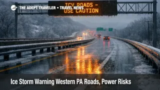
An Ice Storm Warning across parts of western Pennsylvania is expected to create hazardous travel conditions from late Friday morning into early Saturday, as freezing rain builds enough glaze to make roads treacherous. The National Weather Service Pittsburgh office warns of significant icing, with ice accumulations generally between two and three tenths of an inch, and it explicitly flags slick bridges and overpasses, plus likely power outages and tree damage. Travelers with Friday departures, road transfers, or airport drop offs should treat this as a high consequence "last mile" problem, add substantial buffer, and be ready to delay trips until after conditions improve Saturday morning.
The practical change for trip planning is that the Western Pennsylvania ice storm warning raises the odds that a normal drive to an airport, station, hotel, or family stop becomes the failure point, even when flights and trains are still operating.
Who Is Affected
The warned area includes Venango, Forest, Clarion, Jefferson, Armstrong, Indiana, plus higher elevations of Westmoreland and Indiana, with the Ice Storm Warning in effect from 1000 a.m. Friday, December 26, 2025, to 700 a.m. Saturday, December 27, 2025. If your trip crosses those counties by car, shuttle, bus, or rideshare, plan for rapidly worsening traction, slowdowns, and the possibility that travel becomes nearly impossible during the peak icing window.
Travelers in and around Pittsburgh can still be affected even if the longest duration freezing rain sets up north and east, because a thin glaze is enough to snarl commutes, reduce rideshare supply, and slow airport staffing arrival. National Weather Service Pittsburgh outlook messaging also highlights Winter Weather Advisory conditions in parts of the metro region and nearby counties, with around a tenth of an inch of ice possible in some areas, and a broader note that freezing rain can create hazardous travel and bring down trees and power lines.
Drivers should also expect operational constraints on major roads beyond the immediate warning polygon. PennDOT says Tier 3 vehicle restrictions are planned to begin at 10:00 a.m. Friday on all Pennsylvania interstates west of I 81, including the PA Turnpike I 76 and I 70, with speed limits restricted to 45 mph while restrictions are in place, and updates pushed through 511PA. Even if you are not personally subject to the restriction category, the traffic mix changes, speeds collapse, and minor incidents can lock up corridors for hours when freezing rain is falling.
For air travelers, the biggest risk is missed departures caused by road access failure, not necessarily widespread cancellations. Pittsburgh International Airport (PIT) is the main pinch point for western Pennsylvania departures, because most travelers still rely on highways, parking shuttles, and curbside drop offs that degrade quickly in freezing rain. If you are connecting through other Northeast hubs this weekend, conditions across the wider region can compound misconnect risk and reduce reaccommodation options. Northeast Winter Storm Flight Delays Raise Misconnect Risk offers additional connection planning tactics that still apply when the road leg is the weak link.
What Travelers Should Do
If you are scheduled to drive during the warned window, treat departure timing as the lever you control. Leave earlier than you normally would, before freezing rain ramps up, or delay until after daybreak Saturday when the warning expires, and prioritize routes that reduce bridges and exposed elevated segments. If you must be on the road, plan as if highway speeds will collapse, and keep your phone charged, because PennDOT warns roads that look wet can be icy, especially near bridges and ramps.
Use decision thresholds that prevent "slow motion" misses. If your airport arrival plan depends on a tight curbside timeline, a single rideshare pickup, or a single highway corridor, rebook to a later flight, shift to an earlier departure, or add a hotel night near the terminal, rather than hoping conditions hold. PennDOT notes restrictions can change based on roadway conditions and first responder reports, so a trip that looks possible at breakfast can become impractical by midday once icing thickens and incidents accumulate.
Over the next 24 to 72 hours, monitor three things that predict whether you can resume normal transfer assumptions. First, watch National Weather Service updates for any expansion or extension of the Ice Storm Warning timing, and for where the freezing rain line sets up relative to your exact route. Second, watch 511PA for restriction status and corridor level slowdowns, because the "all interstates west of I 81" posture can ripple far beyond the counties in the warning. Third, if you are flying, check whether inbound aircraft are arriving late into your departure airport, because late aircraft plus deicing and staffing friction is a common path to rolling delays even without mass cancellations.
How It Works
Freezing rain becomes an outsized travel disruptor because it attacks both traction and infrastructure at the same time. At the source, a few tenths of an inch of ice can turn bridges, overpasses, and ramps into collision magnets, and even "minor" fender benders can block lanes for long periods when tow response is slowed by the same conditions. That first order road slowdown then propagates into the travel system through staffing and positioning, as airport and hotel employees take longer to reach work, which can stretch curbside operations, security throughput, and shuttle cycles.
The second order ripples usually show up as forced replanning. Missed departures create same day rebooking pressure at the exact moment the wider Northeast is also weather constrained, shrinking the number of viable alternates and pushing travelers into unplanned hotel nights. Road restrictions and reduced speeds also shift demand onto fewer "safer" options, including later flights, nearby airports outside the heaviest ice, or postponing trips altogether, which can tighten inventory and raise prices quickly once disruptions become visible. For a wider view of how delays compound across the U.S. network when weather and traffic management overlap, see Flight Delays and Airport Impacts: December 24, 2025.