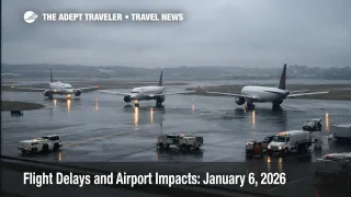
Flight Delays and Airport Impacts: January 6, 2026
Low ceilings are the main operational risk across several major U.S. hubs today, with wind also flagged in key Western markets. Travelers moving through General Edward Lawrence Logan International Airport (BOS), Charlotte Douglas International Airport (CLT), Seattle Tacoma International Airport (SEA), and Newark Liberty International Airport (EWR) are the most exposed to late day compression if instrument conditions reduce arrival rates. The smartest move is to check your airline for a waiver, protect tight connections early, and watch for FAA traffic management programs that can appear with little lead time once ceilings deteriorate.
The FAA daily outlook for Tuesday, January 6, 2026, highlighted low clouds at BOS, CLT, SEA, and EWR, and it flagged wind as a spacing risk around Denver International Airport (DEN) and San Francisco International Airport (SFO). The FAA Command Center operations plan also noted that ground stop or delay programs were possible after 200 p.m. ET for Boston, and after 300 p.m. ET for Newark, if conditions warrant.
As of the FAA status updates published mid afternoon UTC, general delays were still modest at several of the airports most likely to matter for connections, including Boston Logan and Newark. That can change quickly on low ceiling days, because arrival rates can be reduced in steps, and airline banks are often scheduled with limited slack.
Who Is Affected
Connecting passengers are the biggest risk group today, especially those scheduled through Boston Logan, Charlotte Douglas, Seattle Tacoma, Newark Liberty, and Hartsfield Jackson Atlanta International Airport (ATL), because these airports feed dense domestic networks with many same day onward turns. When ceilings drop, controllers increase spacing on approaches, arrival rates fall, and inbound aircraft land later, which then pushes delays into departures that depend on those arrivals, even if the departure airport weather looks acceptable.
Northeast travelers should treat the late afternoon and evening as the fragile window, not only the morning. The FAA planning signal that a Boston ground stop or delay program is possible later in the day matters for anyone on the last nonstop of the night, and for anyone with a sub 60 minute connection, because reaccommodation options shrink sharply once the final bank is disrupted. Newark has a similar profile, with the added complication that demand can spill across the New York area network, which can tighten seat inventory quickly.
West Coast travelers, and travelers using SFO or DEN as connection points, should watch wind driven spacing and runway configuration changes. Even when FAA status pages show only minor general delays, wind can create rolling gate holds during peak banks, and that often shows up first as longer taxi out times and late inbound arrivals that break onward connections by a narrow margin.
Travelers flying into airports with ongoing airfield constraints should also expect less recovery flexibility if delays stack up. The FAA operations plan lists runway or construction impacts at Nashville International Airport (BNA), Orlando International Airport (MCO), and San Diego International Airport (SAN), and a ramp expansion at Charlotte Douglas, all of which can amplify taxi and gate congestion once banks are full.
What Travelers Should Do
Act early on itinerary protection. If you have a tight connection through Boston Logan, Newark Liberty, Charlotte Douglas, Seattle Tacoma, Atlanta, Denver International, or San Francisco International, move to an earlier flight while seats exist, or proactively rebook to a routing with more frequency in case the last bank compresses. If you see your inbound aircraft running late enough that your connection drops below your personal cutoff, treat that as the trigger to change, not as a reason to wait at the gate.
Use clear thresholds for waiting versus rerouting. Waiting is only rational when you have multiple later protected options on the same ticket and you can tolerate a late arrival without losing a hotel night, cruise embarkation, or a time fixed event. Reroute when an airport shifts into a ground delay program, when your flight is assigned an EDCT that pushes you into the evening crunch, or when your flight is the last practical departure of the day.
Monitor the right signals for the next 24 to 72 hours. Watch the FAA Command Center planning updates for Boston and Newark program launches, track whether low ceilings spread across additional hubs, and watch for en route constraints like New York Center thunderstorms or Southeast flow programs that can turn into long gate holds at origin airports. If you are traveling tomorrow morning on an aircraft that is flying late tonight, assume a knock on risk, and consider a backup plan before you go to sleep.
How It Works
The FAA Air Traffic Control System Command Center manages demand when weather or capacity constraints reduce safe throughput, using tools like ground stops, ground delay programs, airspace flow programs, and reroutes. A ground stop holds departures to a destination at their origin airports, while a ground delay program assigns expected delays so arrivals can be metered into a constrained airport without excessive airborne holding. Airspace flow programs, like the one noted in today's operations plan over the Southeast, can delay or reroute flights that would otherwise overload a constrained region of airspace, and those minutes usually show up as "ATC delay" at the gate, not as a weather delay at the destination.
Disruption propagates through the travel system in layers. First order effects occur at the constrained airport, reduced arrival rates, longer taxi queues, and gates occupied by late arrivals. Second order effects hit connections, aircraft rotations, and crew legality, a late inbound into Newark or Boston can cancel a later flight in a completely different city because the aircraft, crew, or gate plan cannot reset fast enough. Third order effects land off airport, missed connections drive last minute hotel demand near terminals, rental car pickups shift, and tour operators and meeting planners absorb no shows, especially when the disruption occurs in the final bank and pushes travelers into an overnight.
For practical continuity and decision context, compare today's setup with Flight Delays and Airport Impacts: January 5, 2026 and Atlanta ATL Fog Ground Stop Delays Flights Jan 5. For evergreen tactics you can apply when delays start compounding, see Tips for Dealing with Flight Delays or Cancellations.
Sources
- FAA Daily Air Traffic Report
- Current Operations Plan Advisory
- General Edward Lawrence Logan International Airport (BOS) Real-time Status
- Newark International Airport (EWR) Real-time Status
- Denver International Airport (DEN) Real-time Status
- San Francisco International Airport (SFO) Real-time Status
- FAA Airport Status: ATL
- FAA Airport Status: CLT