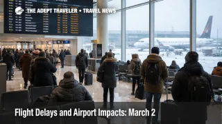
Flight Delays and Airport Impacts: March 2
U.S. flight reliability is set up for a mixed but consequential day on March 2, 2026. Snow in the Washington, D.C., area and low ceilings at several large hubs are the kind of constraints that turn routine delays into missed connections, especially during the afternoon push. The FAA's daily outlook flags snow around the Washington airports and low clouds for Houston and Southern California, plus wind in Las Vegas. The FAA Command Center's operations plan also signals that traffic management initiatives may be needed later, including possible programs at San Francisco International Airport (SFO) and Ronald Reagan Washington National Airport (DCA).
U.S. Flight Delays March 2: What Changed
The biggest change for March 2 is that the day is not defined by a single hub, it is defined by several mid to high volume constraint points that can propagate delays outward. The FAA Daily Air Traffic Report highlights snow affecting flights in the Washington, D.C., area, specifically around Ronald Reagan Washington National Airport (DCA), Baltimore Washington International Thurgood Marshall Airport (BWI), and Washington Dulles International Airport (IAD). It also flags low clouds for George Bush Intercontinental Airport (IAH), William P. Hobby Airport (HOU), San Francisco, Los Angeles International Airport (LAX), and San Diego International Airport (SAN), with wind in Las Vegas.
Separately, the FAA Command Center's March 2 operations plan calls out snow as a terminal constraint in the Washington airspace and low ceilings across IAH, SFO, LAX, and SAN, with wind in LAS. It also shows planned triggers for possible FAA initiatives later in the day, including a potential ground stop or delay program at SFO after 800 a.m. Pacific, and a possible ground stop or delay program at DCA after 1200 p.m. Eastern. Those windows matter because they coincide with banked connection periods, when small arrival rate cuts can create outsized missed connection risk.
Which Travelers Are Most Exposed Today
The highest risk group is travelers whose itineraries depend on same day connections through the Washington, D.C., airports, especially if the first leg is short haul and the connection is under 90 minutes. Snow is not just a visibility problem, it is a throughput problem, runway treatment slows operations, arrival spacing increases, and gate availability tightens as aircraft sit longer on the ground.
The second high risk group is travelers touching Houston or the major California airports that are flagged for low ceilings. Low ceilings tend to reduce arrival acceptance rates first, which is why you can see delays stack even when surface conditions at your origin look manageable. If you are connecting through San Francisco, Los Angeles, or San Diego, assume that the day may swing between "mostly moving" and "metered hard," depending on how ceilings evolve across the arrival banks.
A third exposure that is easy to miss is network ripple tied to route management. The Command Center plan includes route structure and capping or tunneling in the Southeast due to volume, plus additional en route constraint notes that can affect routing efficiency. You can feel this as longer flight times, holding, or late inbound aircraft even if your departure airport is not on the weather list.
What Travelers Should Do Now
Start by treating margin as the product you are buying today. If you have a connection through Ronald Reagan Washington National, Washington Dulles, Baltimore Washington, Houston Intercontinental, San Francisco, Los Angeles, or San Diego, build extra time into both the airport arrival and the connection itself, because the first operational failure mode is usually bank timing, not a single canceled flight.
Use a decision threshold for rebooking versus waiting before you get to the airport. Rebook early if your first leg is already trending toward an hour late, if your connection is under 90 minutes, or if you are on separate tickets, because once metering starts at one of the hubs, remaining seats on later flights get chased by everyone at once. Waiting only makes sense if you have multiple later options that still satisfy your real arrival constraint, not just your preferred arrival time.
Finally, monitor the operational windows that could change the day's shape. If you are flying through the Bay Area, watch for whether SFO moves from "possible" to "active" programs in the morning and midday Pacific window. If you are flying through the Washington region, watch for DCA initiatives around midday Eastern as snow impacts evolve. For context on how quickly multi region constraints turn into missed connections, see Flight Delays and Airport Impacts: March 1 and Flight Delays and Airport Impacts: Feb 28.
How the Disruption Spreads Through the Network
Snow and low ceilings spread through the system in a predictable sequence. First order, arrival rates get cut to maintain safe spacing, which increases airborne holding and pushes scheduled arrival times later. Second order, gates fill and turns slow, so departures that should have left on time wait for aircraft and crews, even at airports with decent local weather. That is why a Washington snow day can show up as missed connections in places that are not seeing snow, because the aircraft and crews are arriving late and the network is trying to recover on a schedule with limited slack.
Low ceilings create a similar pattern, but with more "quiet" failure. Metering tools such as a ground delay program hold flights at their origin so the arrival queue stays manageable, and that can make the destination look orderly while still causing widespread delays across the network. If SFO or another major airport is metered, it can quietly pull later aircraft rotations behind, and those late inbounds then drive gate changes, missed connections, and end of day cancellations when crews approach duty limits. The practical takeaway is that your risk is often defined by where your aircraft needs to be later, not just where you are boarding now.